The walk
This is a picture blog, that simply gives pictures of a walk around Oakham. This is not a walk that takes in the traditional historical highlights, although some of those are included, but is rather one in which I show the things that have caught my eye, mainly on my wonderings about the town with the dog. So it is a little idiosyncratic, but I hope will be of interest to some. Except where otherwise indicated, the pictures were all taken by me, and I am happy for them to be used by others, properly credited of course.
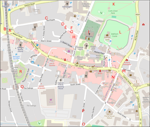
The map
The map below shows the approximate locations from which the photographs (A to R) were taken, superimposed on an up to date map from Open Street Map.
The pictures
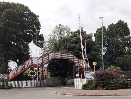


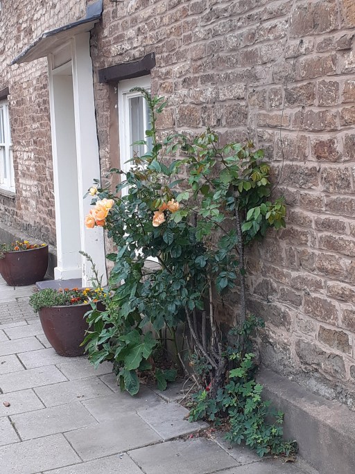


The first picture is of the listed Midland Railway bridge and level crossing (Picture A) a source of endless frustration to drivers, and, as the location of the meeting of five roads, a horribly hazardous place for pedestrians. There must be a better way of doing traffic management here. Picture B is the Midland Railway Signal Box, which was the inspiration for the Hornby Railway model. Turning along Northgate, there are three pictures of rose bushes (Pictures C to E), some cultivated, some not. but in early summer their cumulative effect is striking. Picture F is of a house a little further along Northgate, with a wonderful display of creepers and climbing foliage.
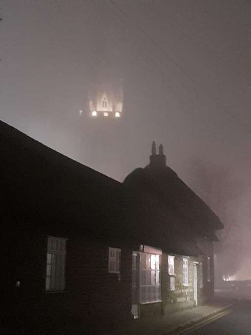
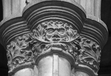
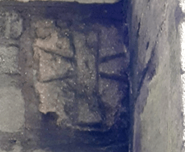
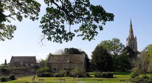
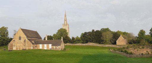
The next six photos all figure All Saints Church in one way or another. Picture G is a photo taken from Northgate on a misty evening where all that can be seen of the tower is a small floodlight area. The thatched cottages on Northgate can be seen in the foreground. Picture H shows the spire of the church from the garden of the Wheatsheaf pub opposite on a pleasant summer afternoon. Picture I (from here) shows the Green Man stone capital within the church – one of a series of wonderful capital carvings I have blogged about elsewhere. Picture J shows a possible Anglo-Saxon Saxon cross built into the south porch of the church. The identification is very speculative, but the cross is very similar to other, demonstratively, Anglo-Saxon examples. Pictures K and L shows t wo views of the Castle Great Hall, Old School and Church, from Cutts Close and the Castle grounds. I have argued elsewhere that these might be an indication of an early church group in the area. Click on the pictures to see the full extent of the photographs.
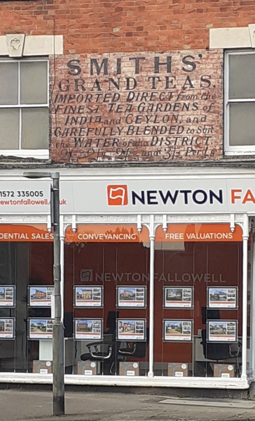
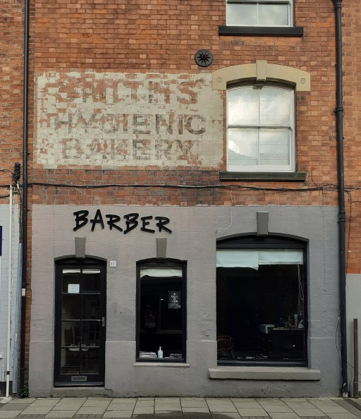
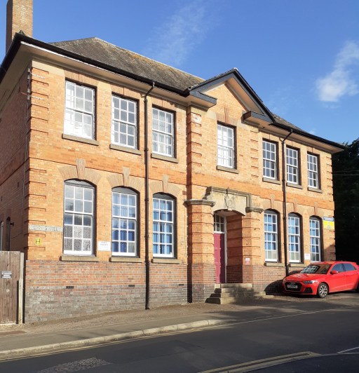
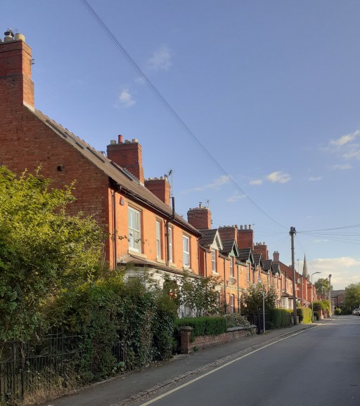
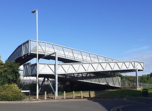
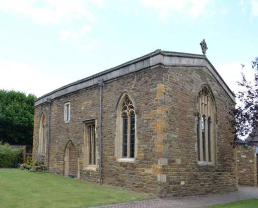
Pictures M and N show two nice examples of ghost signs from Catmose Street and Mill Street – faded, painted signs indicating a former usages. Picture O shows the Old Drill Hall on Penn Street which is impressive despite looking as if it could do with a bit of TLC. Picture P, also on Penn Street shows row of houses with a pleasing skyline. South Street Railway Bridge (Picture Q) is hardly beautiful, but very functional ,offering a way over the railway for pedestrians old and young, cyclists, mobility scooters, prams, shopping trolleys etc. For obvious reasons it is know in my household as the “slow bridge”. Finally Picture R (from here) shows the chapel of St John and St Anne – a medieval foundation serving the sheltered housing around it. It is the only place I know where the minister presiding at communion can watch, through the west window, the tops of passenger and freight trains passing within a few yards of the outer wall.#
Further posts on aspects of Oakham can be found using the button below.
