
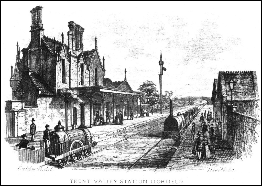
In 2020 I published a blog post entitled “Lichfield Trent Valley 1847-1871” – a study of the “first” railway station in Lichfield that was built when the Trent Valley Line opened in September 1847, and shown in the engraving above. The figure below, reproduced from that post, shows the location of this station in relation to the station of the South Staffordshire Railway that crossed the Trent Valley line and the second (existing station). The underlying map is the 1848 Tithe map of the township of Streethay where the station is situated.
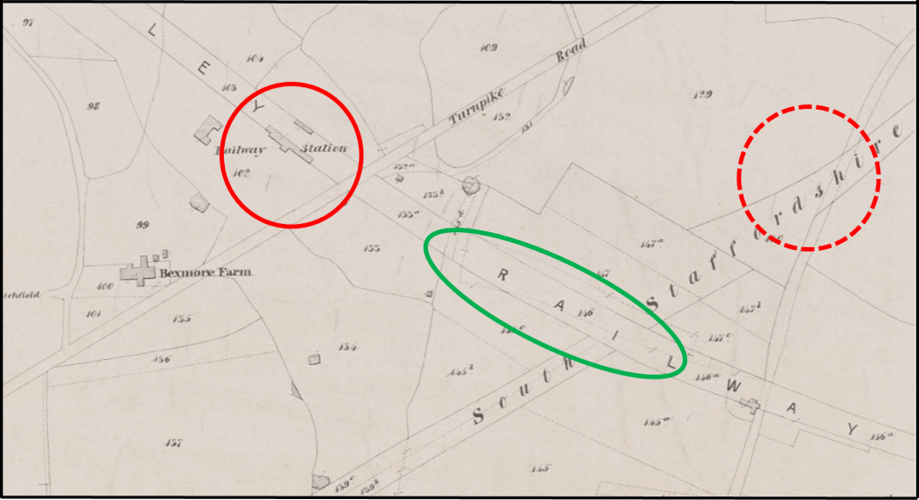
Extract from 1848 Tithe Map (red solid circle LNWR station location 1847-1871; red dotted circle – approximate SSR station location 1849-1871; green oval – location of current station
In 2021, I published a further post “Lichfield’s first station master” that looked at the life and times of William Durrad, the first to hold the position of Stationmaster. Both posts were gratifyingly quite widely read.
However a few days ago, I was browsing the 1851 census returns for Streethay (from which it might be concluded that I lead a rather sad existence). Sure enough, William Durrad and his family were there living at the railway station. But two pages earlier I came across the following entry.

Extract from the 1851 census for Streethay
It can be seen that it refers to Richard Mooney and his extensive family. Richard was a gatekeeper for the Trent Valley Railway and lived at the Old Station. Remember this was in 1851, when the railway had only been opened four years and, as far as anyone knows, the station that was built un 1847, the one shown above, was still in existence. What on earth was this “old station”? Looking at the order in which properties are listed on the census, the location of Richard Mooney’s dwelling can be quite precisely located, and is shown on the figure below, again on the 1848 tithe map. It can be seem to be where a road (the Old Burton Road) crosses the railway on a flat crossing – and thus the building shown is an ideal location for a Gatekeeper’s cottage. If this was a station, it was in use very briefly between the opening of the railway in September 1847 and the preparation of the tithe map sometime in 1848. Perhaps it was a temporary arrangement – simple platforms that were in use as the main station was being completed. It is also quite possible of course that the census entry is incorrect and based on erroneous information from Richard Mooney or the enumerator.
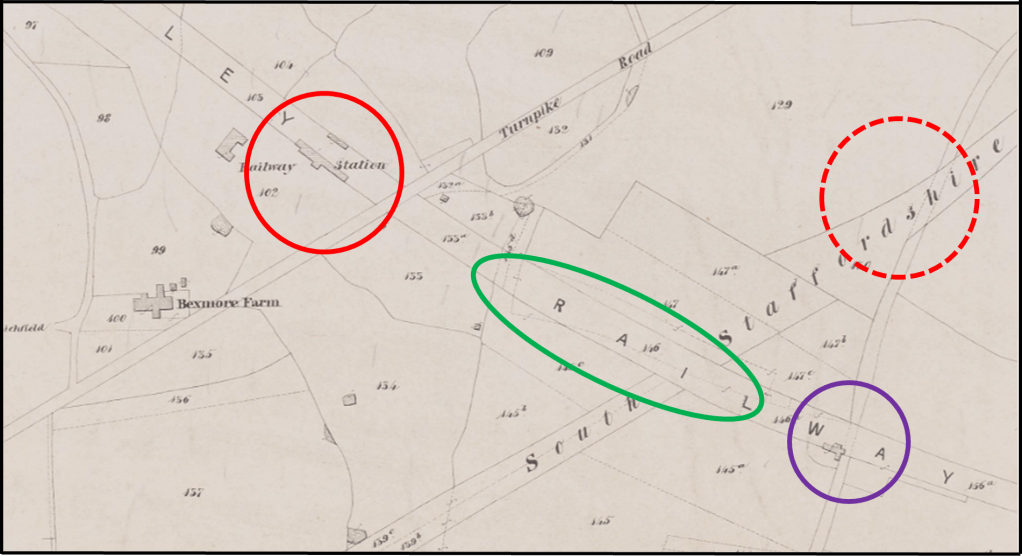
Extract from 1848 Tithe Map (red solid circle LNWR station location 1847-1871; red dotted circle – SSR station location 1849-1871; green oval – location of current station; purple circle – the location of the “old station”
So my initial post may not have been entirely accurate – it seems to me that there is a real possibility that there was, albeit for a very short time, an earlier station than the one I described in my earlier post. Sadly, there is nothing left of it on the ground. The crossing was replaced by a narrow bridge in the early 20th century, and this bridge was itself recently replaced by a much more substantial structure leading to the new cark park at the station. Any traces of the “old station” would have been destroyed when the foundations of the latter were being laid.
