The City of Stanley in Rutland

Introduction

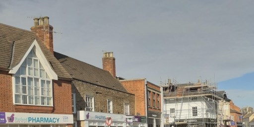
Recently, whilst researching some aspects of the history of All Saints Church in Oakham, I found some really useful articles in the Rutland Magazine and County Historical Record from the early years of the 20th century. It seems that this magazine had only a limited life span, but the volumes that were published contain some interesting and in depth articles on aspects of Rutland history. As I was browsing the contents, I found, in the very first edition, an article by A J Waterfield of Stamford, in which he reviews a 1902 reprint of a 1763 book that sets out an alternative history of England, and in particular describes the reign of King George VI of Britain between 1900 and 1925. In reviewing the book, Mr Waterfield was delighted to find that it contains a description of King George’s new capital – the City of Stanley just south of Uppingham in Rutland! I shared his delight and enjoyment, so I thought I would share his article here. This is set out in the next section. This is followed by some further notes on the eventful reign of King George VI as foreseen from 1763, more on the city of Stanley, and a short discussion on the authorship of the original book.

The City of Stanley, Rutland by Mr A J Waterfield

Rutland Magazine and County Historical Record, 1, 34-36

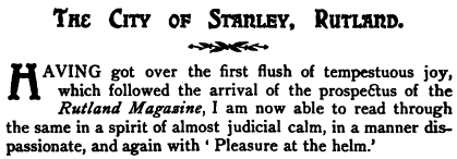
Having got over the first flush of tempestuous joy, which followed the arrival of the prospectus of the Rutland Magazine, I am now able to read through the same in a spirit of almost judicial calm, in a manner dispassionate, and again with ‘ Pleasure at the helm.’ In the list of articles shown as intended for publication, I observe, that one of the many good things promised is styled, ” The Lost Villages of Rutland.” Now the purpose of my present endeavour is to set down a few rambling remarks respecting a City of Rutland which was never founded. It is just a hundred and forty years since there was issued anonymously—printed in London—a little book of about a hundred leaves, bearing title, “The Reign of George VI.” As the name barely affords a glimmer as to the drift of the work,

taken up at a what’s-to-come period, and begun at an era that will not begin these hundred years,

I may be allowed to use the words of the Editor of a reprint, sent out three years ago. Mr. Oman, the well-known author, and Fellow of All Souls’ College, Oxford, says :

The author was intending to influence the men of his own day, by pointing out, in the actions of his puppets what ought to be done and what avoided in the Year of Grace 1763.

The author himself, begins with a reference to Swift’s History of Captain Lemuel Gulliver [written 1726], and goes on to say,

The modesty which is ever the companion of true merit, would by no means admit your author to think of a parallel between this history and the travels of Captain Gulliver.

Briefly then, the volume, under present notice, is a forecast—the years of the ‘ action ‘ being 1900-1925,—and at this stage, that part of the subject concerning the nature and tendency of “The Reign of George VI” may be dismissed. The part played by the gallant little county which the Saxons called Roteland, will presently be discerned. Our author writes:

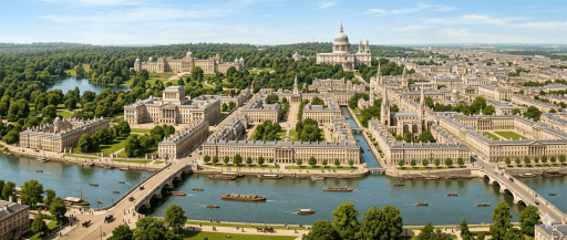
London, though the wonder of the world, never pleased the King. The meanness of his Majesty’s palace disgusted him; he had a taste for architecture, and determined to exert it in raising an edifice, that should at once do honour to his kingdom, and add splendour to his court.

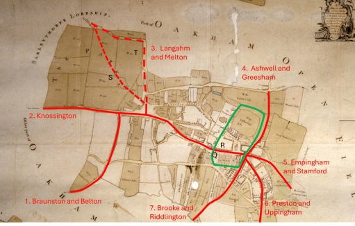
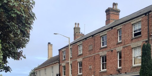
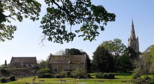
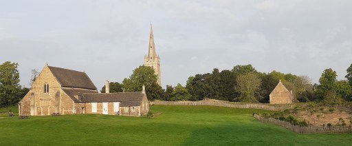
In Rutlandshire, near Uppingham, was a small hunting box of the late King’s, which George admired ; not for the building, but its beautiful situation. Few parts of his dominions could afford a more desirable spot for such a purpose. The old seat stood on an elevated situation which commanded an extensive prospect over the adjacent country. It was almost surrounded with extensive woods ; which having been artfully planted, added the greatest beauty to the prospect, without intercepting the view. On one side there was an easy descent of about three miles, which led into an extensive plain, through which a river took its meandering course. Many villages seemed to rise here and there from out the woods, which gave a great variety to the scene, and the fertile plain was one continued prospect of villages, groves, meadows, and rivulets, and all was in the neighbourhood of a noble and capacious forest.

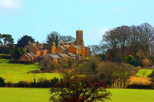
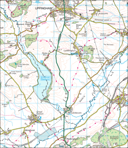
The landscape here described is that seen from Stoke Dry, the river the peaceful Welland, and the neighbouring forest, that of Rockingham. I remember reading, some years since, an ecstatic description of this quite charming spot, by an American visitor (perhaps Elihu Burritt, but I am not sure), whose opinion was that this viewpoint was one of the most delightful in the United Kingdom. Hereabout then, it is written, was begun, (one of several plans having been chosen), the building of a palace for his Majesty, to the exceeding wonder, no doubt, of the whole countryside. Toward the cost, a generous Parliament voted a first grant of a million sterling.

Nothing was spared to make this palace the wonder of the world,

and without touching details this bare statement is, in itself, quite sufficient to engage our interest, if not wonderment. Then followed, through the accident of an afterthought, the raising of some public edifices, Saint Stephen’s church and the Academy of Architecture being the first two ; of the latter, Gilbert, the King’s architect, was the first President. Later,

most of the nobility and many of the rich commoners, in imitation of their sovereign, erected magnificent palaces at Stanley,

by which name the fast uprising city became known.

What gave a prodigious increase to this noble city was the erection of the Senate House : that noble building . . . . the admiration of all Europe.

To hark back a little, I should before have mentioned that, by Act of Parliament, the Welland was made navigable

to the very plain at the bottom of the hill

 on which the city was growing, for the purpose of the conveyance of the material required. Portland stone only was used, and

” the houses were all built to form one general front on each side of every street,”

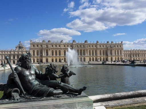
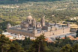
a regularity which might very easily have proved wearisome. An Academy of Painting was formed, on a grand scale, and about the same time the King’s palace was finished, eight years after its commencement. We read that the shell of the building alone cost eight millions sterling, and that the Spanish Escurial and Versailles were each

infinitely exceeded by Stanley

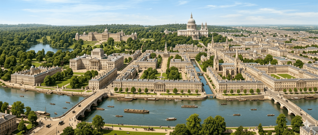
More than a dozen pages of the book are given up to the description of the city of Stanley to name the wonders and outstanding features of which would be, as it were, to compile a catalogue. By the year 1921, it is written, Stanley possessed a Cathedral which

in architecture, grandeur and extent far exceeded Saint Peters’ at Rome,

while the gardens of the King’s palace were become an eighth wonder in the land. The city had grown to be four miles square ; it had its University,

and was evidently become the metropolis of the three, or rather, four kingdoms.

And here we must take our leave of the amazing City of Stanley, Rutland, having in no appreciable degree exhausted the written account of its glories.

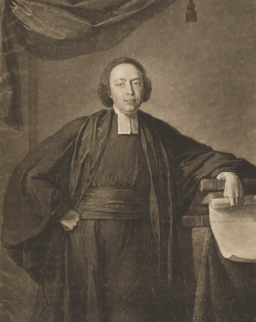
As a pendant to the foregoing, I proceed to add that, in regard to the authorship of “George VI” Mr. Oman, in his Editorial preface, invited information. I sought the aid of Mr. Joseph Phillips, F.S.A., that Admirable Crichton in everything relating to the history and records of Stamford and the district around. One learned that the author was the Rev. William Hanbury, an eighteenth century Rector of Church Langton, Leicestershire, an account of whose by no means Lilliputian achievements, not less than his gigantic (Brobdingnagian is quite too unwieldy) schemes form a really remarkable chapter, in what may be termed local history. Then some pleasant correspondence with Mr. Oman, to whom was given (as a matter of course), the name of my informant, the sterling gentleman whose recent death we all deplore.

King George VI

“The reign of George VI” was written in 1763, three years into the reign of the real George III. In the alternate history he is followed by George IV, George V. George VI then came to the throne in 1900. This suggests long reigns for the first three of these Georges, implying either that at least one of them fathered a child in his old age, or they were not necessarily all fathers and sons. By 1900, when George VI came to the throne, Britain was faced with an aggressive, expansionist Russian Empire that had taken over much of northern Europe. In the first year of his reign, the Russians invaded Britain, engaging in major land and sea battles. The nature of warfare was very much that of the 18th century – based on infantry and cavalry, with the leaders of the army being Earls and Dukes. Parliament refused at first to sanction money for the nation’s defence, partly because the Czar

had conveyed immense sums into England, and had most politically distributed them to the most advantageous purposes

but under pressure from the mob, parliament

they now offered to address his Majesty to take the state under his protection,

which in effect meant royal control over the exchequer, with which he properly equipped the army. The Russians were defeated at Wetherby under the field leadership of the king. The description given of the battle would not out of place in War and Peace. But this was not the end, and ongoing skirmishes with France tipped over into full scale warfare, with the army and the navy of the French king being supplemented by the remains of the Russian forces. George then led a small army into Flanders and northern France and forced the French into submission and a peace treaty was signed. The ensuring peace, in 1903, enabled George to turn to more peaceful interests in building up his country, and in particular in the building of his city of Stanley. The peace lasted until 1917, when the Russians attacked the German Empire, assisted, naturally enough, by the French. George took his army to assist Germany, and helped fight of the Russians, and defeat the French armies. In 1919 he entered Paris in triumph. Europe by this time was in a state of political and economic confusion, and George fought minor skirmishes and military actions throughout the next year, to subdue the Spanish in particular. The American colonists, still loyal to the crown, played their part in the defeat and overrunning of Mexico. It culminated with a victorious George being crowned King of France in 1920.

Entertaining as all of this alternative history is, it is of course, simply a reflection of the period in which it was written and of the concerns of that time. The armies were those of the 18th century, the countries and empires that threatened George were similarly those of that period. Monarchs and aristocracies still ruled and the French and American revolutions hadn’t happened. The huge changes brought about by the Industrial Revolution simply weren’t foreseen. The editor of the revised edition, Charles Oman has much more to say in his preface about the nature of the book’s predictions and how they relate to the politics of the original author’s own day.

The City of Stanley

As noted by Mr. Waterfield, he only gives the briefest of accounts of the City of Stanley, and the book contains much more information than that which he included. Rather than trying to summarise it, I have extracted the Stanley material and this can be accessed through the button below.

Extract from Britannia by John Ogiliby, 1675

But here I would make one or two further points. Firstly, I presume the name of the city comes from the Stanleys who were of course the Earls of Derby and very prominent in politics and intrigue for many centuries before the book was written, But as far as I can see, the choice of name is not made explicit anywhere. I fear that I struggle to take the name seriously, Stanley being forever associated in my mind with Stanley Unwin, Stanly Baxter and Stan(ley) Laurel. But that is my problem.

Secondly it is clear that, as with the political situation that is supposed, in architectural and planning terms, the author is reflecting his own time, and the city he envisages is essentially Georgian. I find it has a slightly nightmarish quality to it – grand, but rather soulless buildings, with no indication of commercial or domestic life. Indeed one wonders where all those who will provide for the aristocratic occupants of Stanley will live and where its food will come from – cities do not exists in a vacuum. At the very least the surrounding areas of Rutland would have been wholly changed in nature.

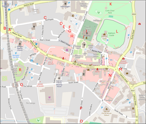
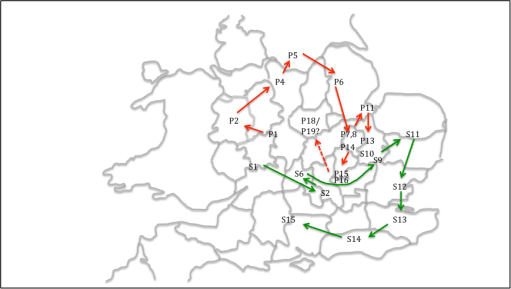
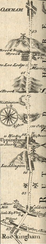
Similarly there is nothing about transport. One might have expected something about a grand road connecting Stanley with London – the author must have surely been aware of John Ogilby’s Britannia from 1675, which showed strip maps starting in London (see the map for our area to the left). Two years before the book was written, in 1761, the Bridgewater canal had been opened in the northwest and was seen as a major technological achievement. That is perhaps reflected in the mention of the canalisation of the Welland. Elsewhere in the book, where King George’s munificence to the general population is described, it is stated that canals connected every city in the realm – more or less the only transportation development that is described.

The City of Stanley – from Gemeni 2 AI

Who was the author?

Charles Oman, the editor of the reprint of 1902, was of the view that the author of “The reign of George VI” was clearly local to Rutland, because of his knowledge of the topography on which Stanley was built, and it is hard ot disagree with that. There are a couple of other indications pointing in that direction. Firstly, the canalisation of the Welland had been achieved in some fashion 100 years before in 1670 by the building of the Stamford Canal from Market Deeping to Stamford bypassing a stretch of the Welland that was used by mills and was not navigable. This predated the building of the first modern canal (the Bridgwater mentioned above) by 100 years and contributed greatly to the commercial success of Stamford. It is plausible to suppose that the author was aware of this attempt to make the Welland navigable in the development of his ideas.

The second point also relates to Stamford. Stanley is said to have 25 parish churches. In this of course, it resembles London, but Stamford also had a multiplicity of small parishes and their churches within the town. Again, this was an idea on which the author might have drawn.

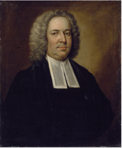
As can be seen from Mr Waterfield’s article, he identified the author as the Rev. William Hanbury, Rector of Church Langton in Leicestershire (1725-1778), and he was certainly an interesting character – a clergyman, garden and plantation creator, music festival organiser and philanthropist. But there seems to be little indication that he authored books and pamphlets such as the Reign of King George VI. Neither was he particularly local to Rutland.

On the edition of the book on Google Books, there is a note “Maddon?” which seems to refer to the Irish author Rev. Samuel Maddon (1686-1765). One of Maddon’s early works, from 1733, was what has been described as the first science fiction book “Memoirs of the 20th century” which included the first recorded depiction of time travel and consisted of diplomatic letters from between 1997 and 1999 in the reign of King George VI. The political situation depicted is however very much of his own time, with international relations mirroring those of 1733. The parallels are obvious, but there is no indication that Maddon was familiar with Rutland, and it may be that his book simply served as the inspiration for “The Reign of King George VI”.

To my mind, neither Hanbury or Maddon has a convincing case for being the author of the work considered here. I would look for somebody who lived in the Rutland / Stamford area, but as to who that might be I have no idea at all.

William Hanbury – National Portrait Gallery
Samuel Maddon – National Portrait Gallery

Oakham adverts 1932

Recently I have come across a number of old Church Guides and Histories for All Saints Church in Oakham- from 1932, 1972 and 1980. PDFS of these can be found on the History and Heritage page of the church website. There comes a time of course when old guides and histories become historical documents in their own right, revealing how the church was thought of and communicated at the time of writing, and in their description of their contemporary activities, give an indication of the nature of the church’s worship and other activities. This is particularly true of the 1932 guide – The Story of Oakham Church, School and Castle by the then vicar, A. Edward Fraser. In what follows I post just a few pages from this this guide – the adverts it contained for local businesses that paid for its publication. These are given below, and I suspect that Oakham readers will find them of considerable interest.

The street topography of early Oakham

Introduction

In the monograph “Oakham Lordshold in 1787”, Clough (2016) considers the map of the town of Oakham in Rutland produced for Lord Winchilsea in that year. This is the earliest map to show significant detail of the urban topography of the town, and from it Clough was able to infer some aspects of its late Anglo-Saxon / early Norman topography, in particular the existence of two enclosures encompassing the castle and the church, and the castle and a large portion of the town. In this post. I take his considerations somewhat further and, by considering the likely Anglo-Saxon road network around Oakham, infer some further features of the Anglo-Saxon urban topography.

Oakham connections

Cox (1994) in his extensive survey of Rutland place names, identifies a number of settlements in the Oakham area that were likely to have been in existence in the sixth and seventh centuries i.e. early on the Anglo Saxon era. These are as follows.

  • Place names ending in -ham, meaning village or estate. These include Oakham itself; Langham and Wymondham to the north west; Greetham and Grantham to the north east, Empingham to the east and Uppingham to the south.
  • Place names ending in -dun meaning a large hill, of which the only one in the vicinity of Oakham is Hambleton.
  • Place names associated with the Anglian tribe of the Hwicce of which Whissendine to the north of Oakham is the only one locally.
  • The villages of Brooke, which has an early attestation, and Braunston, which incorporates an early form of Anglo-Saxon name and has possible Roman antecedents.
  • The -well names meaning spring, and in particular Ashwell, although this might be slightly later than the others.
  • The major settlements in the wider region either with proven continuity since the Roman period or are of an early form- Leicester, Nottingham, Lincoln and Stamford.

In what follows we presume that in the Anglo-Saxon and Norman periods, Oakham had road / pathway connections to these early settlements that are, broadly, the predecessors of those we see today at least out of the settlements themselves. Country roads are very conservative topographical features and change little over the centuries. Within, and on the entry to settlements, they would however have been more prone to change, because of building and commercial developments. In these terms we will consider seven such roads that converge on Oakham and in particular we attempt to trace the “natural” course of these roads into and through the town, again assuming that these are the courses that would have been followed in the Anglo-Saxon period, rather than the courses that have developed over the centuries.  

But first a broader point is worth making. Oakham was in the ninth and tenth centuries was in many ways at the centre of the Danelaw, with roads passing through it that connected Leicester in the west to Stamford and Lincoln in the east, and Northampton in the south with Derby and Nottingham in the north. As such, it is likely to have been of some strategic importance, particularly during the period when King Edward and Lady Aethelflead finally defeated the Danish armies in the area between 910 and 920.

The Anglo-Saxon roads

The roads that we are considering are shown in Figure 1 on a copy of the 1787 map as given in Clough (2016). These are as follows.

Figure 1. The proposed early road layout

  • Road 1 from Belton and Braunston (and beyond that Leicester) that runs up what is now Braunston Road and West Road (formerly known as Cow Lane) and joins Road 2 to the west of Oakham.
  • Road 2, the current Cold Overton Rd from Knossington, runs in a west to east direction, across what would become many centuries later the railway crossing and into Oakham. If the line of the road is continued, it runs along Dean Street (A) towards the church (B), and not along High Street. This straight alignment is very clear from the satellite view of figure 2. I will argue below that High Street was a relatively late development and was laid out in the Norman period. I have then shown the road running to a point in the current market place (C) in front of the castle (D) although this last stretch is conjectural.
  • Road 3 is the road from Melton Mowbray (and Derby and Nottingham beyond) through Wymondham and Langham. The modern approach to Oakham is via a sharp 90 degree turn along the railway down towards the level crossing. It will be seen below that this route was actually in place in the 16th century at the latest, so it is not a modern development. However, here we take the natural line of the road to continue from the north of the area marked as the Parks (E) towards the sharp kink in the modern Northgate (F) and then following Northgate and Church Alley to a junction with Road 2 in the Market Place. Again, this natural course is very obvious on the satellite view of Figure 2. This seems a much more natural route into the centre of the town.
  • Road 4 is from Ashwell and Greesham (and beyond that Grantham) that is taken to follow the existing course of Burley Rd. east of the castle to a junction with Road 5. 
  • The course of Road 5 from Stamford and Empingham has changed significantly over the centuries, as it was moved to loop around Catmose Hall. Clough conjectures that it used to entire town through either or both of Bull Lane (G) or Tanners Lane (H) to the north of Bull St. We choose the latter course here as it allows this road to meet those from the west in the Market Place.
  • Road 6 from Uppingham and Preston follows its modern course to the end of Mill St. (J) and then cuts across to meet the other roads in the Market Place,
  • Road 7 from Brooke and Riddlington follows the current course of Mill St.  to a junction with Road 6 (J).

Figure 2. Satellite views of the western and northern approaches

The Saxon / early Norman enclosures.

Figure 1 also shows two enclosures. The black dotted lines is a (very) conjectural boundary of the Anglo-Saxon settlement, based on the discovery of boundary ditches at K, L and M summarised by Clough. The purple solid line is the enclosure surrounding the castle and the church identified by Clough, largely on the basis of the flooded ditch at N (that has also been identified in archaeological investigations). Taken together these two enclosures would seem to represent the extent of the Anglo—Saxon and early Norman settlement. The strategic and defensive position of the castle (and in particular the Motte in the south east corner P) adjacent to the meeting point of the roads through the town is very clear. The most striking point about the proposed reconstruction is the absence of the High Street – its anomalous orientation with regard to the other roads suggests it postdated the original road layout. South Street was however likely to be in existence early as it marks the southern boundary of the enclosure. Note its original course ran straight from the west to the east, and did not diverge to the south east at its eastern end.

Changes in the Norman period

Figure 3. The post-conquest road layout

Figure 3 shows the road system and enclosures in the later Norman period. Clough identified the enclosure outlined in green that contains the castle and the portion of the town to the south. He speculates that the pattern of enclosures was changed when the manor was relinquished by (probably) William II and divided between Lordshold and Deanshold (the Dean referring to being that of Westminster Abbey), with the results that the church and the castle holdings were separated. This enclosure was again identified on the basis of a flooded ditch at Q. Clearly the function of this enclosure is very different and seems to be about controlling the movement of people and goods through the town (presumably for taxation purposes). It is like that this is the period when the current High Street came into existence. The Speed map of 1611 (Figure 4) shows “Bargate” at R, (built into the current Flores House) where presumably people and goods were assessed . The road system has also been changed to ensure all traffic flows along High Street. In the west, Road 3 was rerouted, probably in the first instance to follow the current line of Park Lane (S) down to Road 2. At some point the area named as the Parks was enclosed (both routes are shown on the 1611 map), and the route would again have been changed to run around this area, resulting in the modern road configuration (T). The current traffic chaos around the level crossing on the Cold Overton Road thus has its genesis many centuries ago! The combined roads 2 and 3 were then rerouted along the new High Street, rather than down Dean Street. To the east, it is likely that the Stamford Road was rerouted to come into town via what is now Bull Lane.

Figure 4. The Speed map of 1611

Loose ends

In this final section we note a number of what might be called loose ends in the above argument – the lack of destinations for one of the identified roads; the lack of direct roads from a significant place in the locality and the nature of the town “gates”.

A road to nowhere

Road 2 approaches Oakham on a straight route from the west, and within the town becomes Dean Street. But where was it coming from? There are no settlements out in that direction that can be confidently given an early date. Two thoughts come to mind – either that it was part of a somewhat roundabout route to Leicester, or that it was the route to what can be surmised to be early fortifications of the Rutland border to the west (where a number of names indicate beacons). There are no doubt other possibilities.

The route to Hambleton

There are clear indications in Domesday that the major settlement in the area at the time was Hambleton, and it was suggested above that this settlement was of an early date. As far as can be ascertained from the fairly recent maps that are available, the route there was a 90 degree junction of the Stamford Road (see the 1900 Ordnance Survey map of Figure 5). However the map shows a pedestrian way to the west of the junction that cuts of a corner and is a much more natural way to Hambleton. It seems possible that the Stamford Road bifurcated at that point with branches to Empingham and Stamford to the north and Hambleton and Ketton to the south, but that this junction was supressed during the enclosures. So Road 5 might better be referred to as the road to Hambleton, Empingham and Stamford

Figure 5. The road to Hambleton (from 1900 Ordnance Survey map

The gates

“Gates” is an ambiguous word. It can either refer to a physical gate to the town, or be a derivation from the Norse -gata simply meaning road. Bearing this in mind, Clough identifies two gates – an East gate at the entry of the Stamford Road into the enclosure around the present Bull Lane, and a West gate – the Bar-gate mentioned above. The road system was clearly arranged to direct all traffic through these, and resulted in quite a small central enclosure.

Now, whilst no south gate has ever been identified, from the earliest maps, there is a Gibbet Gate shown on the Speed Map on Stamford Road (Figure 4). This is someway outside the enclosed areas, and is this case the word gate probably simply defines a road rather than anything else. albeit one leading to a somewhat grisly destination.

The name Northgate, however, appears on a number of maps. On the Speed map this is positioned somewhere near the railway crossing, and on later maps, the current Northgate is known by either that name or by Northgate Street. Again, this could either refer to an actual gate to the town, or simply a way to denote a road. But if there was an actual North Gate, where was it?  In my view, the most likely position is at the current sharp junction of the modern Northgate – F in figure 1, on the original Melton Road and at the possible confluence of the Saxon town and Castle / Church enclosures. A modern photograph is shown in Figure 6 below – taken from the east showing the possible location of the north gate (the thatched cottages) and the line of the road from there to the castle.

Figure 6. The possible location of the north gate

References

Clough T. H. McK. (2016) ” Oakham Lordshold in 1787 – A map and survey of Lord Winchilsea’s Oakham estate” Rutland Local History & Record Society, Occasional Publication No 12

Cox B (1994) “The place-names of Rutland” English Place Name Society

Public Transport in Oakham from the 1960s to the present

Introduction

In this post we will consider how bus and train transport in Oakham has changed from the 1960s to the present day, for both good and bad. To do so, we will use a variety of historical resources, primarily old bus and rail timetables. We will look at four time slices – at the state of the railways in the early 1960s i.e. before the Beeching cuts; at the bus services and train service provided in the late 1960s, after Beeching but before bus deregulation; in the late 1990s after rail privatization and bus deregulation; and the current situation. The time slices chosen have in effect been determined by what information is available. However, between them they give a clear picture of how bus and train services in Oakham have developed (or perhaps degraded) over the last 50 to 60 years.

Sources and limitations

For the early 1960 rail services we use the following sources:

  • London Midland Region timetable for 1963 and 1965 (personal collection);
  • Bradshaw’s Guide 1961 (from Timetable World).

These are quite comprehensive and give a full coverage of the rail services at that time, which is of course before the Beeching Report and associated closures. The sources for the late 1960s are both taken from Timetable World:

  • London Midland Region timetable for 1969;
  • Bus timetables for the late 1960s.

Whilst the rail timetables can again be expected to be comprehensive, the bus timetables are probably less so. Finding services through Oakham requires a search of the index for bus companies operating in the area. It is possible that I have missed some potential sources of information, although I believe I have captured most of the main services. What I have almost certainly missed are any very local services operated by small operators in the Oakham district, which simply do not appear on the Timetable World web site. The bus timetables are from the years 19868 and 1969 with one exception from 1973 (for a Saturday only service). For the late 1990s we obtain information from the following sources:

  • Railtrack Great Britain timetable for 1999 (from Timetable World);
  • Great Britain Bus Timetable 1999 (personal collection).

The Great British Bus Timetable is a compilation of services from across Great Britain. It admits that it excludes local operators and services of a purely local nature, so again the bus information might not be fully comprehensive here. For the current situation we used information for bus and train times that is available on the web as follows:

Operators

In the analysis that follows, we will identify bus and train operators by a two letter code.

  • BL – Blands of Cottesmore – a local bus company based in a village to the east of Oakham.
  • BA – Bartons or Barton Tobin Hood – a large regional bus company based around Nottingham, but with a garage in Stamford.
  • BR  – British Rail – the National pre-privatisation rail operator.
  • CB – CentreBus – an East Midlands regional operator.
  • CC – Cross Country Trains – the current franchise operator of trains through Oakham, with a wide nationwide network.
  • CT – Central Trains – a previous operator of trains through Oakham, based in Birmingham with a wide regional network across the Midlands.
  • EM – East Midlands Railway – the mainline train operator serving the East Midlands cities, that runs occasional services through Oakham (and is, bizarrely, the firm responsible for running the station).
  • KI – Kinchbus – a small Loughborough based bus company
  • LR – Lincolnshire Road Car – a large regional company in the 1960s, primarily based, as might be expected, in Lincolnshire.
  • MR – Midland Red Leicester – the regional operator of the very large Midland Red network that operated buses across the wider Midlands area.
  • RC – Rutland County Council – which currently operates a small number of services for which no franchise partner could be found.
  • UC – United Counties Omnibus Company – a large regional company primarily based in the Northampton area.

Analysis

In what follows we consider the public transport services through time in four categories:

  • Local interurban services to Stamford, Melton Mowbray and Uppingham;
  • Regional services to Peterborough, Leicester, Nottingham, Grantham and Corby;
  • Long distance services to Birmingham, Cambridge and London;
  • Miscellaneous services for which information is incomplete – very local services, long distance coaches etc.

For the first three categories we present the data in tabular form in a consistent format, and then discuss how these have evolved over time. Discussion of the latter category is inevitably rather more diffuse due to the lack of much historical information.

Local interurban services

Tables 1 to 3 show, in standard form, the bus and train services between Oakham and Stamford, Melton Mowbray and Uppingham. Journey times and number of journeys / day are shown. Clearly there are both train and bus options to Stamford and Melton Mowbray, but only bus options to Uppingham. The bus journeys in 1969 and 1999 were provided by major bus operators for which Oakham was at the edge of their operating area – United Counties in Northampton, Lincolnshire road Car, Bartons in Nottingham, Kinchbus in Loughborough. Currently they are provided by more local operators – primarily Blands, but with Rutland County Council running the current Oakham to Stamford service. The bus journey times and service frequencies have remained similar over the period (although note that the former can vary significantly depending on what villages are served on the way between urban centres. The loss of Sunday services is obvious from the data in the tables. What is not so obvious is the fact that evening services on all the bus routes have been significantly cut over the study period.

By contracts the train services have seen major improvement. The Leicester to Peterborough shuttles stopped at all the village stations before Beeching and the journey times between Oakham and Melton Mowbray and Stamford were of the order of 20 minutes. By 1969 these stations had closed and the journey times significantly reduced. This reduction has continued up to the present with faster stock being introduced on the line and, most significantly, the number of journeys has increased by a factor of two with the introduction of hourly through Birmingham to Cambridge / Stansted Airport services. These improvements have however resulted in a significant loss of connectivity to the villages where stations were closed in the 1960s.

Table 1. Oakham to Stamford

  1. Uppingham to Stamford via Ridlington, Wing, Oakham (Railway Station Crossing), Exton, Whitwell, Empingham and Great Casterton. UC also operated service 280 with one return journey on Fridays only from Oakham to Stamford vis Edith Weston.
  2. Oakham to Stamford via Whitwell, Empingham and Great Casterton.
  3. Oakham to Stamford via Whitwell, Empingham and Great Casterton. BL185 has one service from Monday to Friday and four on Saturday.  RCR9 has five services Monday to Friday.
  4. Leicester to Peterborough East via Syston, Frisby, Melton Mowbray, Saxby, Ashwell, Oakham, Manton for Uppingham, Luffenham, Ketton and Collyweston, Stamford, Helpston and (for some journeys) Peterborough North.
  5. Leicester to Peterborough via Melton Mowbray, Oakham and Stamford
  6. Birmingham to Cambridge / Stansted Airport via Leicester, Melton Mowbray, Stamford and Peterborough.
  7. Birmingham to Cambridge / Stansted Airport via Leicester, Melton Mowbray, Stamford and Peterborough. Also, two early morning / late evening EM services from Nottingham to Norwich calling at Loughborough, Melton Mowbray, Stamford and Peterborough (not included in table).

Table 2. Oakham to Melton Mowbray

  1. Melton Mowbray to Oakham (Station Approach) via Whissendine, Ashwell and Langham. Also, four journeys / day Oakham to Langham only.
  2. KIRF (Rutland Flyer) Corby to Melton Mowbray via Uppingham, Oakham and Cottesmore; BA2 Uppingham to Nottingham via Oakham, Langham, Whissendine and Melton Mowbray.
  3. BLR1 Corby to Melton Mowbray via Uppingham, Oakham, Langham and Whissendine; CBR2 is Oakham to Melton Mowbray via Exton, Cottesmore and Whymondham. Also, one BLR4 service per day Melton Mowbray to Peterborough via Oakham and Uppingham (not shown in table).
  4. Leicester to Peterborough East via Syston, Frisby, Melton Mowbray, Saxby, Ashwell, Oakham, Manton for Uppingham, Luffenham, Ketton and Collyweston, Stamford, Helpston and (for some journeys) Peterborough North.
  5. Leicester to Peterborough via Melton Mowbray, Oakham and Stamford.
  6. Birmingham to Cambridge / Stansted Airport via Leicester, Melton Mowbray, Stamford and Peterborough.
  7. Birmingham to Cambridge / Stansted Airport via Leicester, Melton Mowbray, Stamford and Peterborough. Also, two early morning / late evening EMT services from Nottingham to Norwich calling at Loughborough, Melton Mowbray, Stamford and Peterborough (not included in table).

Table 3. Oakham to Uppingham

  1. Uppingham to Stamford via Ridlington, Wing, Oakham (Railway Station Crossing), Exton, Whitwell, Empingham and Great Casterton.
  2. KIRF (Rutland Flyer) Corby to Melton Mowbray via Uppingham, Oakham and Cottesmore; BA2 Uppingham to Nottingham via Oakham, Langham, Whissendine and Melton Mowbray.
  3. Corby to Melton Mowbray via Uppingham, Oakham, Langham and Whissendine

Regional interurban services

In this section we consider the evolution of services from Oakham to the major surrounding conurbations of Peterborough, Leicester, Nottingham, Grantham and Corby (Tables 4 to 8). With regard to Peterborough and Leicester, the same remarks can be made as in the last section in terms of the rail services, with steadily decreasing journey times and a major improvement in service frequency. For both towns there have only ever been occasional and sporadic bus links, addressing specific leisure, employment or educational needs, with long journey times.  Direct services to Grantham were an early casualty of service rationalization and were not provided after the early 1970s.  

In the early 1960s train services were provided from Nottingham to Melton Mowbray, Oakham, Corby, Kettering and beyond. Services on this line were a major casualty of the Beeching closures and there are now only very limited rail services to both Nottingham and Corby. Whilst there was quite a good bus service from Oakham to Nottingham in 1999, operated by Barton, this did not last and there are now no direct bus services to that city. There are, however, regular services to Corby that run through Oakham to Melton Mowbray. In 1999 these were provided by Kinchbus and marketed as the Rutland Flyer. Now the service is operated by Blands. Journey times are of the order of 40 to 50 minutes.

Table 4. Oakham to Peterborough

  1. Melton Mowbray to Peterborough via Langham, Oakham, Uppingham and South Luffernaham.
  2. Leicester to Peterborough East via Syston, Frisby, Melton Mowbray, Saxby, Ashwell, Oakham, Manton for Uppingham, Luffenham, Ketton and Collyweston, Stamford, Helpston and (for some journeys) Peterborough North
  3. Leicester to Peterborough via Melton Mowbray, Oakham and Stamford
  4. Birmingham to Cambridge / Stansted Airport via Leicester, Melton Mowbray, Stamford and Peterborough.
  5. Birmingham to Cambridge / Stansted Airport via Leicester, Melton Mowbray, Stamford and Peterborough. Also, two early morning / late evening trains from Nottingham to Norwich calling at Loughborough, Melton Mowbray, Stamford and Peterborough (not included in table).

Table 5. Oakham to Leicester

  1. Saturdays only. Oakham (Station Road) to Leicester via Braunston, Knossington, Cold Overton and Melton Mowbray.
  2. Leicester to Peterborough East via Syston, Frisby, Melton Mowbray, Saxby, Ashwell, Oakham, Manton for Uppingham, Luffenham, Ketton and Collyweston, Stamford, Helpston and (for some journeys) Peterborough North.
  3. Leicester to Peterborough via Melton Mowbray, Oakham and Stamford
  4. Birmingham to Cambridge / Stansted Airport via Leicester, Melton Mowbray, Stamford and Peterborough.
  5. Birmingham to Cambridge / Stansted Airport via Leicester, Melton Mowbray, Stamford and Peterborough. Also two early morning / late evening trains from Nottingham to Norwich calling at Loughborough, Melton Mowbray, Stamford and Peterborough (not included in table).

Table 6. Oakham to Grantham

  1. Oakham (Railway Station) to Grantham, calling at Cottesmore, Greetham, Market Overton and Thistleton. Also 3 journeys from Oakham to Cottesmore only.

Table 7. Oakham to Nottingham

  1. Nottingham to Uppingham via Melton Mowbray, Whissendine, Langham and Oakham.
  2. Nottingham to Kettering, via Old Dalby, Melton Mowbray, Oakham, Manton for Uppingham, Gretton, Corby and Kettering, Two or three of these were from Nottingham (and beyond) to London St Pancras.
  3. Nottingham to Norwich calling at (Leicester), Loughborough, Melton Mowbray, Oakham, Stamford and Peterborough (early morning and late evening only)

Table 8. Oakham to Corby

  1. Corby to Melton Mowbray via Uppingham, Oakham and Cottesmore.
  2. Corby to Melton Mowbray via Uppingham and Oakham
  3. Nottingham to Kettering, via Old Dalby, Melton Mowbray, Oakham, Manton for Uppingham, Gretton, Corby and Kettering. Two or three of these were from Nottingham (and beyond) to London St Pancras.
  4. Melton Mowbray to London St Pancras calling at Oakham and Kettering.


Long distance services

The three long-distance services we consider are Oakham to Birmingham, Cambridge and London (Tables 9 to 11). All of these are rail based. The first two reflect the changes described above to the Leicester to Peterborough services with a significantly increased number of services and steadily reducing journey times. The London situation is very different. When services ran from Nottingham to London via Oakham in the early 1960s, there were four trains to and from London each day. After Beeching these were withdrawn completely and it is only in recent years that one journey, from Melton Mowbray to London has been reinstated. Thus whilst there has been considerable improvement in east / west connectivity, north / south connectivity has been reduced to a nominal level.

Table 9. Oakham to Birmingham

  1. Birmingham to Cambridge / Norwich via Leicester, Melton Mowbray, Stamford and Peterborough.
  2. Birmingham to Cambridge / Stansted Airport via Leicester, Melton Mowbray, Stamford and Peterborough.
  3. Birmingham to Cambridge / Stansted Airport via Leicester, Melton Mowbray, Stamford and Peterborough

Table 10. Oakham to Cambridge

  1. Birmingham to Cambridge via Leicester, Melton Mowbray, Stamford and Peterborough.
  2. Birmingham to Cambridge / Stansted Airport via Leicester, Melton Mowbray, Stamford and Peterborough. Birmingham to Cambridge / Stansted Airport via Leicester, Melton Mowbray, Stamford and Peterborough

Table 11. Oakham to London

  1. Nottingham to Kettering, via Old Dalby, Melton Mowbray, Oakham, Manton for Uppingham, Gretton, Corby and Kettering. Two or three of these were from Nottingham (and beyond) to London St Pancras.
  2. Melton Mowbray to London St Pancras via Oakham and Kettering

Other services

When looking at the information available from the sources listed above, it is clear that there are two broad categories of bus service that are not fully represented – very local services in and around Oakham and the nearby villages; and long-distance coach services. With regard to the former, it is known that local companies such as Blands provided specific services to places of work and education and indeed that still continues in the latest timetable. These are usually one or two journeys a day with no wider public transport relevance. Als Rutland County Council operate a minibus Rutland Hopper service around the town to out-of-town stores and local villages.

It is also clear that some long distance coaches operated through Oakham, but these are  not easy to find, usually occurring in specific operators timetables. For example, in 1968 Barton operated a long-distance coach service between Corby and Glasgow (presumably for steel worker s to visit families), with daytime trips on Sunday, Monday and Wednesday, and overnight trips on Friday and Saturday, that picked up and dropped off at the Crown Hotel. Similarly in 1969 Trent Motor Traction, based in Derbyshire and Nottinghamshire ran weekend services from Derby and Nottingham to Southend on Sea, Cambridge and Clacton that ran through Oakham, picking up and setting down at the Market Place. There were no doubt other similar occasional services.

Conclusions

So what can one conclude from the data presented above? Firstly with regard to rail services, it is clear that there have been major improvements in connectivity to the east and the west, with reducing journey times and increased frequencies. That being said, current reliability and punctuality is poor and requires improvement. Services to the north and south have however seen major degradation and are now only represented by one journey a day to London. With regard to bus services, in some sense these have seen little change, with journey times and frequencies on most routes remaining broadly constant, at least on weekdays. That being said, there have been some losses – to Grantham and Nottingham in particular, Sunday services are non-existent and evening services have been severely cut back, Perhaps more importantly the service times and frequencies that were acceptable in the 1960s now simply represent a very basic service that is not attractive to most car-owning travelers.

Oakham roofs

Introduction

This post concerns roofs 1 – specifically those on the High Street of Oakham in Rutland. I find the upper floors of urban streets quite fascinating in their form and variety. When walking through towns however, one rarely looks upwards – indeed most of the time you would risk colliding with other pedestrians or walking into the road if you did. It is the shop fronts and their contents on the lower floors that command attention of course. But above them, the buildings themselves are sometimes stylish, sometimes idiosyncratic, sometimes merely odd – and usually worth a look. In what follows I show two galleries of photographs, both looking at the upper floors of buildings on the north side of Oakham High Street, taken from the pavement on the south side. The first gallery is a series of photographs from east to west (the junction with Burley Street and the Market area to the Wetherspoons pub), and the second from west to east. I am not really in a position to comment on the buildings in architectural terms, so the photos are simply presented for the reader’s interest and enjoyment.

1 I am fairly sure that when I was at school I was told that this was spelt “rooves”, but Google informs me that this is an archaic word, no longer used in practice. I fear I am thus labelled as archaic, which is probably true.

From east to west

From west to east

All the photos were taken by me, but I am happy for them to be used by others, with a proper acknowledgement.

A walk around Oakham

The walk

This is a picture blog, that simply gives pictures of a walk around Oakham. This is not a walk that takes in the traditional historical highlights, although some of those are included, but is rather one in which I show the things that have caught my eye, mainly on my wonderings about the town with the dog. So it is a little idiosyncratic, but I hope will be of interest to some. Except where otherwise indicated, the pictures were all taken by me, and I am happy for them to be used by others, properly credited of course.

The map

The map below shows the approximate locations from which the photographs (A to R) were taken, superimposed on an up to date map from Open Street Map.

The pictures

The first picture is of the listed Midland Railway bridge and level crossing (Picture A) a source of endless frustration to drivers, and, as the location of the meeting of five roads, a horribly hazardous place for pedestrians. There must be a better way of doing traffic management here. Picture B is the Midland Railway Signal Box, which was the inspiration for the Hornby Railway model. Turning along Northgate, there are three pictures of rose bushes (Pictures C to E), some cultivated, some not. but in early summer their cumulative effect is striking. Picture F is of a house a little further along Northgate, with a wonderful display of creepers and climbing foliage.

The next six photos all figure All Saints Church in one way or another. Picture G is a photo taken from Northgate on a misty evening where all that can be seen of the tower is a small floodlight area. The thatched cottages on Northgate can be seen in the foreground. Picture H shows the spire of the church from the garden of the Wheatsheaf pub opposite on a pleasant summer afternoon. Picture I (from here) shows the Green Man stone capital within the church – one of a series of wonderful capital carvings I have blogged about elsewhere. Picture J shows a possible Anglo-Saxon Saxon cross built into the south porch of the church. The identification is very speculative, but the cross is very similar to other, demonstratively, Anglo-Saxon examples. Pictures K and L shows t wo views of the Castle Great Hall, Old School and Church, from Cutts Close and the Castle grounds. I have argued elsewhere that these might be an indication of an early church group in the area. Click on the pictures to see the full extent of the photographs.

Pictures M and N show two nice examples of ghost signs from Catmose Street and Mill Street – faded, painted signs indicating a former usages. Picture O shows the Old Drill Hall on Penn Street which is impressive despite looking as if it could do with a bit of TLC. Picture P, also on Penn Street shows row of houses with a pleasing skyline. South Street Railway Bridge (Picture Q) is hardly beautiful, but very functional ,offering a way over the railway for pedestrians old and young, cyclists, mobility scooters, prams, shopping trolleys etc. For obvious reasons it is know in my household as the “slow bridge”. Finally Picture R (from here) shows the chapel of St John and St Anne – a medieval foundation serving the sheltered housing around it. It is the only place I know where the minister presiding at communion can watch, through the west window, the tops of passenger and freight trains passing within a few yards of the outer wall.#

Further posts on aspects of Oakham can be found using the button below.

Rutland – an enigmatic history

The enigmas of early Rutland history

Since moving to Rutland last summer, I have come to realise that there are a number of enigmas in the early history of the county. Firstly, there is the fact that the county was the last one to be formed, and at Domesday, the northern Wapentakes of Alstoe and Martinsley were a detached part of Nottinghamshire, and the large double-hundred of Witchley in the south was part of Northamptonshire. In his consideration of this issue, Phythian-Adams (1), suggests that there was an underlying unity to the area that was to become Rutland, as it was formed from the dower lands of the late Mercian and Anglo-Saxon queens, and as it was also a Royal Forest, and that the split between Nottinghamshire and Northamptonshire occurred at some point during the period of the five Viking boroughs. This seems to have been generally accepted and seems to me quite plausible. Phythian-Adams also speculates that this area might have a longer history as a discrete unit. I have taken these thoughts a little further in a recent blog, and, noted that Rutland is essentially the upper catchment of the River Welland, whilst neighbouring South Kesteven is the catchment of the River Glen that joins the Welland east of Stamford. This of itself falls into the pattern of some early Anglo-Saxon polities in being based on river catchments, but the fact that both rivers run into the heavily managed fenland, in this case in the region of the Spalde of the Tribal Hidage (2) suggests that both Rutland and Kesteven would have required some authority, at least in terms of water management. I went further and suggested that these two polities could have been the East and West Wixna mentioned in the Tribal Hidage, as the order in which that document lists the polities in the fenland area, places them between the Gyrwe around Peterborough on the Nene and the Spalde to the north i.e. consistent with the geographical locations of Rutland and South Kesteven.

The second enigma is that within the county there are a number of place names that refer to the Anglo-Saxon tribe of the Hwicce. These have been investigated by Green (3) and include Witchley Warren, Witchley hundred, Whissendine and Witchely Leys. The Hwicce of course are known in the historical record as a West Midland polity, based around Worcestershire and Gloucestershire, so the existence of these names in Rutland is somewhat odd, and suggests that at some point in their history, at least a part of the Hwicce were resident in Rutland – probably before they became established in the Worcestershire area, so perhaps in the early sixth century. Phythian Adams (1) also points out that, on the western boundary of the county, there are a number of place names that refer to beacons, military guard posts etc., which suggest that the Rutland Hwicce had need to be wary of their neigbours to the west.  I have addressed this issue in a second recent blog post, suggesting that the possible area name of East Wixna is another indication of the presence of the Hwicce, and also pointing out that in 1066 Queen Edith, the wife of Edward the Confessor, as well as holding much of Rutland in Lordship, was also the Lord of a large cluster of manors in Herefordshire, in the area usually ascribed to the Magonsaete tribe, sometimes referred to as the Western Hecani, or Hwicce. How far back these holdings go would require a detailed study, but on the face of it, it does suggest enduring links between Rutland and what was to become the main territory of the Hwicce.

There is however a third enigma – the often-observed fact that the place names within Rutland are overwhelmingly English, despite being surround by Danish areas, which suggest that although the Danes might have had political control of the area, they did not settle there. Phythian-Adams (1) speculates that this was due to an agreement in 893 between a representative of King Alfred of Wessex and the Danes of York, who seemed to be exercising political control in the area, because Rutland was the dower of the late Mercian queens – and thus of his own sister Aethelswyth, the wife of the last King of Mercia, Burged who was deposed by the Danes, and possibly his daughter Aethelflaed, the Lady of the Mercians who was married to Ealdorman Aethelred. Whist this plausible, I do not find it wholly convincing as a reason for Wessex to strike such a bargain with the Danes, presumably at some unspecified cost. In what follows I speculate on a further reason why the rules of Mercia, and later Wessex, might wish to retain Rutland as a specific English-speaking area. I will base this on the work of Green (4), who proposed a wave of migrations eastwards and northwards from Lincolnshire in the early sixth century, and of Jones (5) who mapped the place names associated with the early members of the Mercian royal house.

East of England migrations

Through a detailed consideration of place and tribal names Green (4), in her extensive discussion of Anglo-Saxon Lindsey, shows, conclusively to my mind, that Lindisfarne off the coast of Northumbria, was colonized by settlers from Lindsey in Lincolnshire. She puts this migration in the early part of the sixth century, on the basis that the Anglo-Saxon Chronicle shows Anglo-Saxon expansion from Lindisfarne after 550, with activity around Bamburgh and Yeavering on the mainland. Further she notes that the other main centre of Northumbrian activity was at Jarrow, the early forms of the name are Gyrwe – the same as the people from the Tribal Hidage in the region of Peterborough. Thirdly she notes that Rippingale in Lindsay is cognate with the name Hrepingas, the tribe in the area around the Mercian ecclesiastical centre of Repton. She then further refers to the point that has been made above, that there are many place names in Rutland that relate to the Hwicce. All these relationships and possible migrations are shown on Figure 1. Taken together they show a considerable Anglo-Saxon expansion from the Lincolnshire / Fenland / Ruland area. It seems to me likely that these all occurred in the first part of the sixth century, on the basis of the formation of Northumbria, and that by a century later, Mercia and the kingdom of the Hwicce were well established. This timing suggests that this movement of peoples was associated with the climate catastrophes of the 530s (possibly due to a major volcanic explosion) and the spread of the Justinian plague across Europe in the 540s (6).

Figure 1. 6th Century Anglo-Saxon migrations from the East Midlands (after Green (4))

The early Mercian dynasty

The early kings of Mercia identified themselves as the Iclingas – the descendants of Icel. The early genealogies give their order as Icel, Cnebba, Cynewald, Creoda, Pybba and Penda, although there is much doubt about the veracity of the earlier names.  However, Penda can confidently be placed in the early to mid seventh century. Counting back the generations, on the assumption that the list is vaguely reliable, puts the early names around the end of the fifth and beginning of the sixth century. Now Myers has pointed out that there are a series of place names in the Cambridgeshire / Suffolk area that can be associated with those of the early kings – Ickleford, Ickleton and Icklingham – and perhaps indicate a migration route. These are also shown on the map of Figure 1. However, it has long been known that there are clusters of place names in the Worcestershire / Gloucestershire area that are associated with the names of the later kings from Creoda onwards. These have been mapped by Jones (5), and a composite map for the kings up to Penda, redrawn from the data in Jones’ paper with some added information, is shown in Figure 2. The chronological procession from Suffolk and Cambridgeshire in the east to the West Midlands in the west is clear, and the clustering in the Worcestershire / Gloucestershire area is very striking. Despite the fact that these are Mercian kings, and early Mercia can be placed fairly confidently to the north in Staffordshire and Derbyshire, it seems that the kings from Creoda to Penda were closely associated with the region of the Hwicce.

Figure 2. Place names associated with the early Mercian kings (after Jones (5))

Synthesis

To  sum up what has been written above, in the first half of the sixth century, there was a major movement of Anglo-Saxons (culturally if not ethnically) from the East Midlands to the West. The early ruling dynasty of Mercia was part of this, and place name evidence suggest that they were associated with the tribal area of the Hwicce in Worcestershire and Gloucestershire. Whilst the Hwicce seem to have migrated from the Rutland area, the dynasty of Icel seems to have migrated from somewhat further south in East Anglia. This does however bear on the third enigma outlined above. The fact that Creoda, Pybba and Penda had very close associations with the Hwicce area, could mean that later members of the dynasty regarded the territory of the Hwicce as their homeland of origin, and, by extension, Rutland came to be of ancestral importance for them. So my basic suggestion, which as ever is only really speculation, is that the later Mercian monarchs and their Wessex supporters and successors did all they could to keep Rutland from Danish settlement, not only because it was the dower land of their queens, but also because they regarded it as their place of origin, to which they had a significant historical, and perhaps emotional, attachment. Whatever price they paid to the Danes not to settle in the area was felt to be worth it to protect their (supposed) ancestral homeland.

References

  1. Phythian-Adams C (1980) “The Emergence of Rutland and the Making of the Realm“, Rutland Record 1, 5-12
  2. Hart C (1971) “The Tribal Hidage”,  Transactions of the Royal Historical Society, Fifth Series, 21 (1971), 133-157
  3. Green C (2016) “The Hwicce of Rutland? Some intriguing names from the East Midlands”, https://www.caitlingreen.org/2016/03/the-hwicce-of-rutland.html
  4. Green C (2020) “Britons and Anglo-Saxons: Lincolnshire AD 400-650)”, History of Lincolnshire Committee (Second edition)
  5. Jones G (1998), ‘Penda’s footprint? Place-names containing personal names associated with those of early Mercian kings’, Nomina, 21 (1998), 29–62.

Rutland and the Hwicce

Introduction

The articles by Phythian-Adams (1977,1980) from several decades ago, and the more recent one by Green (2016) have highlighted the rather odd fact that within Rutland in the East Midlands, there are a number of place names that refer to the Hwicce, an Anglo-Saxon tribe whose territory was in the West Midlands, particularly in Worcestershire and Gloucestershire. In this short blog I firstly rehearse some of the findings of these authors and then extend the discussion somewhat, presenting some further, although tenuous, evidence of links between Rutland and the Hwicce based on consideration of the early Anglo-Saxon document known as the Tribal Hidage, and on estate holdings at the time of Domesday.

Place names

We begin by setting out the place name evidence as outlined by Phythian-Adams and Green. They showed that there are a number of place names in Rutland that strongly suggest an association with the Hwicce .These ae as follows.

  • Witchley Warren/Wicheley Heath  – a farm in Edith Weston, but originally covering a significantly larger common area;
  • Withley East and Witchley West hundreds – the extensive area in the south of Rutland, that was included in the Northamptonshire Domesday;
  • The village of Whissendine in the north west of Rutland;
  • Witchley Leas on Whissendine parish.

In addition, around 20 miles to the south in Northamptonshire there is the parish of Whitson. A full discussion of these names, including their earlier forms is given in Green (2016) and their association with the name of the tribe of Hwicce is clear.

Topography and the Tribal Hidage

In an earlier blog I have shown that the current area of Rutland, plus the area around Stamford, matches fairly closely the catchment of the Upper Welland, whilst the catchment of the Glen, which joins the Welland below Stamford corresponds to at least the southern part of the Lincolnshire district of Kesteven. After the junction of the Glen and the Welland, the Welland flows towards Spalding – the territory of the early Anglo Saxon tribal grouping of the Spalde on the margins of Fenland . This was an extensively managed area, with well-defined common rights (Oosthuizen, 2017). In particular the control of water levels was vital to the pastoral economy, and thus the amount entering the area from the Welland was of crucial importance. This level of importance, and the fact that the two catchments of the river became well defined administrative areas, argues for their early definition as coherent units. Taking this further, I suggested that these land units corresponding to Kesteven and Rutland could be identified with the East and West Wixna of the Tribal Hidage (Hart, 1971), the first of 300 hides and the second of 600 hides, where the hide is an economic rather than a geographical measure. The reason for this assertion was that, in the listing of the Tribal Hidage these polities came between the Spalde and the South and North Gyrwa, which are known to be in the Peterborough area*. Although I am neither a linguistic nor a place name expert, it seems to me that the name of Wixna is also possibly associated with the name of Hwicce, and suggests that at the time of the production of the Tribal Hidage, which I take to be in the early seventh century following the argument of Higham(1995) at least part of the Hwiccan peoples populated the areas of Rutland and Kesteven.

*I also made the alternative suggestion that Rutland Kesteven could be identified with the East and West Willa, with names that are cognate with Welland, but on reflection I think their location in the list of the Tribal Hidage makes this less plausible.

Domesday and Queen Edith

It is well know that in 1066, Queen Edith, the wife of Edward the Confessor, held much of what was to become Rutland in Lordship, particularly in the southern Wycherley hundred, which was then part of Northamptonshire. However these were far from her only land holdings. The full extent of them is revealed through the analysis of the Open Domesday web site (Open Domesday, 2023), and shown on the map of Figure 1 below.

Figure 1. The Domesday holdings of Queen Edith (from Open Domesday)

The holdings where Edith was either Lord or Overlord, are shown by small red circles. There is a general dispersed group of holdings scattered across the north London / Oxford / Milton Keynes area, with further scattered holdings across the south Midlands. There are, however, a number of clusters. The Rutland cluster is indicated by the red circle labelled as A. The largest cluster is in the Herefordshire / Worcestershire area and is labelled B, with smaller clusters around Grantham (C) and Horncastle (D), with a further scatter across north Lincolnshire. Cluster B is of particular interest, as this lies in the western part of the territory of the Hwicce, which extends through Worcestershire and Gloucestershire. More specifically it lies within the territory of the Magonsaete, an early polity about which little is known (Pretty 1989), but which is sometimes referred to is referred to as the western Hecani – probably another name for Hwicce. Thus, we possibly have here another instance of Edith, as the Queen of England, and the successor of the Mercian Queens, as having much land in the predominantly Hwicce area, providing another link between the Hwiccan lands of Rutland and the larger Hwiccan kingdom in the west.

But what of the other clusters – can any Hwiccan connection be demonstrated between these and the Hwicce? Here the evidence is tenuous at best. The holdings around Grantham are in the Wapentake of Winnibriggs. This something of an odd name, and Coates (2009) would see it as a compound of a personal name and a bridge. I would make the very tentative suggestion however that this might be associated with the Hwicce, but this is very speculative. With regard to the Horncastle cluster, I can find no relationship at all with the Hwicce in terms of place names. For both however, it may be that historians of the locality may be able to identify any connection if it actually exists.

One further, tenuous connection exists between the Northampton shire village of Whitson mentioned above (which does have a Hwiccan association) with the isolated Queen Edith holding of Finedon. These are in the same area of the county, about 10 km apart. I will leave it to the judgement of the reader as to whether or not any weight should be placed on this.

References

Coates R (2009) “Reflections on some major Lincolnshire place names. Part Two: Ness wapentake to Yarborough”, Journal of the English Place Name Society, 41, 57-102

Green C (2016) “The Hwicce of Rutland? Some intriguing names from the East Midlands”, https://www.caitlingreen.org/2016/03/the-hwicce-of-rutland.html

Hart C (1971) “The Tribal Hidage”,  Transactions of the Royal Historical Society, Fifth Series, 21 (1971), 133-157

Higham N (1995) “An English Empire – Bede and the early Anglo Saxon kings”, Manchester University Press.

Oosthuizen S (2017) “The Anglo-Saxon Fenland”, Windgather Press

Open Domesday (2023) https://opendomesday.org/name/queen-edith/

Phythian-Adams C (1977) “Rutland Reconsidered’ in Ann Dornier, ed., “Mercian Studies”, Leicester, 63-84

Phythian-Adams C (1980) “The Emergence of Rutland and the Making of the Realm“, Rutland Record 1, 5-12

Pretty K (1989) “Defining the Magonsaete”, in The origins of Anglo Saxon Kingdoms ed S Bassett

The origin of Rutland

Preamble

The study of local history is often a very personal affair. I recently moved from Lichfield to Oakham in Rutland, and have thus naturally become interested in the local history of the area, about which I previously knew very little. In particular the early, pre-Domesday, history of the area intrigues me. The nature of the now the county of Rutland in that period is far from clear. At Domesday in 1086 (1), it was divided between “Roteland” – the two northern wapentakes of Alstoe and Martinsley, which were recorded as a detached part of Nottinghamshire, and the southern hundred of Witchly, which was part of Northamptonshire (Figure 1 – from (2)). In a detailed study Phythian-Adams (3,4) argued that there was a deeper underlying unity and that Martinsley and most of Witchley formed the dower lands of late Anglo-Saxon queens, and possibly Mercian queens before that; and that a royal hunting forest stretched over these two regions. He hypothesized that the division of the region took place during the Viking period in the ninth and tenth centuries and this division was incorporated into the newly formed counties in the area in the late 10th and early 11th centuries. In addition, the whole region is also remarkably free from Danish place names, despite being firmly within the sphere of influence of the Five Boroughs of Lincoln, Nottingham, Derby, Leicester and Stamford, again suggesting a shared history of some sort.

Figure 1. Rutland at Domesday (from (2))

(1 indicates Alstoe Wapentake; 2 is Martinsley Wapentake, and the remaining area is Witchly Hundred.)

Be that as it may, Phythian-Adams was unable to make much headway into the origin of the land unit that was to become Rutland prior to the Danish invasions. He suggested that it might be a small polity similar to those listed in the area of Middle Anglia in the Tribal Hidage (5), that most enigmatic of documents that I have discussed elsewhere, but was unable to say any more. He also demonstrated that there were a number of settlement names on the western county boundary that could be interpreted as watchtower / beacon or something similar, suggesting a contested boundary with whatever polity lay to the west.   In addition, he noted that where the Roman Road known as Ermine Street crossed the county boundary, there were significant Roman settlements at Great Casterton and Thistleton. Roman towns on boundaries seems to have been a characteristic of the Roman east midlands, possibly to control the boundaries of different tribal areas, which again suggests that the Rutland area had an identifiable identity at that period as a sub-region of the Corieltauvi tribal area.

In this blog post we revisit this issue of the early origin of Rutland through rather a different approach – by looking at the topography and river catchments of the area, and the interaction with the eastern fenland tribal areas that have been extensively studied by Oostthuizen (6). We will conclude that in these terms, the areas that were to become Rutland and the Lincolnshire “Part” of Kesteven formed two coherent neighbouring territories with rivers that drained into the highly managed fenland boundary and the polities of the Tribal Hidage that existed there and were important in maintaining the fenland habitat. In addition, a VERY speculative reanalysis of the Tribal Hidage gives two possibilities identifications of these territories.

Topography

Figure 2. The Welland catchment

Figure 2 shows a map of the catchment of the River Welland, produced by the Welland Valley Partnership (7). On it we have superimposed

  • the boundaries of the modern County of Rutland and the Lincolnshire area of Kesteven (dotted red lines)and the location of the town of Stamford (red circle);
  • the tentative boundary of the Tribal Hidage region of the Spalde (around Spalding) – Oostthuizen suggests that this represented by the hundred of Elloe in the Lincolnshire part of Holland.
  • The locations of the western “defensive” settlements mentioned above (green circles).

It can immediately be seen that the Martinsley and Witchly areas of Rutland, together with the area around Stamford, is effectively the area of the major part of the Upper Welland catchment and its tributaries, the Eye, the Chater and the Gwash, with the exception of a relatively narrow strip to the south of the Welland. The position of Stamford just outside Rutland in a narrow strip of Lincolnshire has frequently been noted as being anomalous, and consideration of a number of late Anglo-Saxon estate holdings suggest it was once part of the Rutland with significant estate links to the area. In topographic terms, the boundary between Rutland and Kesteven would make much more sense if it were to the east of Stamford. The defensive settlements can be seen to be at the upper end of the catchment, close to the watershed.

 The area of Kesteven contains the catchment of the Glen that feeds into the Welland below Stamford. The Welland then feeds in to the fenland region of the Splade. This is of some significance. Oostthuizen shows that this area was heavily utilised for agriculture, with communal rights to use specific areas of the Fen for grazing. There are indications of the control of rivers and drainage channels in this and other fen boundary areas. This is of importance, as it implies that the Spalde would have every incentive to ensure some degree of control of the contents of the Welland and its tributaries, particularly in times of drought and flood, to ensure the productivity of their region. Thus, the two areas of Kesteven and Rutland would have been of some importance to the fenland economy of the Spalde, which points to the need for some sort of level of organization, either as separate polities, or as upland extensions of the territory of the Spalde, even if only with the status of a modern drainage authority. This in turn suggests that the origin of these two areas could arise from their topography as important catchments for the fenland economy. There is an anomaly here however – the wapentake of Alstoe is outside this catchment, with its streams flowing to the Soar and the Trent. Taken with the fact that this area was not part of the lands of the Anglo-Saxon queens, or of the Royal Forest, tends to suggest that it was not part of the original land unit.

But can we say any more about the nature and names of these two areas of Rutland and Kesteven? To that question we now turn.

The Tribal Hidage

I have discussed the nature of the document known as the Tribal Hidage elsewhere – see here and here. Almost everything about this document is disputed in one way or another and great care needs to be taken in its interpretation and any conclusions that are drawn from it must be viewed with some circumspection. In its various versions, it consists of what was probably a Mercian or Northumbrian tribute list of various polities of a wide range of sizes (Table 1 reprinted from here), some of which can be identified and located, whilst the locations of others are disputed. It is arranged in two lists – a primary list and a secondary list, both, as far as can be judged proceeding a roughly clockwise direction (Figure 3 reprinted from here). Its date is as uncertain as any other aspect of the document, but for me the early date of around 620 proposed by Higham (8) seems the most logical.

Table 1 The Tribal Hidage

Figure 3. The order of the primary and secondary lists in the Tribal Hidage

Now in the primary list we have, at P7 and P8, the south and north Gyrwa. These can be located with some confidence in the Peterborough area, around the River Nene. The Spalde are at P11. Between The Gyrwa and the Spalde at P9 and P10 on the list, we have the East and West Wixna. These have not been located, with some writers placing them around Wisbech or the Norfolk edge of the fen to the east. However, their position in the list would suggest a location between the Gyrwa and the Spalde. As these two polities bordered each other, this is a bit tricky, but to identify them with Rutland and Kesteven is broadly consistent with the order of the list.

But there is another possibility. As mentioned above, the Tribal Hidage consists of two lists. In the Primary list, after the Hicca at P16, which can be located around Hitchen, there is the Whitgara. In the map of figure 3 I did not suggest a location for this. However, in the view of some scholars, such as Hart (5) this is an obvious reference to the Isle of Wight. In placing the unknown entities of P18 and P19 (Noxgaga and Ohtaga) in the Leicestershire / Northamptonshire area, I conveniently ignored this suggestion (on the basis that if some evidence doesn’t fit, it is best ignored – which I observe is a common practice of historians!). But if in fact the identification with the Isle of Wight is accepted, this means that the Primary list has two parts – the rotation round the north of Mercia, and then possibly three large entities in the south – Wight, Noxgaga and Ohtaga added on at the end. This would match with the suggestion of Hart who placed the latter two in the Surrey / London area. Pushing this line of reasoning a little further for the Secondary list, if this was again in two parts, we would have a rotation around the south and east of Mercia, and then a list of major subject kingdoms beginning with East Anglia running around the east and south of England. This in turn opens up the possibility of not having to consider placing S7 to S10 in the South Midlands in order to proceed from S6 (Faerpingas) in Oxfordshire to East Anglia (S11) in a reasonably logical way, but they could be allowed to be in the East Midlands where there is something of a hole on the map. Of particular interest are S9 and S10 – the East Willa and the West Willa. Hart places these in southern Cambridgeshire and argues that the name Willa is cognate with the name of the Well stream, a major waterway in the area. An identical argument could apply for polities next to the River Welland ie Rutland and Kesteven. However , the chain of assumptions is a long one, and this identification should be regarded as very speculative.

Concluding remarks

A consideration of the topography of the Welland Catchment, suggest that this may have been what defined the boundaries of what were to become Rutland and Kesteven. In the early Anglo-Saxon era, both these polities would have been important to the economy and agriculture of the Fenland boundary, and especially the region of the Spalde. In addition, it seems possible that we could identify Rutland and Kesteven with the Tribal Hidage polities of either the East and West Wixna, or the East and West Willa. Of these, the first two fit most naturally into the order of the Tribal Hidage, whilst the last two are most linguistically likely. But neither may be correct!

References

  1. Thorn F (1980) “Rutland Domesday*”, Domesday Book 29, series editor John Morris
  2. Prince Yuri Galitzine (1986) “Domesday Book in Rutland – the Dramatis Personae”, Rutland Record Society, ISBN 0907464 05 X
  3. Phythian-Adams C (1977) “Rutland Reconsidered’ in Ann Dornier, ed., “Mercian Studies”, Leicester, 63-84
  4. Phythian-Adams C (1980) “The Emergence of Rutland and the Making of the Realm“, Rutland Record 1, 5-12
  5. Hart C (1971) “The Tribal Hidage”,  Transactions of the Royal Historical Society, Fifth Series, 21 (1971), 133-157
  6. Oosthuizen S (2017) “The Anglo-Saxon Fenland”, Windgather Press
  7. Welland Valley Partnership (2013) “Enhancing the River Welland“,
  8. Higham N (1995) “An English Empire – Bede and the early Anglo Saxon kings”, Manchester University Press.