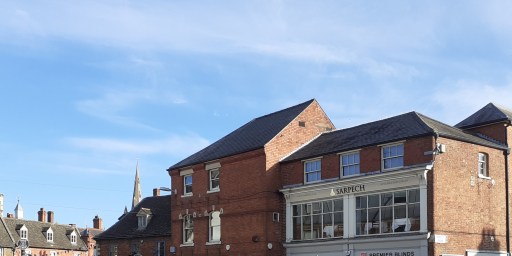
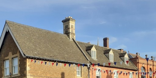
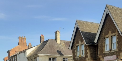
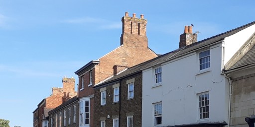
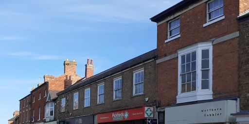
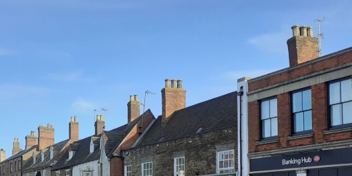
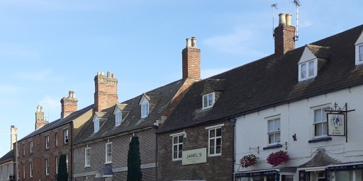
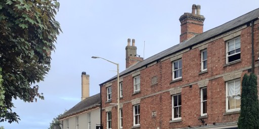
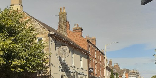
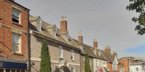
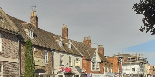
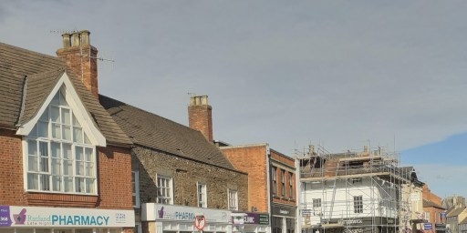
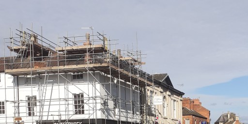
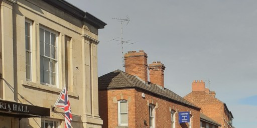
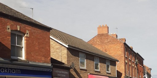
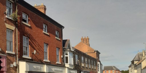
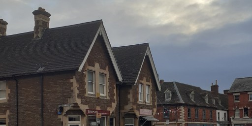
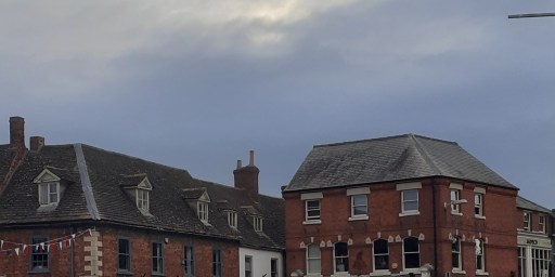
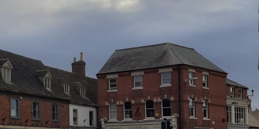
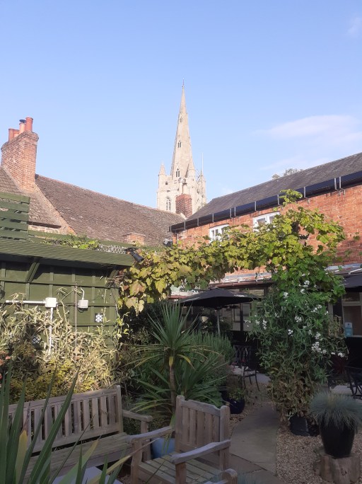
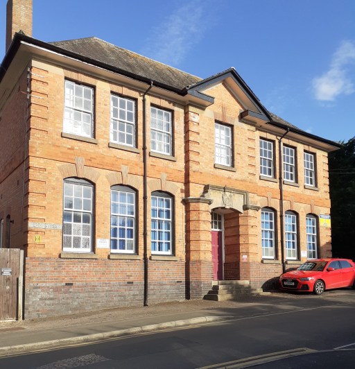
This post concerns roofs 1 – specifically those on the High Street of Oakham in Rutland. I find the upper floors of urban streets quite fascinating in their form and variety. When walking through towns however, one rarely looks upwards – indeed most of the time you would risk colliding with other pedestrians or walking into the road if you did. It is the shop fronts and their contents on the lower floors that command attention of course. But above them, the buildings themselves are sometimes stylish, sometimes idiosyncratic, sometimes merely odd – and usually worth a look. In what follows I show two galleries of photographs, both looking at the upper floors of buildings on the north side of Oakham High Street, taken from the pavement on the south side. The first gallery is a series of photographs from east to west (the junction with Burley Street and the Market area to the Wetherspoons pub), and the second from west to east. I am not really in a position to comment on the buildings in architectural terms, so the photos are simply presented for the reader’s interest and enjoyment.
1 I am fairly sure that when I was at school I was told that this was spelt “rooves”, but Google informs me that this is an archaic word, no longer used in practice. I fear I am thus labelled as archaic, which is probably true.
From east to west
From west to east
All the photos were taken by me, but I am happy for them to be used by others, with a proper acknowledgement.
A picture blog featuring the photographs of Maureen Brand – evocative pictures of the churchyard of St Michael in Lichfield through the changing seasons.
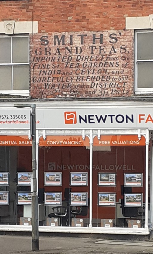
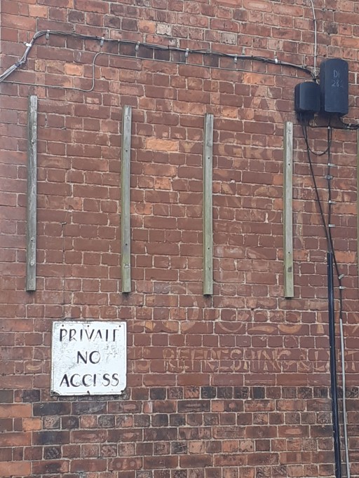
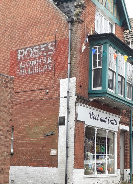
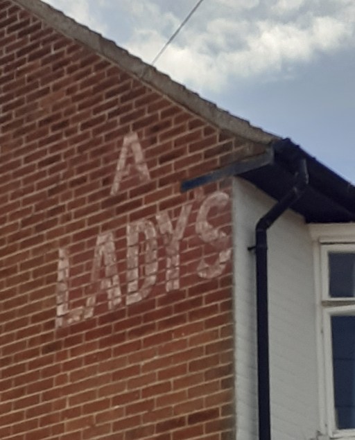
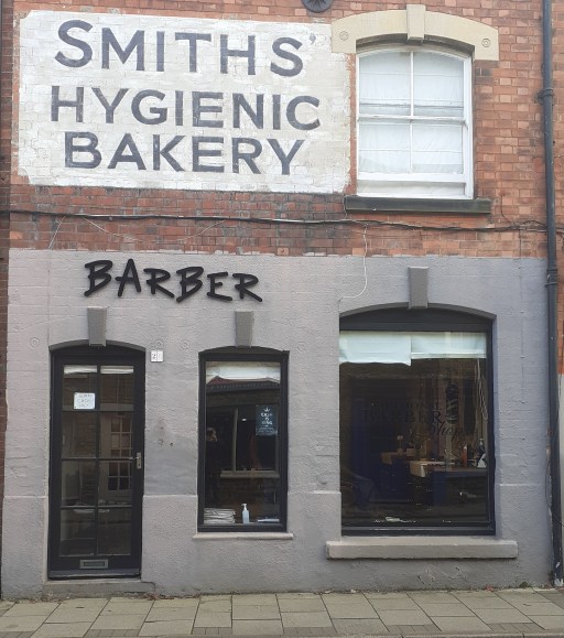
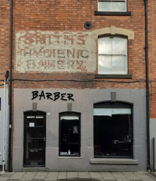
A new interest of mine – the old, faded painted signs on buildings whose function has changed. There are just a few photos for now, and I will add more as I come across them. For those interested there is a much greater selection at this Historic England site.
Oakham, Catmose StreetOakham, Mill StreetOakham High StreetCromerWest RuntonScarborough, Rothbury Street
And from November 2024, the sign in Mill St, Oakham has been repainted or perhaps resurrected or re-embodied?
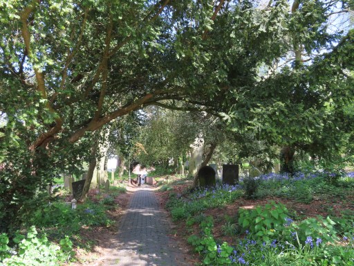
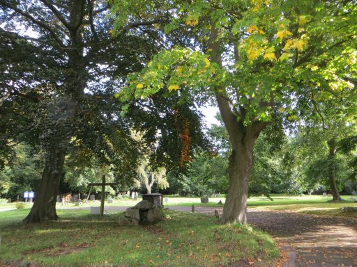
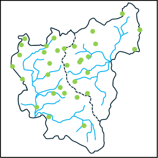
This is a picture blog, that simply gives pictures of a walk around Oakham. This is not a walk that takes in the traditional historical highlights, although some of those are included, but is rather one in which I show the things that have caught my eye, mainly on my wonderings about the town with the dog. So it is a little idiosyncratic, but I hope will be of interest to some. Except where otherwise indicated, the pictures were all taken by me, and I am happy for them to be used by others, properly credited of course.
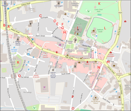
The map
The map below shows the approximate locations from which the photographs (A to R) were taken, superimposed on an up to date map from Open Street Map.
The pictures
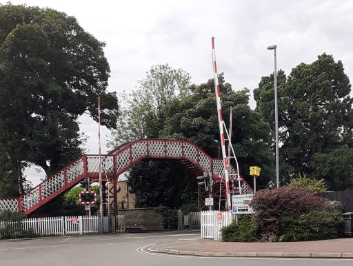
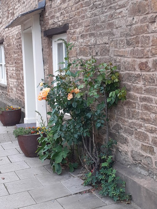
A. The railway crossingB. The signal boxC. Roses on NorthgateD. Roses on NorthgateE. Roses on NorthgateF. House on Northgate
The first picture is of the listed Midland Railway bridge and level crossing (Picture A) a source of endless frustration to drivers, and, as the location of the meeting of five roads, a horribly hazardous place for pedestrians. There must be a better way of doing traffic management here. Picture B is the Midland Railway Signal Box, which was the inspiration for the Hornby Railway model. Turning along Northgate, there are three pictures of rose bushes (Pictures C to E), some cultivated, some not. but in early summer their cumulative effect is striking. Picture F is of a house a little further along Northgate, with a wonderful display of creepers and climbing foliage.
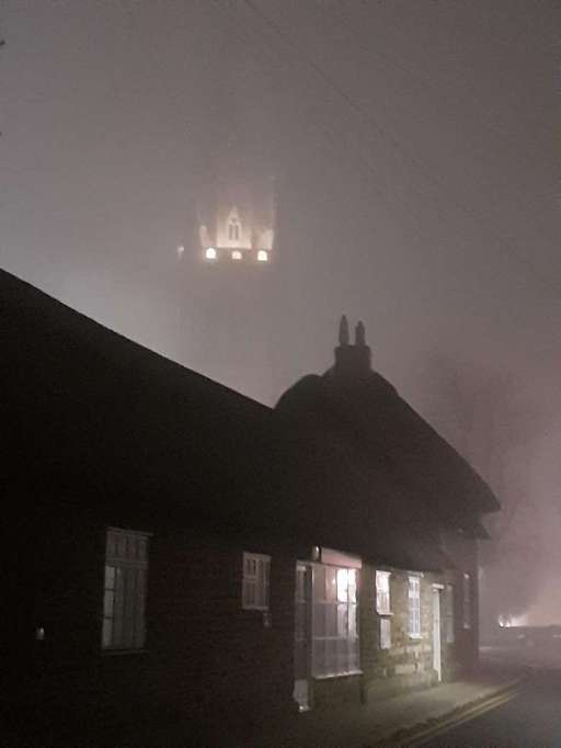
G. All Saints Church through the mistH. All Saints Church from the Wheatsheaf gardenI. Green Man carving in All Saints ChurchJ. Possible Anglo-Saxon cross at All Saints ChurchK. Castle Great Hall, Old School and Church from Cutts CloseL. Castle Great Hall, Church and Old School from Castle grounds
The next six photos all figure All Saints Church in one way or another. Picture G is a photo taken from Northgate on a misty evening where all that can be seen of the tower is a small floodlight area. The thatched cottages on Northgate can be seen in the foreground. Picture H shows the spire of the church from the garden of the Wheatsheaf pub opposite on a pleasant summer afternoon. Picture I (from here) shows the Green Man stone capital within the church – one of a series of wonderful capital carvings I have blogged about elsewhere. Picture J shows a possible Anglo-Saxon Saxon cross built into the south porch of the church. The identification is very speculative, but the cross is very similar to other, demonstratively, Anglo-Saxon examples. Pictures K and L shows t wo views of the Castle Great Hall, Old School and Church, from Cutts Close and the Castle grounds. I have argued elsewhere that these might be an indication of an early church group in the area. Click on the pictures to see the full extent of the photographs.
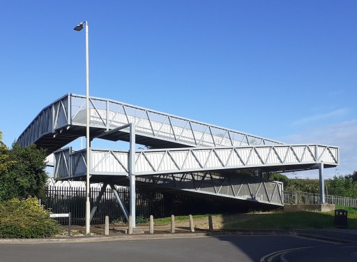
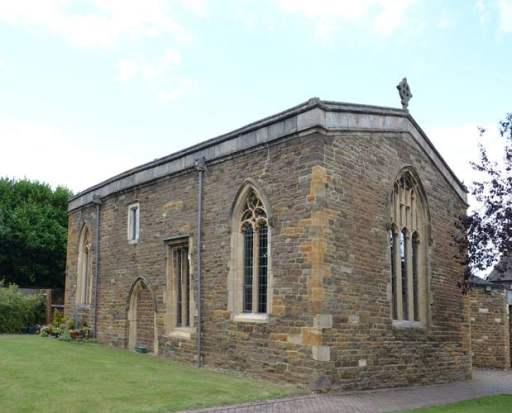
M. Ghost sign on Catmose St.N. Ghost sigh on Mill St. O. The Old Drill Hall on Penn St. P. Houses on Penn St. Q. Pedestrian bridge over the railway at the end of South St. R. The chapel of St. John and St. Anne
Pictures M and N show two nice examples of ghost signs from Catmose Street and Mill Street – faded, painted signs indicating a former usages. Picture O shows the Old Drill Hall on Penn Street which is impressive despite looking as if it could do with a bit of TLC. Picture P, also on Penn Street shows row of houses with a pleasing skyline. South Street Railway Bridge (Picture Q) is hardly beautiful, but very functional ,offering a way over the railway for pedestrians old and young, cyclists, mobility scooters, prams, shopping trolleys etc. For obvious reasons it is know in my household as the “slow bridge”. Finally Picture R (from here) shows the chapel of St John and St Anne – a medieval foundation serving the sheltered housing around it. It is the only place I know where the minister presiding at communion can watch, through the west window, the tops of passenger and freight trains passing within a few yards of the outer wall.#
Further posts on aspects of Oakham can be found using the button below.
Amended on 8th May 2024 to include further details of Our Lady’s Well.
In her book describing the architecture and liturgy of the Anglo-Saxon church in England (1), Gittos describes, in some detail, the existence of what she calls “church groups”. By this she means the practice of constructing a number of churches close to each other in some sort of relationship, which can be demonstrated archaeologically at a number of sites around England, primarily from the early Anglo-Saxon period. These usually take the form of two or more churches aligned on one axis (usually approximately east / west), sometimes with other churches on a parallel axis a few hundred metres away. The alignments can also include crosses or other monuments. Typical examples can be found at St. Augustine’s Abbey in Canterbury, with the linear group of St Peter and St Paul, St Mary and St Pancras and the non-linear groups at Hexham and Ripon. These are of course from a monastic context. Gittos hypothesizes that these churches were used for different aspects of the liturgy, with processions between them. A similar linear arrangement can be shown to have existed at the secular Yeavering site.
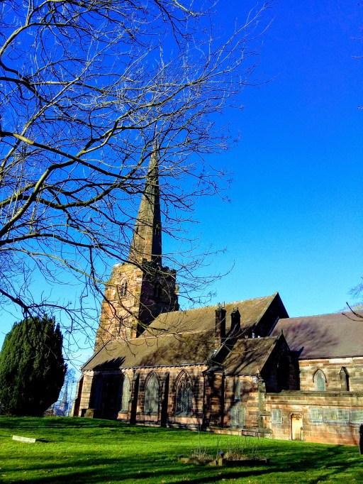
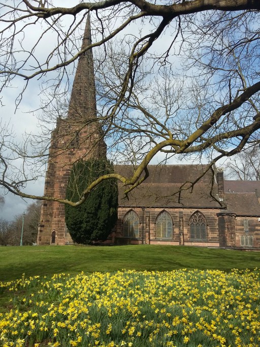
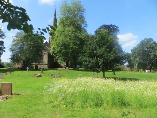
Figure 1. All Saints Oakham (from the south)
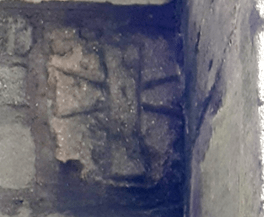
Readers of my blogs will know that I recently moved to Oakham in Rutland and have become a member of the parish church of All Saints (Figure 1). In looking at the layout of the church and its environs, it seems to me that there are some topographical hints (and I would put it no stronger than that), that this was the site of an Anglo-Saxon church group. The oldest part of the current church, the south porch, visible at the left of the photograph of figure 1, dates from around 1190, but the church almost certainly stands on the site of an Anglo-Saxon predecessor (2). In the wall of the south porch, there is what was thought to be a consecration cross, but it is visually very similar to the one shown in Gittos (p 239) from Earls Barton in Northamptonshire, that is demonstrably Anglo-Saxon (Figure 2). If the Oakham cross is Anglo-Saxon, it was presumably taken from the Anglo-Saxon church in the rebuilding of the late 12th century.
Figure 2. The crosses at Earls Barton (left) and All Saints Oakham (right)
All Saints now consists of a nave, transepts and chancel, with side chapels to either side of the chancel – dedicated to the Holy Trinity to the north, and to the Virgin Mary to the south. The original Norman church just consisted of the nave with the current transepts, the latter acting as side chapels (the communion niches, which would have been next to the altars, can still be seen). The earlier Anglo-Saxon church was probably of similar shape and dimensions.
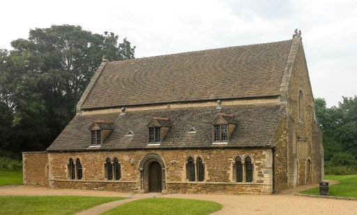
The first hint that the church might once have been part of a group arises from the fact that it lies within a substantial enclosure that now contains the Hall, inner bailey and outer bailey of Oakham Castle, as well as the church and church yard. This can be seen in Figure 3. The interesting fact is that the Great Hall of the Castle, regarded as possibly the best surviving example of Norman Domestic Architecture (Figure 4) lies fairly precisely on the same axis as the church, and eighteenth century maps show a postern gate in the wall on the alignment, offering access between the Great Hall and the church.. There seems to be no reason for these features, other than whatever was on the site before the hall was built was in some way associated with the church. Interestingly, early sources indicate that there was a chapel within the Great Hall (3) to which specific individuals held right of appointment, which suggests that it was more than simply a domestic chapel. One can thus conjecture that there was a church / chapel on this site before the castle was built in 1190.
Figure 3. The church and castle enclosure (from 1900 Ordnance Survey Map)
Figure 4. The Great Hall of the Castlefrom the south
The second indication that there was a church group comes from extending this alignment to the west. This takes it through the medieval site of Northgate, shown in Speed (4) as a large open area with a small drawing of a cross on a plinth (Figure 6). Whilst the cross is somewhat south of the strict alignment (although due west of All Saints), its presence is again suggestive. Note that alignment of the church and the castle shown on the map is not accurate and does not represent the situation on the ground. The area around Northgate was bisected by the building of the Midland Railway in the 1840s and, if the Speed map is accurate, the location of the cross was at the position of the current signal box. This is itself a grade II listed building and the prototype for model railway signal box construction kits (Figure 6). Whether or not this is enough to make up for the loss of the cross must be left for the reader to decide.
Figure 5. The Speed map of Oakham (the cross can be see on the left of the picture)
Figure 6. Oakham signal box at the site of the Northgate Cross
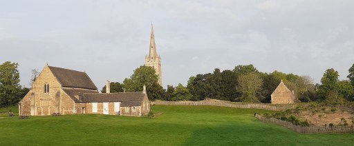
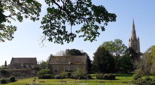
The third hint is the building to the north of the church, but on a roughly parallel axis that can also be seen in Figure 3. This is the original Oakham Grammar School, dating from just after the Reformation. It is built on the site of two former Guild chapels – one dedicated to St Mary, and one to St Michael the Archangel (3). The former included a toft, possibly the Guild Hall, and the latter at least was quite substantial, having dimensions of 60 feet by 30 feet. (3). Their topographical relationship to All Saints echoes that at Hexham and Ripon, referred to above. Perhaps here we have survivors of other ancient chapels that were part of the overall church group. Figure 7 shows a modern (i.e. May 2024) photograph of the castle (on the left), the old school (in the centre) and the church of All Saints (on the right) from the north side of Cutts Close Park (once the outer bailey of the castle). Visually they form quite a striking arrangement.
It also seems that there were another two pre-Reformation guilds at All Saints – one dedicated to All Saints itself, and presumably centred on the high altar, and one to the Holy Trinity, presumably centred on the chapel of that name within the church itself. How the Guild chapel of St Mary relates to the chapel with the same dedication in the church itself is not clear.
Figure 7. The castle, old school and church
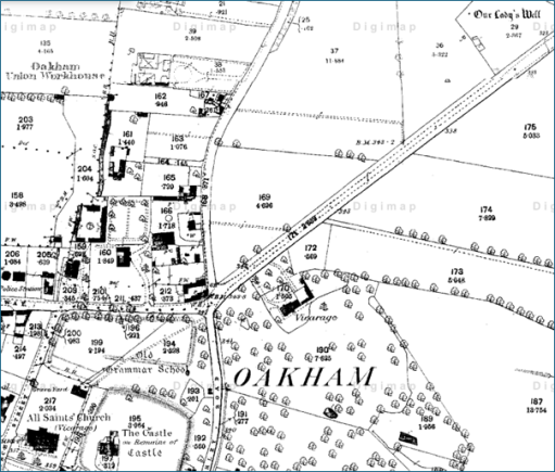
Reference (3) also indicates that there were pre-Reformation processions to a well dedicated to St Mary a “quarter of a mile to the north of the church”, and to an image of St. Michael, possibly within the chapel of that name – another of the characteristics of church groups identified by Gittos. The well still exists. It is shown on the 1880 and subsequent Ordnance Survey maps as “Our Lady’s Well”, actually almost half a mile north east of the church (Figure 8) with a straight path across Cutts Close and the Burley Road forming a direct and prominent link between the church and the well. It is not currently accessible being in an overgrown area managed for wildlife. Our Lady’s Well and All Saints church are on quite an accurate midwinter sunset / midsummer sunrise alignment. Whether or not this was intentional I will leave for others to judge. If it was then it suggests some sort of ritual activity at the site that predates the Anglo-Saxon era.
Figure 8. Our Lady’s Well and All Saints Church (from an 1880s OS map – the church is in the bottom left and the well in the top right).
At this point it is also worth noting that there is another surviving chapel in Oakham – that of the medieval Alms Houses of St. John and St Anne. This is however, not on the same alignment as the cross, church and castle and is some distance to the south west, and not likely to be part of any group. Neither is it in any sort of solar alignment with All Saints, being too far north to lie on the All Saints / Lady Well alignment. But the dedication is rather odd and perhaps hints at an earlier history.
So we can conjecture that we have here the surviving topography of a church group, with one church on the site of the current church in a linear alignment with one on the site of the Castle Great Hall and a cross at Northgate, and two on the Old School site where the guild chapels once stood. A church or chapel on the site of the current chancel of the church of All Saints is also a possibility. In making this suggestion we are of course making major assumptions that all the current buildings stand on the site of Anglo-Saxon originals, for which the evidence, such as it is, is very weak. There is also no evidence that there was ever monastic activity at Oakham, which seems to have been the context of many early church groups. So the suggestion that we have here the remains of a church group, attractive as it is, must only be regarded as very speculative.
References
Gittos H (2015) Liturgy, Architecture, and Sacred Places in Anglo-Saxon England, Oxford University Press, 978-0198737056
Aston N (2003) All Saints’ Oakham. A guide and history. Friends of All Saints, Multum in Parvo Press.
Speed J (1611) Theatre of the Empire of Great Britaine. Modern version by Nigel Nicolson (1998) The counties of Medieval Britain. A Tudor atlas by John Speed. Pavilion Books Ltd.
This is the second of two blogs that set out a timeline of the destruction by fire and subsequent demolition of the Crooked House in Himley in early August 2023, through links to local and national press reports. It covers the period from January 2024 onwards. Earlier news items can be found in the first blog here.
In the days after the fire, there were many, very similar, press reports and thus there has been a need to be selective. In what follows, I thus use three main sources.
BBC local and national news websites, which was, and continues to be, the most comprehensive source.
The Express and Star website, which gives a local perspective. Note that many of the articles that are linked require free registration to be read.
The Guardian website – although many national newspapers reported the story in early August, the Guardian’s was probably the most comprehensive and, through its columnists, the most reflective.
I also include articles from other sources where they complement the above, including a few from overseas to demonstrate the reach of the story. I will update this list at intervals over the coming months.
In addition to the news links, there are two Facebook pages that contain news and (often robust) comments covering a range of opinion.
In histories of specific places in the Black Country, the first paragraph often begin in a similar way to that of (1) with regard to West Bromwich.
“Of the pre-conquest history of West Bromwich, we know practically nothing.”
There are a number of reasons for this lack of knowledge, but perhaps the main one is that much of the evidence of the remote past has been destroyed in the rush to industrialisation in the eighteenth and nineteenth centuries. That being said, I want to show in this blog, that by considering evidence from a wide variety of sources over the entire region, it is possible to say something about the pre-Domesday history of the area, even if only in the broadest outline.
I will look at the material that exists chronologically – the stone ages, bronze age, iron age, the Roman period and the Anglo-Saxon period, before looking in a little more depth at the Domesday record itself. But we begin by defining an area of study.
Defining the Black Country before it was black.
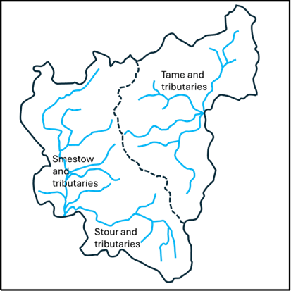
The first question that arises is what area we should consider? The concept of the Black Country as such is of course a creation of the 19th century, and even today, there is no consensus on its extent. Some would argue that it is confined to the area of the South Staffordshire coalfield, others that it is the area of the current boroughs of Dudley, Sandwell, Walsall and Wolverhampton. The status of places around its periphery are argued over endlessly (and vehemently). The only consensus is that Birmingham isn’t part of it. But none of these definitions are of relevance to the period before Domesday, when the area was wholly rural. So, in what follows, I have chosen major natural features to define the area of interest – basically the catchments of the upper Stour and Smestow, and of the headwaters of the Tame. These are shown in Figures 1a and 1b, with the former identifying the rivers and the latter showing the position of the major modern towns in the area. The catchment maps are taken from (2) and (3). It should be noted, that as with everything else in the Black Country, the precise locations of the streams shown in these figures owe a great deal to human activity and may well have been different in the periods we are considering. The boundary between the two catchments, shown by the dotted line, is a continuation of the Pennine chain – the major watershed of England, at this point dividing the headwaters of the Rivers Severn and Trent. The area chosen corresponds roughly to what most would define as the Black Country, although they contain sizeable rural areas to the west in the modern South Staffordshire district and to the south, in north Worcestershire and do not contain the Smethwick and Handsworth areas. This will not please all readers, but a least offers a geographically consistent area – and indeed on that will be seen proves historically useful to consider. It has the potential to offend almost everybody!
(a) (b)
Figure 1. Definition of the study area: a – river catchments, b – location of modern towns.
The Stone and Bronze Ages
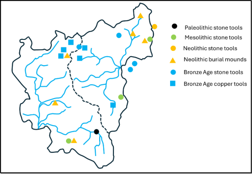
Reference (4) gives an excellent overview of archaeological finds in the area of the Black Country from the Palaeolithic era through to the Roman period. The information presented there is summarised in the map shown in Figure 2 for the Palaeolithic (950,000-9500 BC), Mesolithic (9500-4000 BC), Neolithic (4000-2400 BC) and Bronze Ages (2400-700 BC). (4) gives more detail of the various finds, and only some broad points will be made here. The first and most obvious is that the majority of finds lie just outside the modern urban area to the northeast and the south, or in rural enclaves within it (such as the Sandwell Valley and Barr Beacon). This is almost certainly due to the destruction of archaeological material by industrialisation. Secondly however, there do seem to be a couple of clusters -one in the Aldridge area around Castle Old Fort, and one on the watershed around Wolverhampton. But the huge time period under consideration needs to be borne in mind – these finds were from a wide variety of periods. Nonetheless they do suggest that there was some limited habitation of the area in the prehistoric periods.
Figure 2. Archaeological finds in the Stone and Bronze ages drawn from information in (4).
The Iron Age
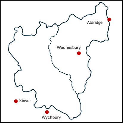
Now let us turn our attention to the situation in the Iron Age before the Roman invasion (700-43 BC). There is in fact very little that can be said with any certainty. However, there are a small number of hill forts in the area – three just outside the study zone at Wychbury in the south (4) Kinver in the southwest (5) and at Castle Old Fort near Aldridge in the northeast (6). There was also probably one at Wednesbury within the study area, although the evidence for this is recent and probably not conclusive (7). These are shown on Figure 3 and three of them seem to line up nicely in a southwest / northeast direction. The spacing along the line suggest that there may also have been one at Dudley on the boundary between the catchments, the traces of which will have been long obliterated by the castle. The configuration suggests a defensive alignment – but who was defending what from who is not in any sense clear. Copper horse bridal fittings have also been found at Wychbury and Castle Old Fort (4).
Figure 3. Iron Age hill forts.
The Roman Period (43 BC – 400AD)
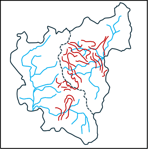
The first truly historical fact about the area that can be relied on is that there were a number of Roman army marching camps in the Greensforge area (8) – see Figure 4. In total there seem to have been two auxiliary forts and five marching camps, which can be dated to the early years of the Roman invasion (45AD to 80AD). They were probably used as the Roman army pushed north and west into England, but also seem to have an intensive period of occupation around the Bouddican revolt of 60AD. These camps were short lived, and there is no evidence of occupation after about 80AD. There is however some evidence of civilian occupation close to the site near Camp Hill, throughout the Roman period (8). An intensive network of roads also remained. These linked into the major arteries of Watling Street to the north and Ryknield Street to the east (figure 4). The importance of Greensforge seems to have been as a ford over the River Smestow. The roads that converge there can be identified with some confidence are as follows (9).
1. A road to the south, to the salt producing areas at Salinae, modern day Droitwich.
2. A road to the north to Pennocrucium, modern day Water Eaton, on Watling Street.
3. A road to the northwest to the major city of Viroconium (Wroxeter), with a branch to Uxacona (Redhill), again on Watling Street.
4. A road to the west to Bravonium near Leominster –presumably with a crossing of the Severn near Quatford, south of Bridgnorth.
Figure 4. Roman Roads in the Black Country
All of these roads can be traced, at least in part, on modern maps and on the ground. Note that the roads from Salinae, through to Viroconium, and onwards to Chester, formed a major “saltway” for the transport of that precious commodity. In addition, the existence of another road can also be indirectly inferred. – from Letocetum (Wall) on Watling Street, south of Lichfield, possibly via Wednesbury before passing through The Straits in Sedgley (another name often linked with Roman Roads) and then heading for Greensforge (10). A further road that probably ran northwest from Metchley in the south to Pennocrucium on Watling Street, can be traced on the ground at its southern and northern ends. Thus, it is likely that there were two roads crossing the Black Country from southwest to northeast and southeast to northwest, that would have crossed in the vicinity of Wednesbury. The precise line of these roads has again been obscured by industrialisation.
Such a road network would form an important focus for both military and civilian business, and as noted above, it is more than likely that there was some sort of small-scale occupation at Greensforge throughout the Roman period. One might expect something similar in the Wednesbury region.
In terms of Roman political structures, the Black Country sat close to the boundaries of three civitas or tribal territories – those of the Cornovii in the upper Severn Basin, the Dobunni in the lower Severn basin, and the Corieltauvi, largely in the Trent basin. Although it is not possible to be sure of the boundaries, the territory of the latter was probably to the east of the main English watershed that passes through Sedgley and Dudley. In addition, it is likely that this ridge was also the boundary of two of the late Roman provinces – that of Britannia Prima to the west and Flavia Caesariensis to the east. (4) reports that a Dobunnic coin has been found at Lutley in the south of the study area.
Many modern historians of that period would see continuity between these civitates and late Iron Age tribal groupings, which would place the Black Country on the boundary between three different tribal groups. Thus, in general terms, the Black Country before and during the Roman period would seem to have been a border zone between different tribal groupings, but nonetheless well traversed by both the invading Roman armies and the traders that would have followed in their wake.
The Anglo-Saxon period (400 -1066 AD)
After the Roman armies left Britain in the early firth century, the traditional view has been that the native Britons were gradually pushed westward into Wales and Cornwall by the military force of invading Anglo-Saxon armies and a number of Anglo-Saxon kingdoms were established. Over the last few decades, a great deal of archaeological evidence has emerged to show that it was a lot more complicated than that. There were undoubtedly migrations of Germanic speaking people from Europe, firstly in the service of the native British population and later in conflict with them. But there is also much evidence of continuity of agricultural practices and political systems that are simply not consistent with a wholesale replacement of one people by another (11, 12), Genetic evidence, which needs very careful interpretation, suggests that there is a broad similarity of genetic background of all peoples across England and Wales, although there are some very distinctive local genetic variations that could possibly be linked to specific migrations (13). Similarly, there is evidence that the replacement of the Celtic British language (old Welsh) by a Germanic form (proto-old English) was not a uniform process with some limited evidence emerging that Germanic languages were spoken in England during the Roman period (14), and of the survival of pockets of British speakers across England into the 9th and 10th centuries (11).
So, we have a very complex picture emerging of the movements of peoples and languages across England in the immediate post Roman era. What can be said with a little more certainty is that there were significant movement of people in the second half of the sixth century, when the early Anglo-Saxon kingdoms come into view, with evidence of migration from the east to the west (15, 16). In my view this was probably triggered by the climate cris caused by large volcanic explosions in 536 and 543, and by the arrival of the bubonic plague (the Justinian plage) at about the same time (17).
But what does this say about the Black Country in that period? Here we turn firstly to place name evidence. Within our study region most names undoubtedly have an Anglo-Saxon origin. But there are some that are or earlier, British or even older origin. Some of these relate to geographical features – the Rivers Stour, Smestow or Treasle, and the Tame, and the hill names of Barr and Penn (3). Just to the west of the study area there are a number of British names – Kinver, Morfe and possibly Quatt, whilst inside our study area we have Compton (containing the root Welsh cwm for valley) and Walsall, the first component of this being a British name. These names again suggesting that the Black Country in this period was something of an ethnic and linguistic borderland. When we come to the English names, there are two clusters that stand out – those names containing the component “leah”, meaning woodland clearing, and those containing the component “tun” meaning settlement or dwelling. These are shown in figures 5a and 5b. The former strongly suggest that these names originate from a migration of English speakers into a forested area in which they created their own smallholdings and settlement.
(a) (b)
Figure 5. Place name elements: a – leah, b – tun.
Moving on, can anything be said about the political and social groupings in the area? There is strong evidence that two of the Roman Civitas in the area morphed onto territories or kingdoms with Anglo-Saxon names – the Dobunni to the south became the Hwicce and the Cornovii to the west became the Wroecansaete. From the early seventh century most of our study area was part of Mercia, and indeed the Hwicce and the Wreocansaete were absorbed fully into Mercia by the end of that century. The boundary between the Hwicce and Mercia can be traced from the Diocesan boundaries between Worcester and Lichfield, which date back to the late seventh century when they were set up as dioceses to serve the two kingdoms. In our study area, this boundary passes along the Stour, with the Hwicce to the south and Mercia to the north, although the area around Dudley seems always to have been in Worcester diocese. This in turn was matched by the county boundary when the counties were formed in the tenth century. The boundary between Mercia and the Wreoconsate in the early Anglo-Saxon period seems to have been along the Severn to the west of the Black Country – indeed the tenth century county boundaries of Staffordshire extended as far as the Severn. North of our study area, the boundary seems to correspond to the modern county boundary between Staffordshire and Shropshire which follows the watershed between the Trent and the Severn. The incorporation of the area west of the Black Country to the Severn into Mercia would have given them direct access to Bridgnorth – which at that time would have been near the head of the navigable waters of the Severn, and thus accessible by ships from Bristol and beyond, and would offer considerable trading opportunities.
In a charter of 854 relating to the boundary of lands near Cofton Hacket in Worcestershire, preserved in Hemming’s Cartulary, a particular point is described, on the boundaries of the Worcester and Lichfield dioceses, that is a boundary between the Tomsaete, and the Pencersaete (18) and possible with the Arosaete (19). It is generally accepted that the Tomsaete were a Mercian people associated with the River Tame, and indeed this point is at the southern edge of the Tame catchment. Similarly, the Arosaete, who are mentioned in the Tribal Hidage (20), are regarded as the inhabitants of the valley of the River Arrow, in the territory of the Hwicce (19). Again, this point is at the northern end of the Arrow catchment. Cyril Hart has argued that this implies that the Pencersaeten were a people to the north and west of this point, and he suggest they were a Mercian tribe, centred on Penkridge, to the north of Wolverhampton (19). This seems to have become the accepted identification and can be found in a number of texts. Clearly the name suggests that there might be some association with the Penn / Pensnett area, and if the tribe were centred in Penkridge, then this area would certainly be included. However, the author remains unconvinced by this identification. If it were true this would imply that the Pencersaete extended across two catchments – that of the Stour / Smestow which flow into the Severn, and that of the Penk in the upper reaches of the Trent catchment. This seems to the author unlikely, and not consistent with the other tribal boundaries in the area, with the probability being that the bounds of the Pencersaeten extended only over the Stour / Smestow region i.e. just one catchment, and probably centred on the Penn region.
There is another interesting possibility concerning the Hwiccan territory. Green (20) notes that there is a cluster of names with components relating to the Hwicce in Rutalnd in the East Midlands, and speculates that this might be the region from which an Anglo-Saxon tribe called the Hwicce migrated westward in the later sixth century. If this was the case, we could see this tribe as assuming power in the former area of the Dobunni, and the area becoming associated with its name. As I said, the situation concerning migration / kingdom formation etc is very complicated.
At least in the early part of the Anglo-Saxon period, the Roman roads would have remained in use, and probably for many centuries after that. No doubt they were used by those engaged in both commerce and warfare during this period, as they passed by the growing settlements in the area. There were a couple of occasions however when there was more substantial activity. In 893 the Great Heathen army of the invading Vikings marched from near the River Lea north of London to Bridgnorth, where presumably they were met by others coming up the Severn from the Bristol Channel (21). The most obvious way would have been up Watling Street to Wall, then along the proposed road through the Wednesbury area to Greensforge and thence on to Bridgnorth. The passage of the army, with its associated foraging, might have been an uncomfortable experience for those living in the area. Then again in 910, a Viking army moving north out of Bridgnorth was pursued by the combined Mercian and Wessex forces and overtaken and defeated in the Tettenhall area (22). Again, one might expect the route of both armies would have involved the road network passing through Greensforge.
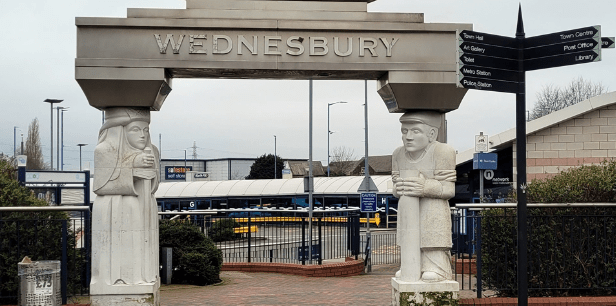
In response to Viking attacks on Mercia. King Alfred’s daughter Aethelfleda and her husband built defended settlements or burghs across Mercia, one of which is reputed to be at Wednesbury (23). However no hard evidence of an early fortification has been found at Wednesbury- but this hasn’t stopped the council from erecting a statue of Aethelfleda at the entrance to Wednesbury bus station – see the header to this blog.
The Conquest and Domesday (1066 – 1086 AD)
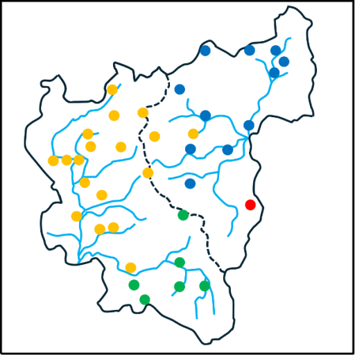
When we come to the Domesday survey, we have for the first time detailed information about our study area. Domesday lists 38 manors in our area and these are shown in figure 6 – from the excellent compilation of (24). The colours in this figure indicate the administrative region in which the manors fall – yellow for Seisdon Hundred in Staffordshire, blue for Offlow Hundred, again in Staffordshire, green for Client Hundred in Worcestershire and blue for an entry in Northamptonshire Domesday. It can be seen that the boundary between Seidon and Offlow hundreds basically follow the watershed, although a couple of Seisdon manors (Ettingshall and Bilston) fall into the Tame catchment. The boundary between Client is Worcestershire is along the Stour as would be expected from the Diocesan and County boundaries, with Dudley to the north. The Northamptonshire entry is for (West) Bromwich – which seems to have been included by mistake with its Lord’s entries in that county.
Figure 6. The Domesday manors
The Domesday book also contains much factual information about each manor. However, as all who use this information will know, the details need to be treated with some circumspection. It was compiled from oral evidence by many different people and there are many inconsistencies in the way the data was collected and is presented. This is particularly true of the numerical data for the hidage (originally a measure of area, but by the time of Domesday also a fiscal assessment), the number of ploughlands (the area that could be cultivated by one person) and the number of plough teams. There is however more consistency in the information about Lordship in 1066 and 1086, and the number of workers in various categories (25), and this information is shown in table 1 below. This shows the number of workers in each manor in 1086, in the following categories.
Free men with on average about 30 acres of land and two plough oxen;
Villagers of Villeins, unfree and bound to the Lord but with similar holdings to Free Men;
Smallholders of Bordars, unfree with about 5 acres of land and use of the communal plough team;
Cottagers, unfree with very meagre land holdings;
Slaves, owned by the Lord;
Priests.
The Lords in 1066 and 1086 are also given. The manors are ranked in terms of total number of workers. This order is perhaps surprising to modern eyes. Of the major modern industrial towns in the area, only Wolverhampton is near the top of the list in terms of population. The others – Wednesbury, Dudley, West Bromwich, trail behind, and one, Walsall, is simply not present in the list. The major centres in the area at Domesday were Sedgely, on the watershed between catchments, and Halesowen to the south. Many of the manors had very few workers of any sort. Of those workers the Villagers were the most common, accounting for 56% of the total, which is in line with the larger English picture. 11% of the population were slaves – a perhaps somewhat shocking statistic to modern eyes – with the major concentrations in Halesowen, Wolverhampton and Wombourne. The number of priests is small at 6, and one suspects must be an underestimate. The overall number of workers is 580. Allowing for a household size of 5, which seems a reasonable assumption, gives a total population somewhere around 3000. Even if the Domesday survey omits sections of the population, or if the assumed average household number is too small by a large factor, the population is tiny in comparison to the current population of the Black Country boroughs, which is something over 1 million.
The effect of the Norman conquest on land ownership is starkly clear. In 1066, the major Lords were King Edward with 11 manors, the Canons of St Mary’s Wolverhampton (now St Peter’s) with 5, and Countess Godiva with 3. There were 14 other Lords. By 1086, the number of Lords had been reduced to four. In the main the lands of King Edward had passed to King William; the Canons of Wolverhampton had retained their manors (although one suspects that by then the body of Canons had been thoroughly Normanised) and the Bishops of Chester had retained their single manor. The rest were now under the Lordship of William Fitz Ansculf, who held 98 manors in total across the country, centred on his castle at Dudley. As elsewhere in England, we see how revolutionary and far reaching the Norman takeover was.
Free
Villagers
Small holders
Slave
Priests
Total
Lord in 1066
Lord in 1086
Halesowen
4(a)
42
23
10
2
77
Wulfwin
Earl Roger
Sedgley
45
2
3
1
51
Earl Algar
William Fitz Ansculf
Wolverhampton
6
30
14
50
W’ton St Mary
W’ton St Mary
Bloxwich
16
11
1
28
King Edward
King William
Shelfield
16
11
1
28
King Edward
King William
Wednesbury
16
11
1
28
King Edward
King William
Wombourne
14
3
8
1
26
Thorsten
William Fitz Ansculf
Bushbury
15
2
2
19
Countess Godiva
William Fitz Ansculf
Crockington
14
4
1
19
King Edward
King William
Essington
15
2
2
19
Countess Godiva
William Fitz Ansculf
Kingswinford
14
4
1
19
King Edward
King William
Swinford
5
11
2
1
19
Wulfwin
William Fitz Ansculf
Pedmore
3
10
4
1
18
Thorger
William Fitz Ansculf
Cradley
4
11
15
Wigar
William Fitz Ansculf
Dudley
1
3
10
2
15
Earl Edwin
William Fitz Ansculf
(West) Bromwich
10
3
13
Brictwin
William Fitz Ansculf
Ettingshall
9
3
12
Thorsten
William Fitz Ansculf
Wednesfield
6
6
12
W’ton St Mary
W’ton St Mary
Bilston
8
3
11
King Edward
William Fitz Ansculf
Himley
8
3
11
Ravenkel; Wulfstan
William Fitz Ansculf
Orton
7
2
2
11
Wulfstan
William Fitz Ansculf
Upper Penn
8
2
1
11
Earl Algar
William Fitz Ansculf
Trysull
4
1
5
10
Thorgot
William Fitz Ansculf
Rushall
6
2
8
Vithfari
William Fitz Ansculf
Willenhall
5
3
8
King Edward
King William
Amblecote
4
2
1
7
Earl Agar
William Fitz Ansculf
Compton
4
3
7
King Edward
King William
Tettenhall
4
3
7
King Edward
King William
Lower Penn
1
6
6
Countess Godiva
William Fitz Ansculf
Lutley
2
1
2
5
W’ton St Mary
W’ton St Mary
Bradley
4
4
Untan
William Fitz Ansculf
Oxley
4
4
Alric; Godwin.
William Fitz Ansculf
Seisdon
2
2
King Edward
William Fitz Ansculf
Bescot
0
King Edward
King William
Chasepool
0
William Fitz Ansculf
Haswic
0
W’ton St Mary
W’ton St Mary
Pelsall
0
W’ton St Mary
W’ton St Mary
Tipton (b)
+Chester
+Chester
Totals
6
327
182
65
6
580
Table 1 Domesday manors from (24). ( a- Specified as Riders , b- Part of the Bishop of Chester / Lichfield manor. Breakdown of workers not given. )
A look beyond Domesday
Before closing, there is perhaps one further point that is worth raising. Ultimately it was the geological wealth of the area that resulted in its transformation in the eighteenth and nineteenth centuries, and specifically its coal reserves. But the coal didn’t suddenly appear in that era – it was there all the time and in many places there were surface outcrops. The locations of these are shown from the Coal Authority web site (26). It is very likely that these resources were exploited on a small scale from the Roman period onwards. The major transformation of the area came in the last few hundred years, but the seeds of that transformation were being sown well before Domesday.
Figure 7 Coal outcrops from (26).
References
Dilworth D (1973) “West Bromwich before the Industrial Revolution”, Black Country Society ISBN 0 9501197 9 2
Green C (2020) “Britons and Anglo-Saxons: Lincolnshire AD 400–650”, Studies in the History of Lincolnshire, History of Lincolnshire Committee ISBN 0902668269
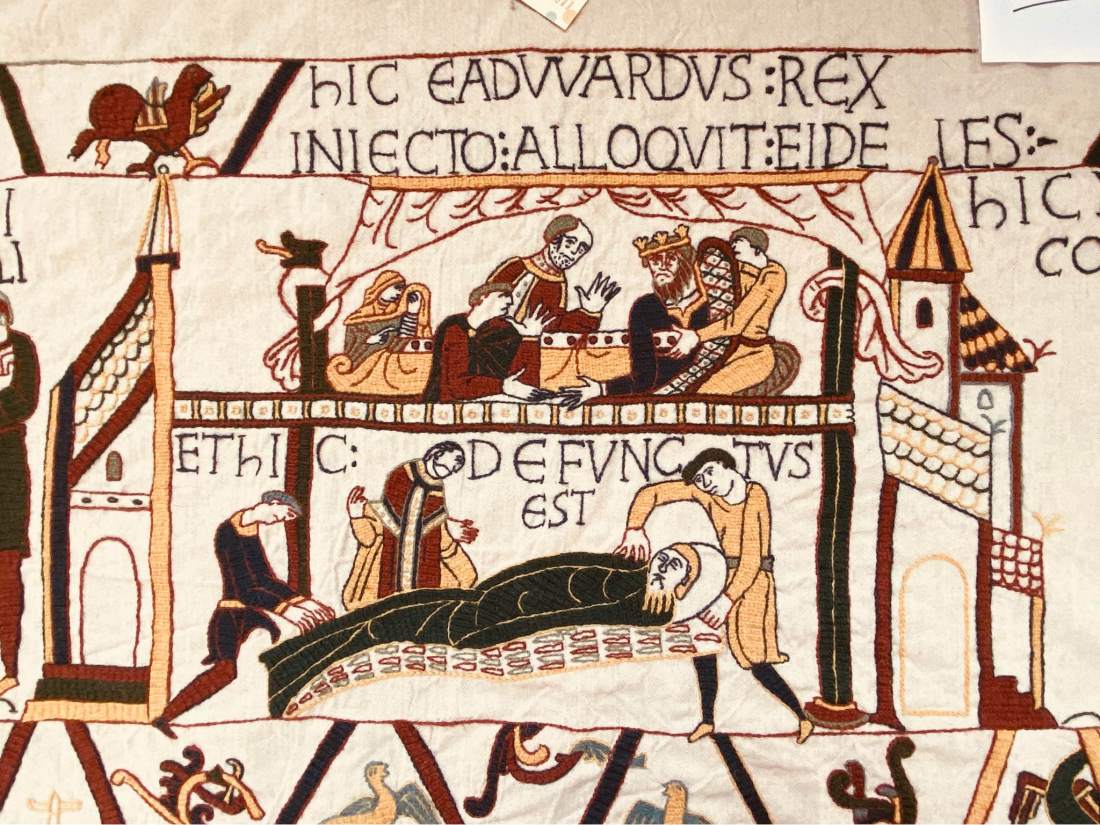
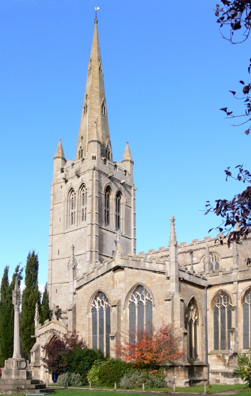
By way of introduction, you will see that in Worship for the Week I am referred to as a professor, which seems to give this address some level of academic respectability. And while that appellation is true enough, my actual title is Professor of Environmental Fluid Mechanics, and I have spent my career teaching civil engineering students. In terms of expertise on Queen Edith, I fear, ladies and gentlemen, you have an imposter in your midst. But let’s see where we get to.
Edith of Wessex was born sometime around 1024 or 1025, so saying we are celebrating the 1000th anniversary of her birth is a bit of a guess, but not a bad one. Her father was one of the most powerful men in the country at that time – the Saxon Earl Godwin. Her mother was Danish, Gytha, a relative of Cnut, the then king of England, Norway and Denmark. England was that time was an ethnically and linguistically very diverse society with the undoubted tensions that resulted. Edith’s brothers and sisters mostly had Danish names, and she too most probably was given a Danish name that was to be changed when she married. I think it likely her mother tongue was Danish. She was brought up and educated at Wilton Abbey near Salisbury, and came to speak Danish, English, Latin and Irish fluently. She also was very capable in weaving and embroidery and, we are told, in a work she commissioned, accomplished in grammar, rhetoric, arithmetic and astronomy.
After the death of Canute and his son Harthacnut, the Anglo-Saxon dynasty that their ancestors had forced into exile was re-established in 1043 with Edward, ultimately to be known as Edward the Confessor, taking the throne. Edith was married to Edward in 1045 and, unusually for the time consecrated as well crowned as queen. For the first few years of her marriage, she would have lived in the shadow of Edward’s mother, the dowager queen, Emma of Normandy, the wife of Edward’s father Aethelred, and then the wife of Canute, a redoubtable and quite ruthless lady. I would imagine there were mother-in-law issues. The marriage was childless, which no doubt caused both personal and political tensions. In 1051, Godwin came close to armed rebellion, and he and his family were forced into exile, with the loss of his titles and his lands. Edith also fell out of favour and was consigned to a nunnery, perhaps as a prelude to a planned divorce because of her childlessness. Just over a year later, the situation was reversed, and Edward, faced with the threat of an armed conflict that he could not win, was obliged to reinstate Godwin to his former titles and lordships, and over the next 13 years, the Godwins became very powerful, holding most of the large earldoms in England. Edith too was released from the convent and reinstated as Queen. She was to become a close confidante and advisor to her husband, a de facto if not de jure member of the Witan, his body of counselors. We are told she took care to ensure that his royal dignity was appropriately displayed in his dress and his presentation. She acquired large estates and became a very wealthy woman – including most of Rutland, which were the dower lands of the later Mercian and Anglo-Saxon queens. That wealth was also used in generous benefactions to the church, particularly in Winchester and Abingdon.
The question of succession was ever apparent. Edward brought back to his court other members of the Anglo-Saxon dynasty who had been in exile following the Danish takeover, and Edith took on parental responsibilities for the young boy Edgar, named the Aetheling as being eligible for the throne, and his sister Margaret, who Edith arranged to be educated at Wilton. The latter was to marry Malcolm Canmore, King of Scotland in around 1070, for whom, allegedly, Birnam Wood to Dunsinane didst come, and it was through their descendant’s marriage into the Norman royal line that the ruling family of England again came to be connected to Cerdic, the sixth century founder of the Wessex dynasty. In retrospect, Edith’s care for the child Margaret was thus to be of major long-term significance.
Over the latter part of his reign, Edward became increasingly occupied by the building of the Abbey Church at Westminster, which was consecrated in December 1065, just before his death and burial there in January 1066. The succession question then became critical. The claims of Edgar the Aetheling were swept aside, and the throne was taken by Harold Godwinson, Edith’s elder brother. This was disputed by both the King of Norway and, of course William of Normandy. By October that year, Edith had lost not just a husband, but her brother Tostig at the battle of Stamford Bridge, where he fought against Harold on the side of the Norwegian king, and three other brothers at the battle of Hastings. Edith submitted to William at Winchester and was allowed to keep her estates, the only surviving member of the Anglo-Saxon royal family to remain in England. In the years before her death in 1075, she continued to be a benefactor of various churches, and if some historians are correct, was instrumental in the design and production of the Bayeux Tapestry, or more properly the Bayeux embroidery. She also commissioned a book on the life of her husband and continued to manage his reputation after his death – and her actions were in large part responsible for his cannonisation several hundred years later. In the Anglo-Saxon Chronicle of 1075, we read
Edith the Lady died seven nights before Christmas in Winchester, she was King Edward’s wife and King William had her brought to Westminster with great honour and laid her near King Edward, her lord.
But what can we say about Edith as a person? Well, it depends upon what you read – the sources that we have can best be described as propaganda for various parties. They were either produced under the direction of Edith herself, or by those who saw her as a traitor. They describe her variously as moderate and wise, or hard and interfering. She is also alleged to have been involved in a number of church and court intrigues and was accused of rapaciously appropriating religious relics from churches around the kingdom and giving them to those she favoured. and of facilitating the murder of a Northumbrian noble, on behalf of her brother Tostig, the then Earl of Northumbria. It is simply not possible to say whether these descriptions or the allegations were true, and most probably have the same level of historical reliability as the Marriott Edgar poem that sees, at the conclusion of the Battle of Hastings
King Harold so stately and grand, Sitting there with an eyeful of arrow, On his horse, with his hawk in his hand.
But, with regards to Edith, taking all things together, it is probably fair to say that she was no saint. The words of Dylan Thomas through the Rev Eli Jenkins of Llareggub seem applicable.
We are not wholly bad, or good, who live our lives under Milk Wood.
In our consideration of the life and times of Queen Edith, we see the emergence of much that contributes to our modern world, and many historical parallels and continuities. Our language is a direct descendent of the one of those that Edith spoke; our constitutional monarch is still a descendent of Cerdic; in the gathering of counsellors around the king on the Witan, we see a foreshadowing of our system of government; and the system of shire, shire reeves and shire courts that underpinned late Anglo-Saxon England, we see the foundations of our local government and legal systems. Indeed, the very existence of Rutland is due to it being Edith’s dower lands, and she has left her name in one of its villages. And shire reeves are of course still around. Despite these solid foundations, English society in Edith’s time was in a state of turbulence – divided by ethnicity, politics and language; threatened by external powers; at the mercy of the ambitions of powerful men, again foreshadowing something of current tensions in our own society and around the world. The life of Edith herself also evokes many modern issues some of which have a particular resonance for Mothering Sunday – the shame of childlessness, the struggles of an arranged marriage, the pain of loss of family and friends on the one hand and devotion to husband and adopted children on the other. And above all the simple struggle for a woman to survive in a male dominated society. And this is perhaps the most significant thing about Edith – she was a survivor – a woman who tried to hold things together as family and society were falling apart; something we see in the faces of women in refugee camps and war zones around the world.
But there is I would suggest a deeper continuity between Edith’s times and ours, one that is perhaps not obvious in our secular age where religion is largely seen as a private pastime, and spiritual experiences and realities dismissed. But in Queen Edith’s time that was not the case, and the spiritual was enmeshed in everyday life to a degree we would find hard to understand. Prof Richard North of University College London writes of the perceptions of the Anglo-Saxons in the pre-conversion era, with words that are equally applicable to Edith’s time, that spiritual realities
…were varied and widespread, and to the heathen mind in the early seventh, if not our own blind folly in the twentieth century, the world was charged with their power.
It is perhaps the rhythms of our worship that are a clock through which we can come to a deeper understanding of Edith’s times – as we go from Advent to Pentecost, from Lady Day to Michaelmas, we experience the unfolding of the scriptural and seasonal narratives with which those of Edith’s day would have been familiar, rhythms that would have constrained and ordered her life. She would have experienced the daily rhythm of the nunnery – the Magnificat sung in Latin at Vespers and the Nunc Dimittis at Compline. And further, whilst there can be no certainty, it seems to me highly likely that at some stage in her 20 years of marriage, Edith would have visited her dower land in Rutland, and we can imagine her in one of her manorial churches in Ridlington, Hambleton or Oakham, and can picture her participating in the mass or Eucharist that has been regularly celebrated down the centuries in these churches, with very few breaks – perhaps only in the interdict of King John’s Day, the turmoil of the Civil War, and most recently during the Covid lockdown. They were presided over by priest’s wearing very similar vestments to those used today – indeed when it was suggested we dress up as Anglo-Saxons at yesterday’s events, I thought about simply turning up wearing the Eucharist vestments! And the liturgy that she would have taken part in there would have been very similar indeed to the Eucharistic ceremonies of today – in Latin rather than English, but nonetheless essentially the same. God is praised, his saving work for the reconciliation of all things to himself is narrated, bread is broken, and wine is shared. I would suggest that it is in our worship that we can understand the rhythms of Edith’s time, and in which we find the deepest continuities between past and present.
And the Eucharist of course points to a yet deeper continuity, a longer thread, a thousand years before Edith – to Jesus and his disciples eating the Passover meal in Jerusalem just before his death and, three days later his resurrection. And that Passover celebration itself points to an even more remote time perhaps twelve hundred years before that, in a time and culture that for us would be utterly strange, as the people of Israel fled from Egypt to worship their God Yahweh, I am what I am, in the cloud and the fire on Sinai.
As Edith, with all her flaws and ambiguities, watched the mass in her Rutland churches, as we, being all too aware of our inadequacies, similarly eat the bread and drink the wine of the Eucharist here in Oakham, as we move in the rhythm of the year towards Lady Day, Good Friday and Easter, we become part of that long thread of history that takes us back to Sinai and Jerusalem, and to the England of a 1000 years ago, in which we join with all God’s children, alive and dead, the saintly and the not so saintly, and become part of the outworking of God’s plan for the salvation of the world.
It thus seems appropriate to end with words of praise to God – the words of the earliest known English hymn – that of the Northumbrian cowherd Cadmaeon from the late 7th century.
Now we must praise – the protector of the heavenly kingdom the might of the measurer – and his mind’s purpose, the work of the glory father – as he for each of his wonders, the eternal Lord – established a beginning. He shaped first – for the sons of the earth heaven as a roof – the holy maker; then the middle-earth – mankind’s guardian, the eternal Lord – made afterwards, solid ground for men – the almighty Lord.
One of the most interesting features of the parish church of All Saints in Oakham is the set of elaborately decorated capitals at the top of the pillars supporting the arches in the nave. The subject matter includes biblical stories, images of grotesque beasts, angels, devils and a green man. This blog posts will consider these capitals in some detail, trying to understand what is represented on each one, and speculating as to whether or not there are relationships between some or all of the individual designs.
There have been a number of descriptions of the capitals in the past – the Victoria County History for Rutland (1), Pevsner’s Buildings of England (2) and Aston’s Guide and history of the Church (3). These will be referred to as VCH, Pevsner and Guide in what follows. In addition, Lionel Wall has a web page on his “Great English Churches website (4), with many photographs of the capitals. These are significantly better than the photographs I have managed to take, and he has kindly given me permission to use them in this post. Thus nearly all the photographs in what follows are from this source, although they have all been rendered in greyscale for comparative purposes. However, I will use a few of my own photographs, which will be clearly distinguished in what follows, even if only by their poor quality.
I have adopted an identification system for the Capital carvings, and this is shown in figure 1 below, the underlying plan being taken from (1). T indicates the carvings on the Tower capitals, C those on the chancel, CA those on the chancel arch and P1, P2 and P3 those on the pillars. N indicates those on the north side of the church, and S those on the south side.
Figure 1. Key to the Capitals – plan taken from (1)
On P1N, P2N, P1S, P2S and P3S the carvings encircle the capitals, whilst on P3N the carving is only on the Nave side. TN, TS, CN, CS, CAN and CAS are, due to the local geometry, carved on one side only. CAN and CAS have been partially damaged by the installation, and possibly the later removal, of the Victorian rood screen.
I will begin by looking at the Capitals in turn, and then move on to speculating as to the nature of a possible overall arrangement with links between the individual designs.
Descriptions of the Capitals
Tower North (TN)
VCH – expulsion from Eden; Pevsner – expulsion from Eden; Guide – the expulsion of Adam and Eve from Eden
Figure 2. The Tower North Capital
The three earlier descriptions are clearly correct, but more can be said. The carving on the left of figure 2 shows Adam and Eve either side of either the Tree of Life or the Tree of the Knowledge of Good and Evil – there is debate amongst scholars as to whether or not these names refer to the same tree. The serpent can be seen between them (Genesis 3.1-6). Eve’s arm is extended to Adam, perhaps offering him the apple from the tree. The figure on the right shows the pair being expelled from the garden, with the angel with flaming sword depicted blocking the way back (Genesis 3.23-24).
Pillar 1 North (P1N)
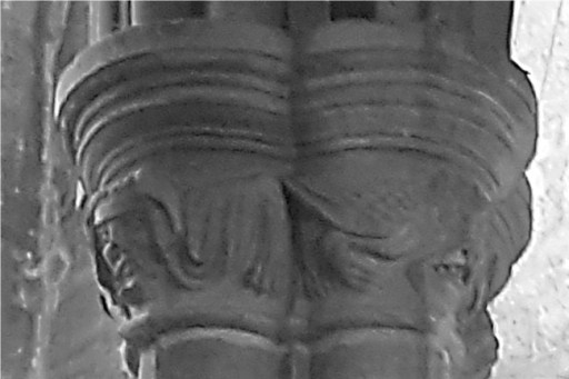
VCH – grotesque heads and hands; Pevsner – grotesque figures; Guide – grotesque heads and legs
Figure 3 Pillar 1 North Capital (photographs by author)
The four figures are indeed grotesque, with faces showing a range of expressions from aggression to horror. If they represent anything at all other than the stonemason’s fancy, they could represent the state of fallen humanity, or be representations of demons. This capital was very difficult to photograph because of the lighting conditions, and the pictures are not all that I would wish for.
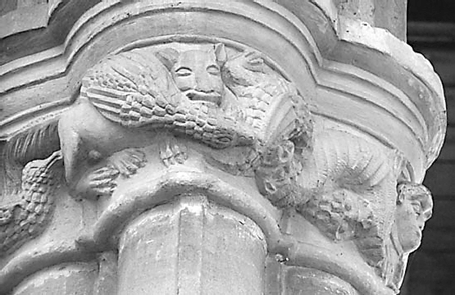
Pillar 2 North (P2N)
VCH – grotesque heads and limbs with a dragon biting itself; Pevsner – dragon; Guide – grotesque heads and a dragon.
Figure 4. Pillar 2 North Capital
There are more grotesque heads on one side of the capital, a male and a female in my view, with a coiled dragon on the other. The dragon only occurs in scripture at several places in the book of Revelation, where it is unambiguously a representation of Satan. So perhaps we have here a picture of the oppression of humanity by the devil. The two faces have animal like bodies however, so perhaps these too are meant to represent demons or evil spirits.
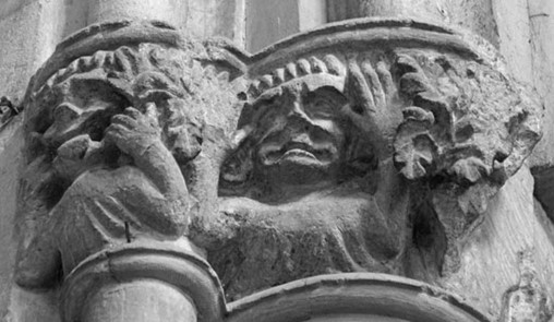
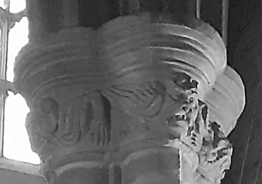
Pillar 3 North (P3N)
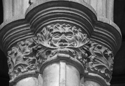
VCH – foliage; Pevsner – leaves; Guide – the Green Man.
Figure 5. Pillar 3 North Capital
Oddly both VCH and Pevsner miss the main feature of this Capital – a rather fine Green Man with foliage sprouting from its mouth. This design is on one side of the capital only. The notion that the Green Man represents a survival from pagan worship has been thoroughly debunked in recent years (5), and historians have demonstrated an origin in India that came, via the Arab world to be used with a decorative function in European churches. In terms of Christian iconography, some think that Green Men with foliage springing from their mouths, such as the one here, reflected the Golden Legend of Jacobus de Voragine, from the 13th century, which describes how Seth, the third son of Adam, planted seeds from the Tree of Life in his dead father’s mouth as he lies in his grave. The tree that grew from them became the tree of the true cross of the crucifixion. The figure could thus represent the death mask of Adam, with a foreshadowing of the cross and resurrection.
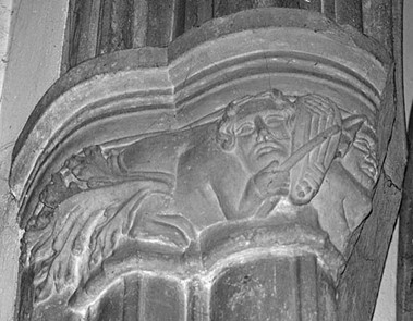
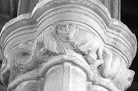
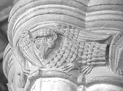
Chancel North (CN)
VCH – a beast-like figure playing upon a musical instrument, the figure ending in foliage; Pevsner – not described; Guide – a beast with a human head plays an instrument.
Figure 6. The Chancel North Capital
The decoration on the pillar next to the chancel show a winged beast with a human head playing an instrument that looks like a lyre, using a bow. The only meaning I can give to this is that it is a Siren of the legends of antiquity, that lured sailors to their death by the beauty of their song – the medieval period was much influenced by such classical legends. As such it may represent the alluring temptations of sin.
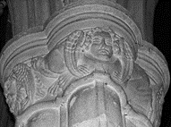
Chancel arch north (CAN)
VCH – not described; Pevsner – not described; Guide – not described.
Figure 7. The Chancel Arch North Capital (right hand photograph by author)
This carving was damaged by the installation of the Victorian rood screen, long since removed. Thank you, Gilbert Scott. The front figure shows two figures making faces, and there was presumably a third to the right. Around the back however, on the other side of the rood screen damage, there is a much more serious, although rather worn, person in prayer. What this all represents is beyond me – I am inclined to think it is simply the sense of humour of the mason.
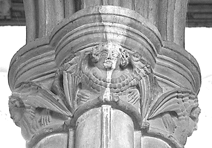
Tower South (TS)
VCH – rich foliage and a pelican in piety; Pevsner – birds; Guide – the pelican in her piety – symbol of the sacrament.
Figure 8. The Tower South Capital
The identification of the Pelican with Holy Communion is well set out in the following quote from the Catholic Education Resource Centre (6).
The symbolism of the mother pelican feeding her little baby pelicans is rooted in an ancient legend which preceded Christianity. The legend was that in time of famine, the mother pelican wounded herself, striking her breast with the beak to feed her young with her blood to prevent starvation. Another version of the legend was that the mother fed her dying young with her blood to revive them from death, but in turn lost her own life. Given this tradition, one can easily see why the early Christians adapted it to symbolize our Lord, Jesus Christ. The pelican symbolizes Jesus our Redeemer who gave His life for our redemption and the atonement He made through His passion and death. We were dead to sin and have found new life through the Blood of Christ. Moreover, Jesus continues to feed us with His body and blood in the holy Eucharist.
On the Capital we have the pelican and her chicks on a nest in a tree – perhaps again representing the Tree of Life.
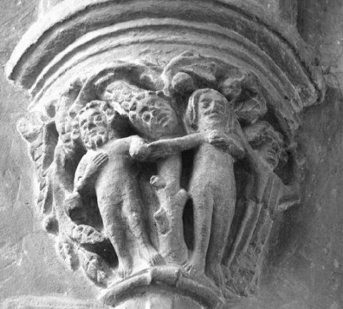
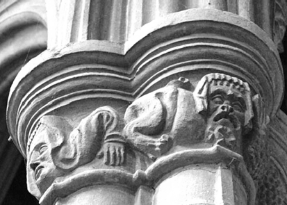
Pillar 1 South (P1S)
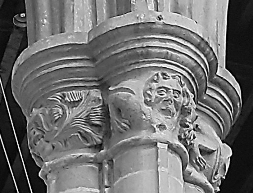
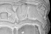
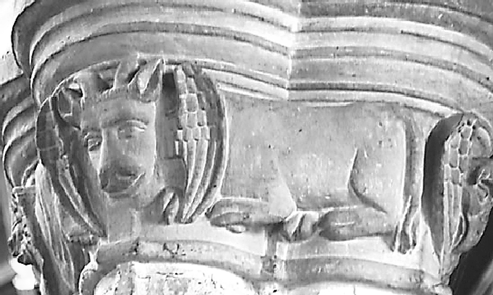
VCH – fox stealing goose followed by goslings and man with a besom, and on the other side an ape with his clog; Pevsner – a fox, an ape with a chain ending in a clog; Guide – the legend of Reynard the Fox.
Figure 9. Pillar 1 South Capital
This is perhaps the most complex of the carvings and certainly the most difficult to interpret. VCH and Pevsner’s descriptions are brief and partial, whilst that of the Guide makes quite a firm statement as to its content. The Guide goes on to give the following further explanation.
The carving of Reynard the Fox is similar to that at Tilton on the Hill, 8 miles west in Leicestershire. At Oakham Reynard is seen on the north side of the capital, with a goose in his jaws, followed by goslings. A man points his distaff at the fox. A fettered monkey is also depicted, and two snake-like creatures intertwine, each biting the others tail. The fox may represent the Abbot of Westminster making off with the great tithe, leaving only the small tithe for the local priest (the fettered monkey). Alternatively, it could be and illustration of Chaucer’s Nun’s Priest tale.
I find some of this very debatable indeed. Firstly, my reading of the medieval stories of Reynard the Fox suggests he is primarily a trickster, and I can find no reference to him stealing a goose. The Nuns Priest’s tale is perhaps a better fit. A summary from the Harvard Geoffery Chaucer web site (7) reads as follows.
In a chicken yard owned by a poor widow, the rooster Chaunticleer lives in royal splendor with his seven wives, of whom his favorite is the fair Pertelote. He dreams that he is attacked by a strange beast (a fox, which he does not recognize because he has never seen one). Pertelote advises he forget the dream; dreams, she says, come from indigestion. Chaunticleer insists on the power of dreams to predict the future. But he takes her advice. Later that day a fox appears and by trickery seizes Chaunticleer and carries him off, pursued by all of the old widow’s household. Chaunticleer tells the fox to taunt his pursuers; the fox opens his mouth to do so, and Chaunticleer is free to fly into a tree. Chaunticleer, the fox, and the narrator all draw morals from the adventure.
The specific moral of interest is a warning against vanity – as demonstrated by both Chaunticleer and the fox.
As the fox seems to have dropped the “goose” from his mouth, and he is pursued by seven “goslings”, this would seem to fit with at least part of the Capital depiction, although how well a stonemason might be expected to know what was essentially a courtly tale is debatable. It could however be based on a folk tale that was used by Chaucer for his composition.
But, there are other characters in the carving that certainly don’t figure in the Nuns Priest’s tale: the recumbent man holding a distaff (but why should be holding a distaff, usually the symbol of a women, is another issue); the creature with the chain around its neck which is almost certainly an ape or a monkey – the “weight” that seems to hang from it is a clog – a wooden block that was used to attach to a chain (although the animal appears unfettered); and the serpentine figure between the fox and the ape.
I presume the notion that this is representative of the disagreements between the clergy of Westminster Abbey and the local clergy has a source somewhere, but I have never come across it, and why the former should be represented by a fox and the latter by an ape / monkey is a bit of a mystery.
So what are we to make of this? Perhaps the answer lies in Christian symbolism. Foxes are occasionally mentioned in scripture, almost always negatively. Jesus refers to King Herod as “that fox” (Luke 13.32). In the Song of Solomon we read
Catch for us the foxes, the little foxes that ruin the vineyards (Song of Solomon 2.15)
Perhaps we have here the likely meaning – the fox is a symbol of and of the sins of church members that are the ruination of faith – in particular, if the Nuns Priest’s tale is referred to, the sin of vanity. In Christian iconography, monkeys or apes represent base instincts such as lust, greed and malice, particularly when unchained (8). The snakes might also be representations of the devil. So taken together we might have an allegorical representation of the sins that defile individuals and the church. But the level of speculation here is becoming excessive.
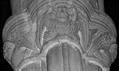
Pillar 2 South (P2S)
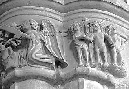
VCH – four angels; Pevsner – four angels; Guide – four angels facing the points of the compass.
Figure 10. Pillar 2 South Capital
The four angels are indeed facing in the four cardinal directions. They are all quite similar in form. Symbolically they may simply be an indication of the protection of God’s people, or they might refer more explicitly to the four angels of Revelation 7.1.
After this I saw four angels standing at the four corners of the earth, holding back the four winds of the earth, that no wind might blow on earth or sea or against any tree.
The winds here indicate the coming judgement of God on the world, held back until the right time by the heavenly powers.
Pillar 3 South (P3S)
VCH – symbols of the four Evangelists; Pevsner – signs of the Evangelists; Guide – the four Evangelists
Figure 11. Pillar 3 South Capital (bottom two photographs by the author)
These figures do indeed represent the four gospel writers – Saint Luke (Ox – top left picture), Saint John (Eagle – top right picture) and St Mark (Lion – bottom left picture) and Saint Matthew (Angel – bottom right picture). These in turn reflect the natures of the four living creatures of Ezekiel’s vision from the Old Testament, the seraphim bearing the throne chariot of God each with the same four faces. Ezekiel 1.10 describes them as follows.
Their faces looked like this: Each of the four had the face of a human being, and on the right side each had the face of a lion, and on the left the face of an ox; each also had the face of an eagle.
This chapter, and its associated symbolism, was very influential in early Christian and Jewish apocalyptic literature (9). These symbols then probably represent the Word of God, and the presence of God.
Chancel South (CS)
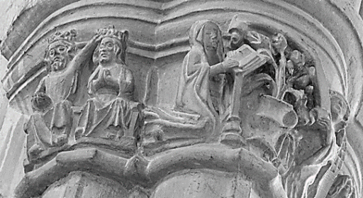
VCH – the Expulsion from Eden, the Annunciation, the Coronation of the Virgin; Pevsner – Adam and Eve, the Annunciation and the Coronation of the Virgin; Guide – Coronation of the Virgin – the Annunciation.
Figure 12. Chancel South Capital
This is perhaps the most intricately carved of all the capitals in All Saints. There are three scenes. The first shows a king crowning a queen, taken as being the Crowning of the Virgin Mary in heaven by either God the Father or her son Jesus, also crowned – a thoroughly non-biblical story. The very anthropomorphic nature of the scene suggests to me that this is based on a model of the coronation of a medieval queen. The second scene is a representation of the Annunciation – the appearance of the angel Gabriel to Mary to announce the coming birth of Christ. Between Mary and Gabriel, we can see the Lily – the symbol of Mary. Finally on the right we seem to have another Adam and Eve scene, accompanied by an angel with a scythe – perhaps representing the final harvest of souls, where the first couple are given a vision of the redemption of the world by the son of Mary.
Chancel arch south (CAS)
VCH – not described; Pevsner – not described; Guide – damaged by the Victorian rood screen
Figure 13. Chancel Arch South Capital (photograph by author)
As with the north chancel arch carving, this was damaged to install the Victorian rood screen. Its contents are not clear, but seem to be largely foliage. However it is perhaps possible that some of the foliage is actually small heads, and digits, but there is too much damage to be certain. Again, hearty thanks are due to Mr Scott for his contribution.
A bigger picture
So, having discussed all the Capital designs individually, is it possible that they fit into an overall scheme in some way? In what follows I will try to make the case that there is an overarching theme that connects all the designs, although in doing so, I am conscious I might simply be reading too much into the available evidence – and that the collection simply represents the imagination and arbitrary decisions of the masons.
Figure 14 below is an annotated version of Figure 1 that will help to understand the musings that follow with relationships between the different capitals indicated by arrows. Firstly, there are clear similarities of them between TN and CS – the story of Adam and Eve, both at the creation and at the end of time. These are on a diagonal across the church. Moving clockwise PIN and P3S are clearly similar although opposites of each other. – grotesque animals and faces in the former, with a devilish aspect, with similar, but sanctified beasts in the latter representing the evangelists. P2N and P2S are also opposites – the devil in the former and the angels in the latter. Carrying on clockwise, we come to P3N (the Green Man) and P1S (the fox and his entourage). It is hard to see much in common or in opposition here, other than their ambiguity of meaning. Perhaps in the former we see good coming from evil, whilst the latter shows that evil is always aiming for a comeback. Then we come to CN and TS – both featuring birds or winged beast – the first luring humanity to sin, and the second showing the cure for sin – the eucharist. That leaves us with the chancel arch decorations – I can see no linkage here, and, if there is an overall plan to the other carvings, I do not think these are part of it.
Figure 14. Relationships between Capitals
Overall then, these carvings seem to show a set of images in opposition to each other across the nave of the church – symbols of evil and darkness on the north and symbols of redemption and light on the south – which is quite consistent with many aspects of church and churchyard architecture.
One final puzzle however – nowhere I the carvings is there an unambiguous representation of Christ, unless that be in the scene of the Coronation of the Virgin. This seems to me odd, but perhaps the reader better versed in medieval symbolism might be able to enlighten me.
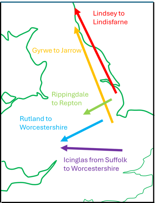
Since moving to Rutland last summer, I have come to realise that there are a number of enigmas in the early history of the county. Firstly, there is the fact that the county was the last one to be formed, and at Domesday, the northern Wapentakes of Alstoe and Martinsley were a detached part of Nottinghamshire, and the large double-hundred of Witchley in the south was part of Northamptonshire. In his consideration of this issue, Phythian-Adams (1), suggests that there was an underlying unity to the area that was to become Rutland, as it was formed from the dower lands of the late Mercian and Anglo-Saxon queens, and as it was also a Royal Forest, and that the split between Nottinghamshire and Northamptonshire occurred at some point during the period of the five Viking boroughs. This seems to have been generally accepted and seems to me quite plausible. Phythian-Adams also speculates that this area might have a longer history as a discrete unit. I have taken these thoughts a little further in a recent blog, and, noted that Rutland is essentially the upper catchment of the River Welland, whilst neighbouring South Kesteven is the catchment of the River Glen that joins the Welland east of Stamford. This of itself falls into the pattern of some early Anglo-Saxon polities in being based on river catchments, but the fact that both rivers run into the heavily managed fenland, in this case in the region of the Spalde of the Tribal Hidage (2) suggests that both Rutland and Kesteven would have required some authority, at least in terms of water management. I went further and suggested that these two polities could have been the East and West Wixna mentioned in the Tribal Hidage, as the order in which that document lists the polities in the fenland area, places them between the Gyrwe around Peterborough on the Nene and the Spalde to the north i.e. consistent with the geographical locations of Rutland and South Kesteven.
The second enigma is that within the county there are a number of place names that refer to the Anglo-Saxon tribe of the Hwicce. These have been investigated by Green (3) and include Witchley Warren, Witchley hundred, Whissendine and Witchely Leys. The Hwicce of course are known in the historical record as a West Midland polity, based around Worcestershire and Gloucestershire, so the existence of these names in Rutland is somewhat odd, and suggests that at some point in their history, at least a part of the Hwicce were resident in Rutland – probably before they became established in the Worcestershire area, so perhaps in the early sixth century. Phythian Adams (1) also points out that, on the western boundary of the county, there are a number of place names that refer to beacons, military guard posts etc., which suggest that the Rutland Hwicce had need to be wary of their neigbours to the west. I have addressed this issue in a second recent blog post, suggesting that the possible area name of East Wixna is another indication of the presence of the Hwicce, and also pointing out that in 1066 Queen Edith, the wife of Edward the Confessor, as well as holding much of Rutland in Lordship, was also the Lord of a large cluster of manors in Herefordshire, in the area usually ascribed to the Magonsaete tribe, sometimes referred to as the Western Hecani, or Hwicce. How far back these holdings go would require a detailed study, but on the face of it, it does suggest enduring links between Rutland and what was to become the main territory of the Hwicce.
There is however a third enigma – the often-observed fact that the place names within Rutland are overwhelmingly English, despite being surround by Danish areas, which suggest that although the Danes might have had political control of the area, they did not settle there. Phythian-Adams (1) speculates that this was due to an agreement in 893 between a representative of King Alfred of Wessex and the Danes of York, who seemed to be exercising political control in the area, because Rutland was the dower of the late Mercian queens – and thus of his own sister Aethelswyth, the wife of the last King of Mercia, Burged who was deposed by the Danes, and possibly his daughter Aethelflaed, the Lady of the Mercians who was married to Ealdorman Aethelred. Whist this plausible, I do not find it wholly convincing as a reason for Wessex to strike such a bargain with the Danes, presumably at some unspecified cost. In what follows I speculate on a further reason why the rules of Mercia, and later Wessex, might wish to retain Rutland as a specific English-speaking area. I will base this on the work of Green (4), who proposed a wave of migrations eastwards and northwards from Lincolnshire in the early sixth century, and of Jones (5) who mapped the place names associated with the early members of the Mercian royal house.
East of England migrations
Through a detailed consideration of place and tribal names Green (4), in her extensive discussion of Anglo-Saxon Lindsey, shows, conclusively to my mind, that Lindisfarne off the coast of Northumbria, was colonized by settlers from Lindsey in Lincolnshire. She puts this migration in the early part of the sixth century, on the basis that the Anglo-Saxon Chronicle shows Anglo-Saxon expansion from Lindisfarne after 550, with activity around Bamburgh and Yeavering on the mainland. Further she notes that the other main centre of Northumbrian activity was at Jarrow, the early forms of the name are Gyrwe – the same as the people from the Tribal Hidage in the region of Peterborough. Thirdly she notes that Rippingale in Lindsay is cognate with the name Hrepingas, the tribe in the area around the Mercian ecclesiastical centre of Repton. She then further refers to the point that has been made above, that there are many place names in Rutland that relate to the Hwicce. All these relationships and possible migrations are shown on Figure 1. Taken together they show a considerable Anglo-Saxon expansion from the Lincolnshire / Fenland / Ruland area. It seems to me likely that these all occurred in the first part of the sixth century, on the basis of the formation of Northumbria, and that by a century later, Mercia and the kingdom of the Hwicce were well established. This timing suggests that this movement of peoples was associated with the climate catastrophes of the 530s (possibly due to a major volcanic explosion) and the spread of the Justinian plague across Europe in the 540s (6).
Figure 1. 6th Century Anglo-Saxon migrations from the East Midlands (after Green (4))
The early Mercian dynasty
The early kings of Mercia identified themselves as the Iclingas – the descendants of Icel. The early genealogies give their order as Icel, Cnebba, Cynewald, Creoda, Pybba and Penda, although there is much doubt about the veracity of the earlier names. However, Penda can confidently be placed in the early to mid seventh century. Counting back the generations, on the assumption that the list is vaguely reliable, puts the early names around the end of the fifth and beginning of the sixth century. Now Myers has pointed out that there are a series of place names in the Cambridgeshire / Suffolk area that can be associated with those of the early kings – Ickleford, Ickleton and Icklingham – and perhaps indicate a migration route. These are also shown on the map of Figure 1. However, it has long been known that there are clusters of place names in the Worcestershire / Gloucestershire area that are associated with the names of the later kings from Creoda onwards. These have been mapped by Jones (5), and a composite map for the kings up to Penda, redrawn from the data in Jones’ paper with some added information, is shown in Figure 2. The chronological procession from Suffolk and Cambridgeshire in the east to the West Midlands in the west is clear, and the clustering in the Worcestershire / Gloucestershire area is very striking. Despite the fact that these are Mercian kings, and early Mercia can be placed fairly confidently to the north in Staffordshire and Derbyshire, it seems that the kings from Creoda to Penda were closely associated with the region of the Hwicce.
Figure 2. Place names associated with the early Mercian kings (after Jones (5))
Synthesis
To sum up what has been written above, in the first half of the sixth century, there was a major movement of Anglo-Saxons (culturally if not ethnically) from the East Midlands to the West. The early ruling dynasty of Mercia was part of this, and place name evidence suggest that they were associated with the tribal area of the Hwicce in Worcestershire and Gloucestershire. Whilst the Hwicce seem to have migrated from the Rutland area, the dynasty of Icel seems to have migrated from somewhat further south in East Anglia. This does however bear on the third enigma outlined above. The fact that Creoda, Pybba and Penda had very close associations with the Hwicce area, could mean that later members of the dynasty regarded the territory of the Hwicce as their homeland of origin, and, by extension, Rutland came to be of ancestral importance for them. So my basic suggestion, which as ever is only really speculation, is that the later Mercian monarchs and their Wessex supporters and successors did all they could to keep Rutland from Danish settlement, not only because it was the dower land of their queens, but also because they regarded it as their place of origin, to which they had a significant historical, and perhaps emotional, attachment. Whatever price they paid to the Danes not to settle in the area was felt to be worth it to protect their (supposed) ancestral homeland.