
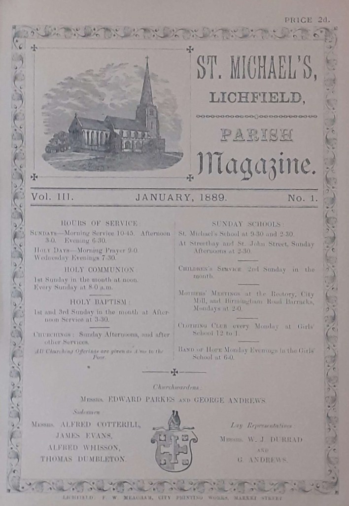
Preamble
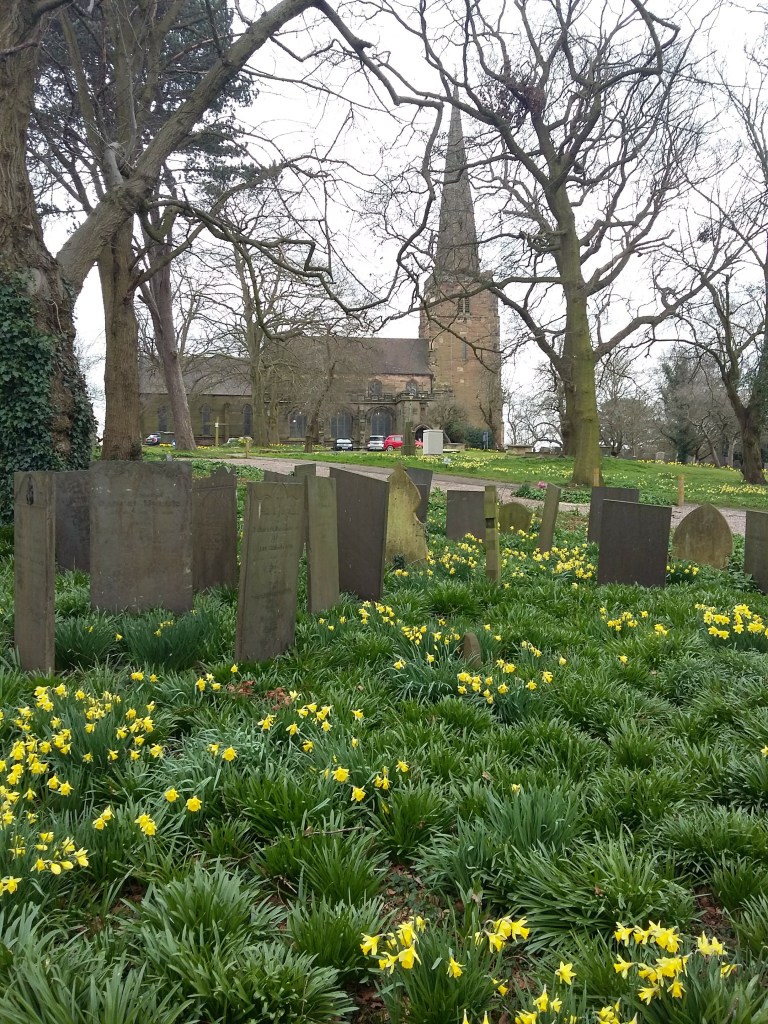
The churchyard of St Michael-on-Greenhill in Lichfield is one of the largest and possibly one of the oldest in the country and has long served as the last resting place of the people of the Lichfield parishes of St Michael and St. Mary. Unsurprisingly it is rich in grave memorial inscriptions that give a glimpse into the life and times of those whom they commemorate. This post will consider a number of aspects of these memorials, although space constraints mean it will inevitably be somewhat superficial and will leave much more to be said.
Context
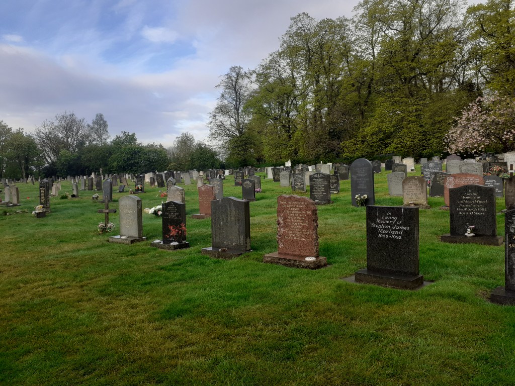
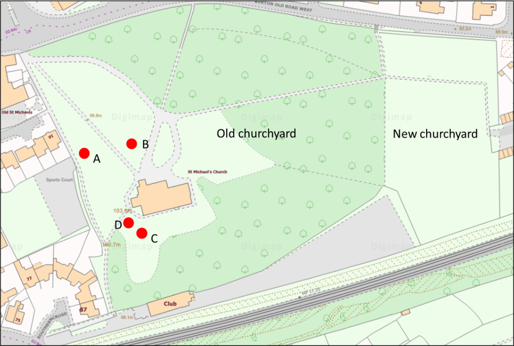
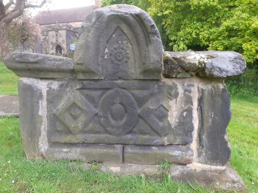
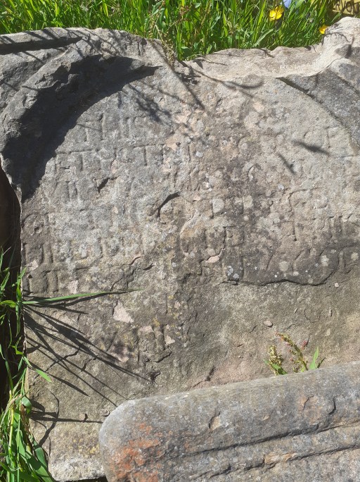
But first some context. The churchyard is effectively divided into two – the old (full and closed) churchyard around the church with an area of around nine acres, and the new churchyard to the west that is still in use, although space there is becoming limited. This post only considers the former. In the late 1960s, a major re-ordering of the old churchyard was carried out, prior to responsibility for it being taken by the local council. This involved moving many headstones into clusters and either grassing large areas of the churchyard for the purposes of maintenance or encouraging the growth of scrub and trees. This has led to it becoming something of a wildlife haven, with very many different species of plant and tree and it is highly valued as an outdoor resource by those who live locally. Before the re-ordering a survey was carried out of all the graves that were visible and 2084 graves were identified, and the names of those they commemorated were recorded dating back to the 16th century. In the 1980s the Birmingham Society for History and Genealogy carried out a major survey of all the monumental inscriptions in the graveyard, and transcribed 1562 inscriptions. Sadly, the effects of time have meant that many of the inscriptions identified in the 1960s and 1980s are now very difficult to read, and a considerable debt is owed to those who undertook the surveys and recorded the information for posterity. Indeed some of the inscriptions below can no longer be located due to the headstones being moved, and these surveys are the only record we have.
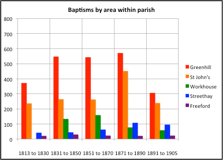
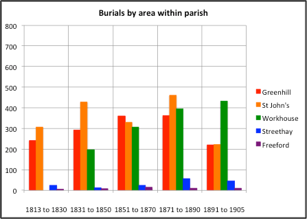
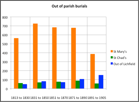
There is however some reason to think that the recorded graves and inscriptions represent only a small proportion of the burials in the graveyard. Between 1813 and 1905, there are 9128 entries in the church burial register. For the same period the 1960s survey identifies 1729 burials in 1099 graves and the 1980s survey of inscriptions identified 1623 burials in 1018 graves. Doubtless some burials and graves have been lost due simply to degradation over the course of the years – both due to the effects of the climate and to human action. With regard to the latter, pictures of the church from the 1830s in the William Salt Library show a number of gravestones that seem to have been done away with in the church rebuilding in the “gothic” style in the 1840s. The Victorian restorers were far from being historically sensitive. But the large number of recorded burials in relation to the number of graves does suggest that the major proportion were in unmarked graves, which is perhaps not surprising. This number of such burials was swollen by the fact that St Michael’s was the burial ground for Workhouse residents. Thus the grave inscriptions that we have only tell us something about the levels of society that could afford the services of a stonemason.
The nature of the inscriptions
The bulk of the inscriptions have a very simple biographical form – a dedication (In memory of / In remembrance of / Sacred to the memory of etc.) followed by the full name of the deceased, an indication of where they were from, a description of death (died / fell asleep, entered into rest etc.) and a date and age of death. A typical example is that of Maria Webster.
Sacred to the memory of MARIA WEBSTER of the City who died Jan. 16 1873 aged 78 years.
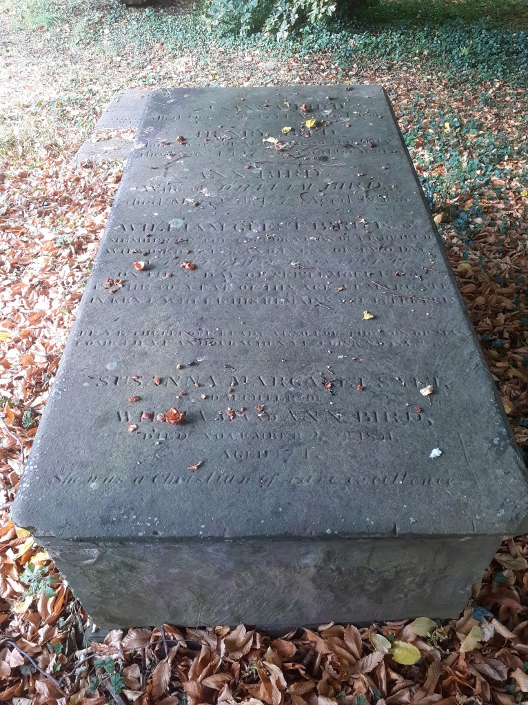
This can be repeated a number of times depending on how many are buried in the grave or commemorated on the memorial, which is not necessarily the same thing. Apart from giving names and death dates, such inscriptions are not terribly informative. Where there are numerous burials in one tomb, the inscriptions can become very complicated. For example, those the Bird family tomb has the following set of inscriptions.
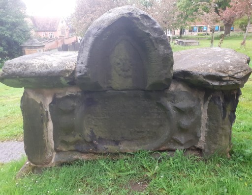
SUSANNA BIRD died October 28th 1754 aged 34 years. HENRY BIRD many years an Alderman of this City died November 1st 1783 aged 65 years. ANN BIRD wife of WILLIAM BIRD died May 28th 1778 aged 28 years. WILLIAM GUEST BIRD Esq member of the Corporation of Lichfield who died after an illness of two days in the Faith of Jesus Christ on the 5th day of September 1833 in the 46 year of his age at Margate in Kent where his remains are interred. Be ye therefore ready also for the Son of Man cometh at an hour when ye think not. SlJSANNA MARGARET SALT daughter of WILLIAM & ANN BIRD died November 28th 1851 . She was a Christian of rare excellence. WILLIAM BIRD of this City died the 9th of September 1817 aged 72 years. MARY BIRD relict of WILLIAM BIRD died April 7th 1821 aged 74.
However, some memorials contain more information. Some of this is an extension of the biographical, describing the role of the deceased or the nature of their demise. In the above example Susannah Margaret Salt is described as
a Christian of rare excellence
The biographical style is particularly common for military casualties. For example, that of James Henry Thorpe which is part of a larger family inscription
…….. Also of their youngest son JAMES HENRY THORPE, Sergeant 1st South Staffordshire Regiment who fell in action at Kleine Zonnebleke, October 26th 1914 aged 26 years……….
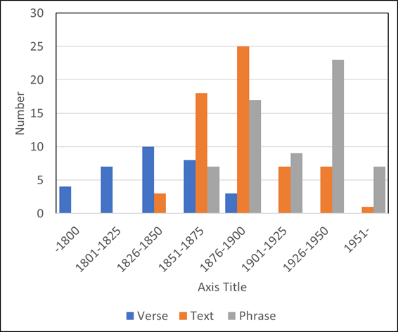
Instead of, or as well as, such biographical information, around 180 graves give inscriptions of a pious or religious nature. These are of three forms. The first, and earliest, is in the form of a verse (I hesitate to use the word poetry, since many of the inscriptions represent crimes against the English language!) such as that for Thomas Lee.
Sacred to the memory of THOMAS LEE who departed this life December 15th 1829 aged LXX. No flattering titles deck this humble stone. This verse is sacred to the truth above. Here lies exceed the character who can. An upright Mason and an honest man…
The second is a verse from the bible, often a verse used in the funeral liturgy – such as “In the midst of life we are in death” or “Blessed are the dead which die in the Lord”. The third type is a simple vaguely religious, but non-scriptural sound phrase such as “Peace, perfect peace”, “Rest in peace” or “Reunited”.
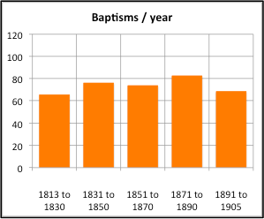
Interestingly these three types can be distinguished by the age of inscription. The bar chart below shows the raw number of each type of inscription in 25 year periods – the non-uniformity of the data is such that I have not attempted a more rigorous statistical analysis. It is clear that the verse form has maximum popularity between 1826 and 1850, the biblical text between 1876 and 1900, and the simple phrase between 1926 and 1950.
In what follows, we will first give a few of the more interesting examples of the “biography” type of inscription, and similarly give some examples of the verse form.
Biographic inscriptions
Soldiers
There are a number of biographic descriptions of soldiers’ lives – both those who died at an advanced age and those who dies on active service. Perhaps the most visited of the memorials is that of Trumpeter John Brown, who served in the Crimean War.
Near here is the grave of Trumpeter JOHN BROWN 1815—189B who sounded the trumpet for the 17th Lancers at the Charge of the Light Brigade, Balaclava 25th October 1854.
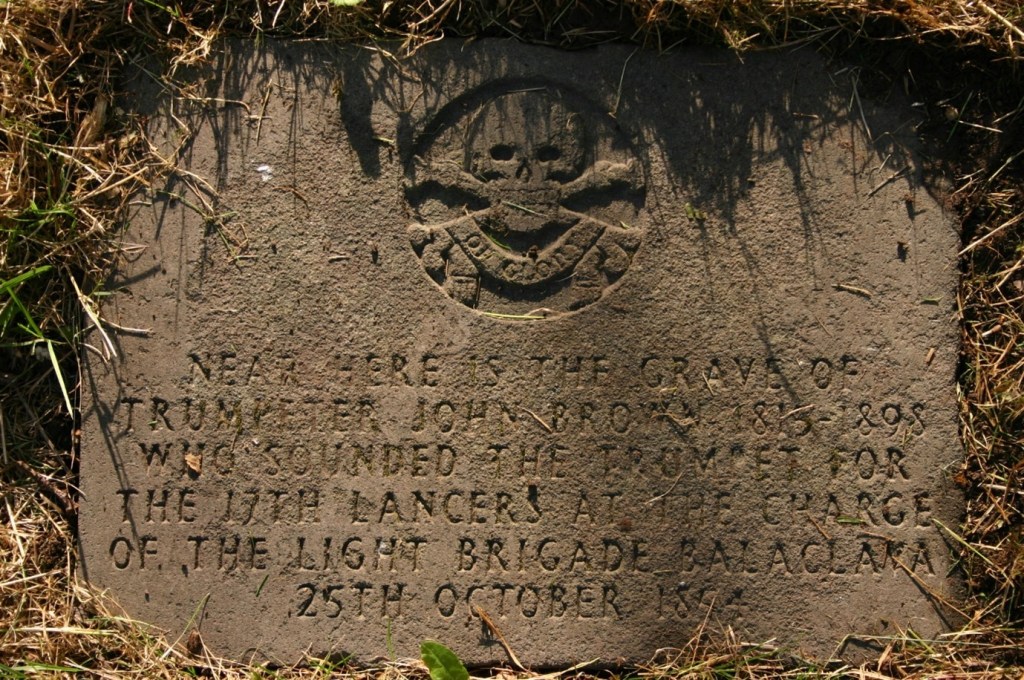
More details of Trumpeter Brown can be found here. A number of Lichfield soldiers were killed in the first and second world wars and these are memorialized both on individual gravestones and on the Commonwealth War graves memorial. These include the following.
….. In Ioving memory of FRANK STANDLEY BUTLER 1st/ 8th Royal Warwicks who fell in action in France August 17 1917 aged 20 years.
…… Also FRANK LARKIN his brother Lance Corporal 1st North Staffs. Regiment who fell in action at Ypres July 9th 1915 aged 31 years. Also of MERVIN GODFREY LARKIN brother of the above born September 22nd 1888 who fell in action in France March 14th 1917.
,,,,Also his brother L/Cpl GEORGE WOLFE 6th North Staffs. Regt who made the supreme sacrifice at Caen Aug 15th 1944 interred in Grand Aunay British Cemetry France aged 23 years.
It is hard to imagine how the deaths of two sons affected the parents of Frank and Mervin Larkin.
Civic officials
A number of civic officials are buried in the graveyard, including former Mayors of Lichfield. The memorial to Alderman Joseph Raby from 1916, Mayor in 1915 also contains memorials to his wife who dies in 1938 and to his son who died in action in an unspecified location in 1918.
In loving memory of Alderman JOSEPH T. RABY, J.P. , F. J . I. Mayor of Lichfield 1915—16 called suddenly to rest May 30th 1916 aged 62. Also HANNAH his beloved wife died April 22nd1938 aged 86. Also Pte. HORACE S. RABY beloved son of the above who died November 8th 1918 aged 26 years.
The memorial to Robert Bridgeman, a sculptor by profession, contains both his biographic details, a short non-scriptural phrase, memorials to the death of his son in the first world war; and also the memorials to another son who was also mayor, and to that son’s wife, and is a good example of how complex the inscriptions can become.
ROBERT BRIDGEMAN, Sculptor. Sheriff and twice Mayor of this City departed this life March 1st 1918 in his 73rd year. After life’s fitful journey may he rest in peace. ROBERT GEORGE BRIDGEMAN Serge. Royal Engineers killed in action in France Nov. 5th 1916 aged 24. SARAH ANN wife of JOSEPH HENRY BRIDGEMAN died April 18th 1948 aged 83 years. JOSEPH HENRY BRIDGEMAN twice Mayor and also Sheriff of this City died February 24th 1951 aged 80 years.
Church officers and clergy
A number of church officers and clergy have memorials in the churchyard, The oldest of these is to the father and the son both named William Clarke, long term clarkes of the church. The death dates assigned when the stone was restored in 1870 were 1525 and 1562, although I have argued elsewhere that this is probably a misreading and they should be a century later.
Here lyes the body of WILLIAM CLARKE who was clarke of this church 51 years and buried March 5th 1525(?) aged ??. Here lies the body of William Clarke clarke of this church 71 years who died September 26th 1562 aged 86. Restored 1870
The two churchwardens that are explicitly mentioned are George Andrews and William Treadgold, the latter being warden at St. Mary’s rather than St. Michaels. There are however others buried in the churchyard who are not so identified – for example William Durrad, Lichfield’s first Station Master.
In loving memory of GEORGE ANDREWS sometime churchwarden of this parish born December 31st 1828 died July 24th 1905. Also of CATHERINE ANDREWS his widow born April 20th 1826 died April 24th 1909.
In loving memory of EMMA wife of WILLIAM TREADGOLD who died April 2nd 1935 aged 75. Also of WILLIAM TREADGOLD Churchwarden of St. Mary’s, Lichfield, who died September 1st 1944 aged 81.
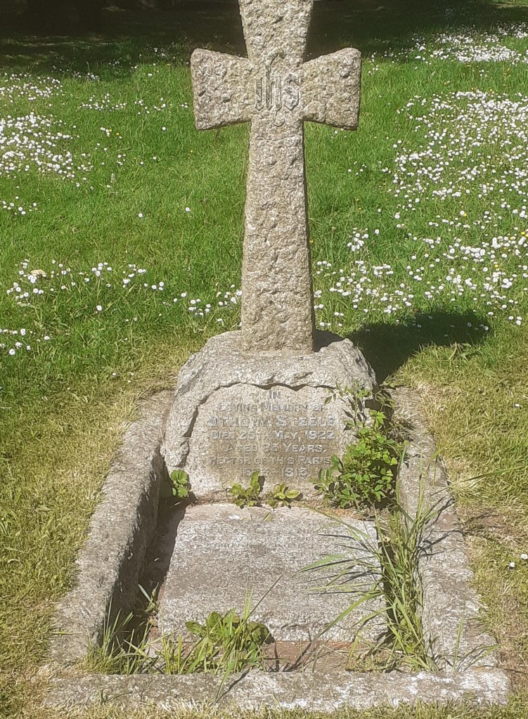
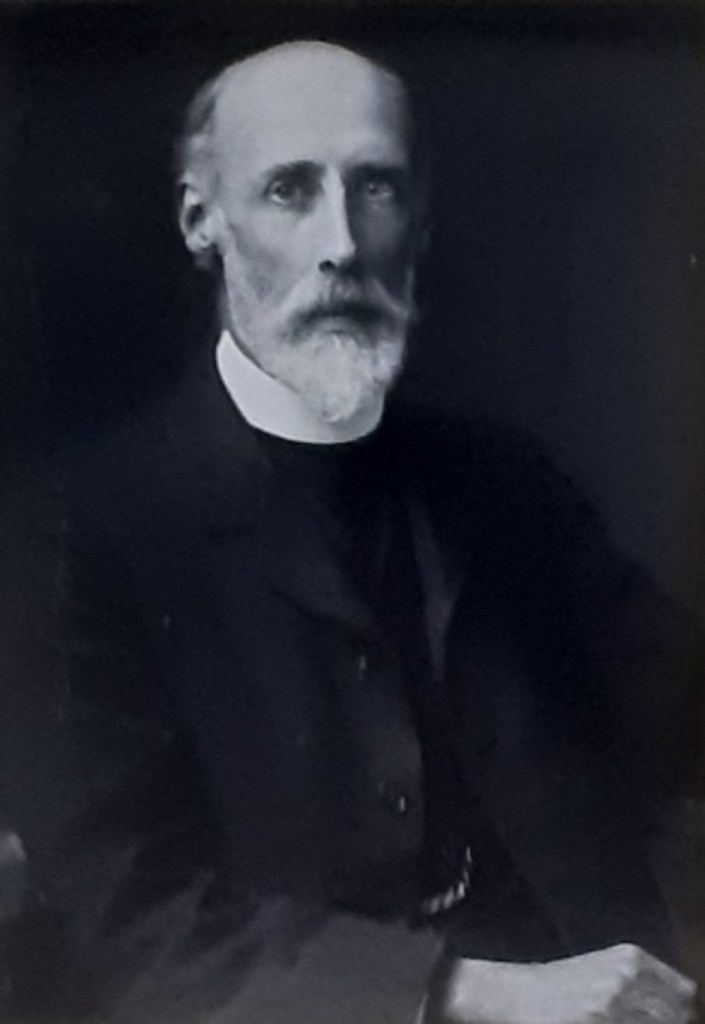
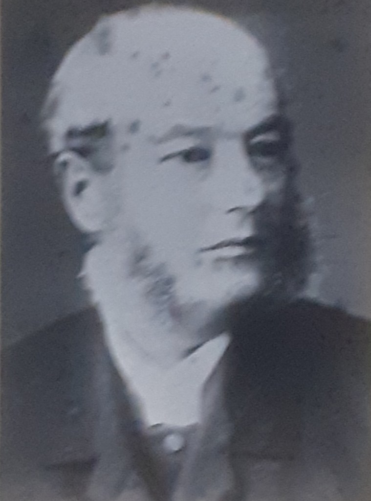
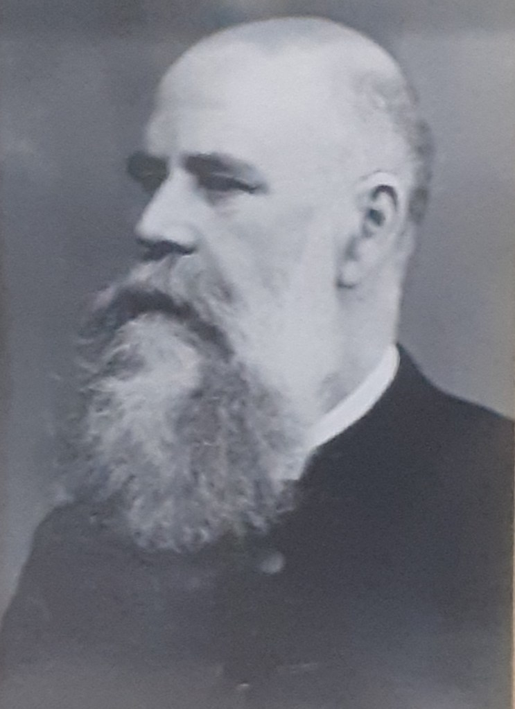
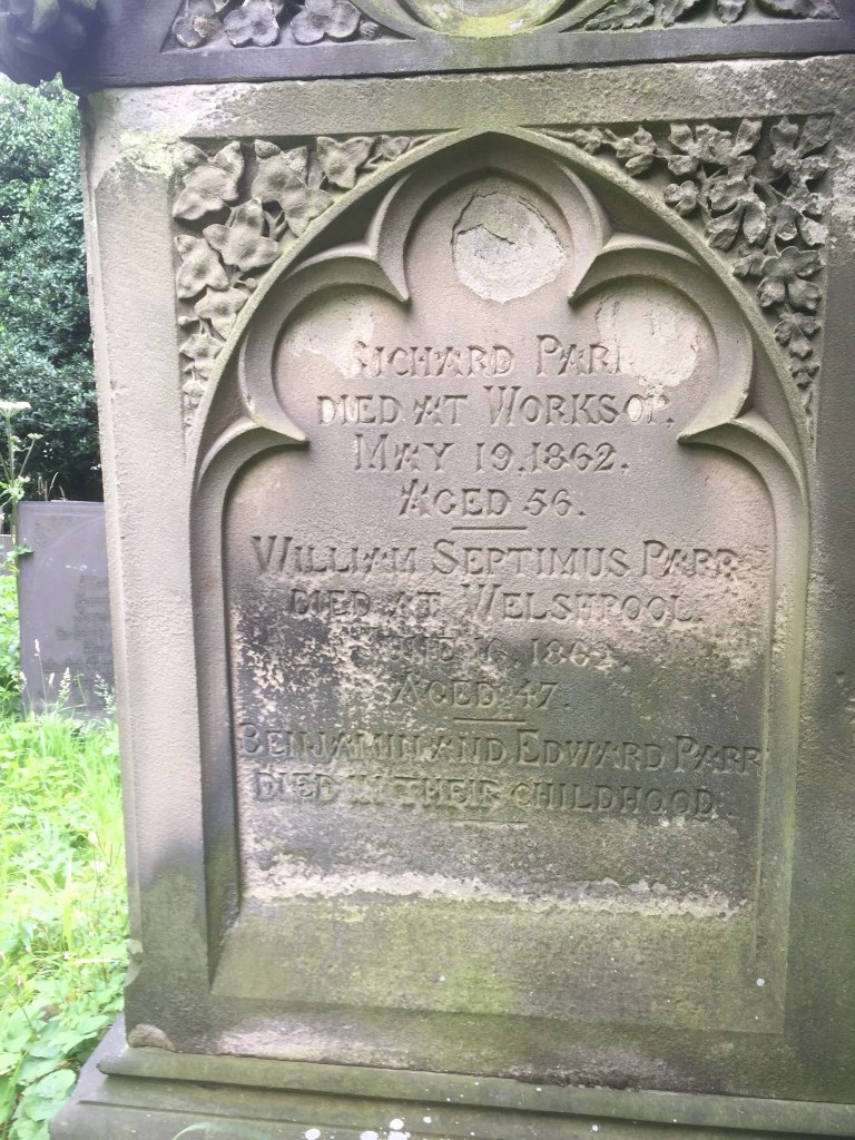
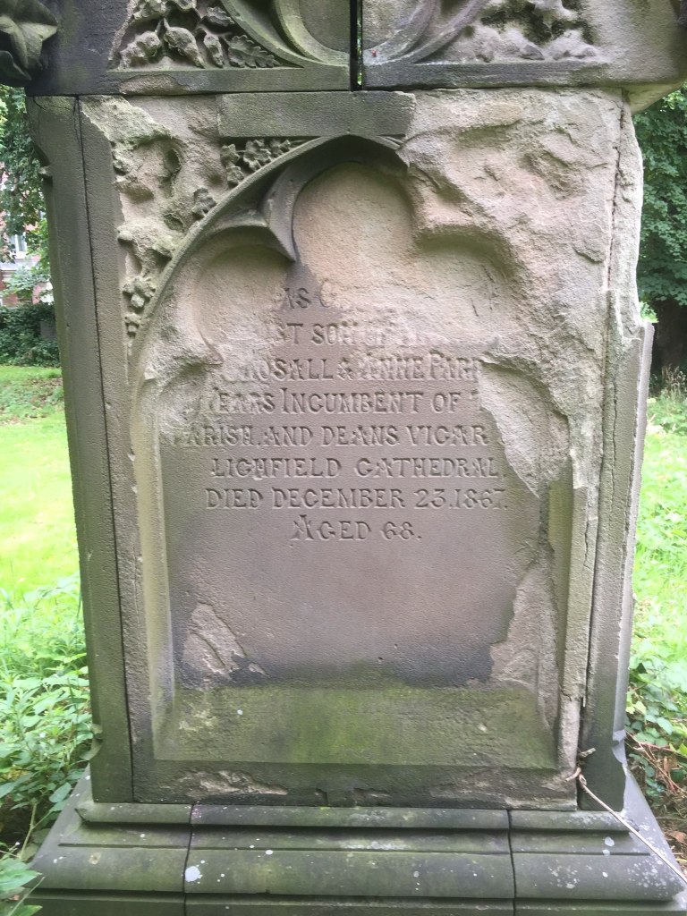
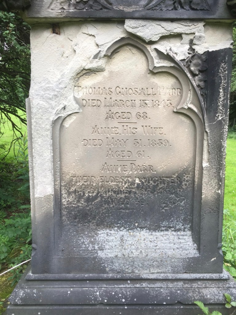
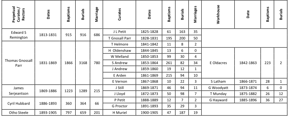
Four of the first five rectors of the parish are buried in the churchyard – Thomas Gnossall Parr, James Serjeantson, Otho Steele and Percival Howard. The inscriptions on the graves of Parr, Steele and Howard are given below. Only the names of the Serjeantson grave were recorded in the 1960s survey and tnis was not recorded at all in the 1980s. The story of these rector’s is told elsewhere.
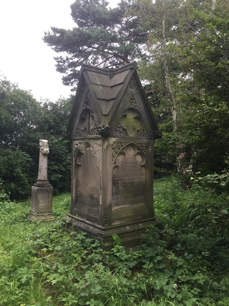
THOMAS GNOSALL PARR died March 13th 1843 aged 68. ANNE his wife died May 31st 1839 aged 61. ANNE PARR their eldest daughter died Aug…. 1862 aged 59. THOMAS GNOSALL eldest son of THOMAS GNOSSALL and ANN PARR…years, incumbent of this parish ………and Deans Vicar of Lichfield Cathedral died December 23rd 1867 aged 68. RICHARD PARR died at Worksop May 19th 1862 aged 56. WILLIAM SEPTIMUS PARR died at Welshpool June 16th 1862 aged 47. BENJAMIN & EDWARD PARR died in their childhood.
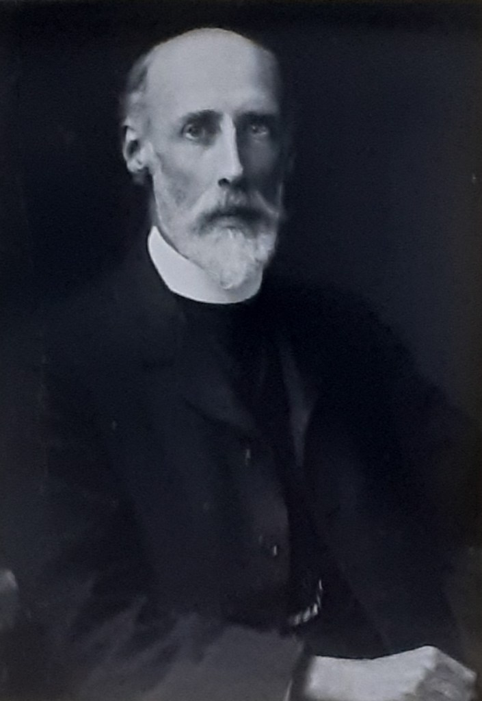
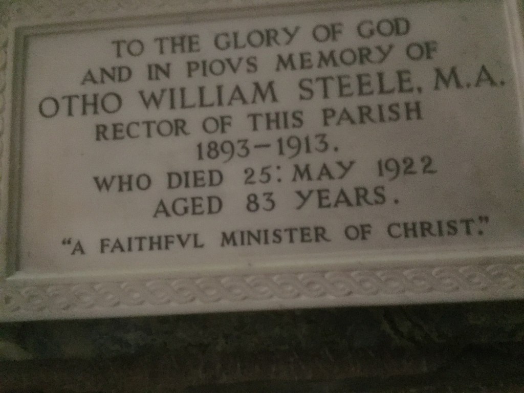
In loving memory of OTHO W. STEELE died 25th May 1922 aged 83 years. Rector of this Parish 1893-1913. CICELY MARY ANDERSON daughter of the above born 11th June 1877 died 2nd Sept. 1972. HENRY STEWART ANDERSON, C.M.G. , R. A.M. C. born 15th April 1872 died 12th May 1961.
PERCIVAL HOWARD born 7 July 1875 died 16 October 1955. Rector of this Parish 1913—1947.
Children
Of the different types of inscriptions, those in memory of children are the most poignant, and given the high incidence of child mortality up to the start of the twentieth century, the most common. A few illustrations are given below. The first, for Tabitha Morley, quotes a saying of Jesus, that refers to a dead child he brought back to life. The second and third record multiple childhood deaths in the same family.
Sacred to the memory of TABITHA the only and dearly beloved child of SAMUEL MORLEY Vicar of Warslaw—cum—Elkstone in this County and SARAH his wife. She died in her infancy 15th day of July 1861. She is not dead, but sleepeth.
In affectionate remembrance of the beloved children of JOSEPH and ANN ALLTON. JOSEPH who died June 12th 1855 aged 14 years. ELIZA ANN who died December 22nd 1856 aged 3 years 8 months and WILLIAM ALFRED who died June 7th 1862 aged 18 years. Also of three others who died in their infancy.
In memory of dearly beloved children of HERBERT & HARRIET LARKIN. AMY born October 24t 1872 died September 24th 1896. KATE ELLEN born September 30th 1877 died March 23 1897. WILLIAM HENRY born June 11th 1875 died April 8t 1876. FLORENCE born December 23rd 1878 died September 23 1879. LUCY DOROTHEA born September 21st 1885 died October 26 1886.
Others
There are a number of other interesting biographical descriptions in the churchyard. Firstly that of Elizabeth Logan. Her story perhaps to be told more fully.
Sacred to the memory of ELIZABETH LOGAN who died February 28th 1878. Having acted with MISS NIGHTINGALE in the Crimea on her return she followed the profession of sick nurse for which she was eminently qualified by her skill and experience. A strong sense of duty and great kindness of heart. No one who witnessed her self—denying exertions in aid of suffering humanity could ever forget them. Well done good and faithful servant. Thou hast been faithful over a few things, I will make thee ruler over many things. Enter thou into the joy of thy Lord.
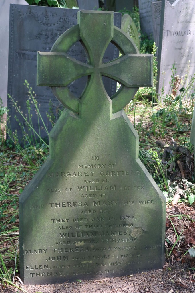
The Corfield memorial is at first sight a simple family biographical memorial, until one realizes that nearly all of them died on the same day. This was the result of a fire in a house on Breadmarket Street in 1871 (next to the Johnson House) that resulted in William Corfield, his mother, his wife and his four children all suffocating due to smoke inhalation. A large crowd attended the funeral and the whole incident was covered in detail by the press.
In memory of MARGARET CORFIELD age 81. Also of WILLIAM her son age 47 and THERESA MARY his wife age 35. They died January 14th 1873. Also of their children WILLIAM JAMES age 5 years and 5 months. MARY THERSA age 4 years and 2 months. JOHN aged 3 years and 1 month. ELLEN age 6 weeks. They died January 14th 1873. THOMAS died May’ 27th 1871 age 17 days.
Family Groups
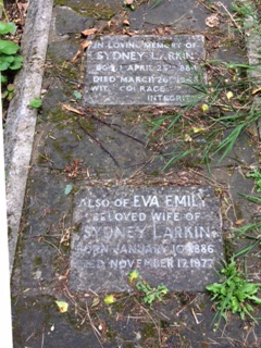
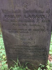
There are a number of family groups of graves in the churchyard. The most prominent of these are those of the Treadgolds, with thirteen burials in six graves between1894 and 1971, the Gilberts, with thirty two burials in nineteen graves between 1790 and 1904, and the Larkins with forty three burials in 18 graves between 1827 and 1977. These include the grave of Sidney and Eva Larkin, the parents of the poet Philip Larkin, who famously once said of Lichfield ‘God, this place is dull’. Behind Sidney and Emma’s grave is the memorial to another Philip Larkin who died in 1878. The story is told that when the 18-year-old poet came across this gravestone, he was understandably perturbed and wrote to a friend, ‘I reeled away conscious of a desire to vomit into a homburg hat’.
Verse inscriptions
A number of verse inscriptions are given below. It is very easy to be rude about the quality of both the rhyme and the rhythm of these verses – and indeed I have been so above. But nonetheless they were chosen by relatives of those who are buried in the churchyard and must express at least something of what they wished to say. So, whilst 200 years on, we may be amused by what is written, it is perhaps important not to be too critical and scornful.
Early deaths
A number of the verse inscriptions refer to early and sudden deaths – often as dire warnings for those who follow to prepare themselves for a similar fate.
Sacred to the memory of ANN RILEY who died October 28th 1838 aged 75 years. Also of ROBERT RILEY who died May 24th 1843 aged 81 years. Sacred to the memory of SARAH RILEY who died September 18th 1825 aged 28 years. Lost in the bloom of life lamented maid. Sweet by thy slumber in death’s dreary shade. And when thou leav’st thy lowly bed of rest. O may’st thou mount and mingle with the blest.
In affectionate remembrance of WILLIAM HITCHINS who died December 27th 1867 aged 21 years. He sleeps in Jesus. Also of JOHN HENRY HITCHINS who died October 5th 1869 aged 23 years. Weep not for me my mother dear. I am not dead but sleeping here. My end you know, my grave you see. Prepare therefore to follow me.
In affectionate remembrance of HARRY ALLEN MOONEY who died June 30 1883 aged 20 years. Death to me no warning gave. Therefore be careful how you Iive. Prepare in time make no delay. For no one knows their dying day.
Sacred to the memory of SUSAN daughter of WILLIAM and SUSANNAH ROGERS who died Feby 28 1843 aged 19. Also of two sons and one daughter who died infants. Ye, who with youthful steps, now lightly tread. O’er these green hillocks of the unconscious dead. Pause a few moments at this lowly tomb. And learn — an early death may be thy doom. Sacred to the memory of WILLIAM ROGERS who died July 29th 1864 aged 82. Also of SUSANNAH his wife who died April 3rd 1866 aged 83.
Husbands and fathers, wives and mothers
The verses for family members are often quite sad and reflective whilst describing the attributes of the deceased.
Sacred to the memory of JOHN HILL late of the Scales in this City who died April the 27th 1809 aged 66 By sudden death, he was deprived of life. Left years, son and daughter, and a faithful wife. Who mourn his loss and hope his sours on high. With Jesus Christ above the starry sky. His near relations do his fate bemoan. And to his memory have placed this stone.
In affectionate remembrance of WILLIAM BOOTH who departed this life April 5th 1876 aged 67 years. Dear wife and children do not weep. Whilst with the dead do sleep. A troublesome world I left behind. A crown of glory I hope to find.
In memory of ANN the wife of GEORGE GILBERT who died November 2 1824 aged 57 years. and of two children who died in their infancy. A faithful wife in silence slumbers here. A tender mother and a friend sincere. While living just, industrious and kind. A loss to all her friends she’s left behind.
Sacred to the memory of HANNAH wife of JAMES DABBS who died March 15th 1834 aged 48 years. A long affliction I do bear. Physicians were in vain. Till God did please to summons me. And ease me of my pain. Sacred to the memory of PHILIP SALT who departed this life January 29th 1823 aged 46. Also SARAH his daughter who died May 16th 1834 aged 23.


