
Holy Week and Easter liturgy
The traditional Catholic / Anglo-Catholic liturgy for Holy Week and Easter is both powerful and deeply moving. It is built around four services – the liturgy of Palm Sunday, the washing of the feet and institution of holy Communion on Maundy Thursday, the liturgy of the Crucifixion on good Friday and the Service of Light and Holy Communion on Easter Day. It has a well established form that has been shaped by 2000 years of history and, some might say, should not be changed or modified to any degree.
Whilst I personally always find the sequence of service uplifting and thought provoking, I have to admit that there are aspects that I find distracting and unsatisfactory. The entire passion gospel is read twice – on Palm Sunday and Good Friday, and this seems to me to have two downsides. Firstly the unfolding series of events in Holy Week is somewhat obscured using this approach, and secondly this limits the time for serious preaching on the passion narrative at these two services. The on Easter Day, the traditional order places the reading of the resurrection gospel a long way into the service, which has always struck me as off, as to my mind, this belongs right at the start.
Now in 2026, I was, for the first time in my ministerial career, able to craft the Holy Week services to reflect my own views. This is a task normally undertaken by any incumbent, but as we don’t currently have one I was able to take advantage. This post contains the liturgical material that was put together for that week, that I offer here perhaps as a model that others might use. It is not terribly radical – the main innovation being that it is based around the reading of the Passion narrative from the gospel for the year (Matthew in this case) throughout Holy Week, and its use of both online and face-to-face services to enable as many as possible to take some part in the celebration.
The setting
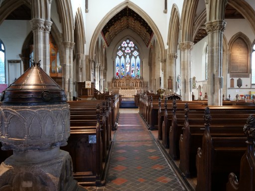
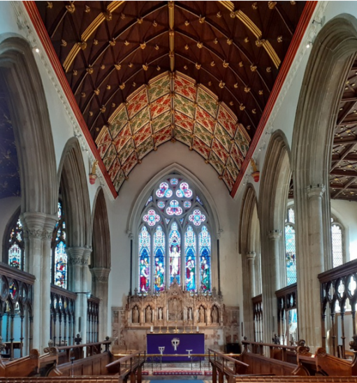
There were two settings for the Holy Week liturgy presented here – one physical and one virtual. The physical one is of course All Saints itself. this is a large, high church, with nave, nave aisles, transepts, chancel and chancel chapels, The nave and transepts are, in the main, filled with pews, which limits the amount of liturgical movement, but the aisles offer room for processions, and some pews have been removed at the front of the nave, which allows for a nave altar to be used on most Sundays. The chancel, normally used for the choir, offers a different and more intimate worship space for small congregations. The Eucharist is celebrated at the high altar at the east end on festivals. Even when a nave altar is used, communion is usually received at the communion rails at the high altar. The chapel to the north side of the chancel (dedicated to the Holy Trinity) is used for small worship services and, as we will see below, is used as the Chapel of the Watch in Holy Week.
The virtual context is the streaming of services via Facebook, which has been used since the Covid lockdown. The audience for streamed Sunday services can be significant, but there is also a regular audience for streamed morning prayer services on three days a week.
Principles
My objectives in developing the Easter and Holy Week services for 2026 were as follows.
- To broadly follow the traditional form, but to improve its consistency in the context of the congregations and facilities at All Saints Oakham.
- To read through the Passion account for the set gospel of the year (Matthew), allowing space for sermons to be preached on most aspect of the story.
- To allow members of the congregation to follow the liturgy to as great an extent as they could individually manage, through the provision of a pattern for readings, and streaming and face to face services.
The readings
A booklet of readings was available for collection in church from Passion Sunday onwards and was also posted on line. The gospel readings basically followed the account in Matthew 21 and 26 to 28 from Palm Sunday onwards, although a precise chronological framework is not of course possible. Appropriate Old Testament readings were also provided.
Palm Sunday
The service began with the reading of the gospel and the palm procession from the south door to the west door. The story of Jesus in the temple was then read, a sermon preached and the eucharist followed in the normal way. The service featured full ceremonial – formal processions with incense and anthems.
Monday to Wednesday
From Monday to Wednesday, Morning Prayer was streamed on Facebook using the normal online form from Common Worship Daily Prayer. The Old Testament readings were taken from Lamentations in a traditional pattern. Compline was said in the chancel of church every evening, with a short address and suitable recorded music. At both Morning Prayer and Compline each day the same New Testament reading from Matthew was used was used.
Maundy Thursday
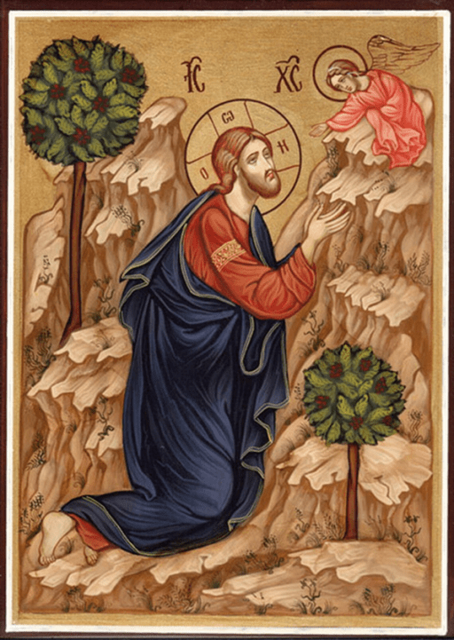
Morning Prayer was again streamed over Facebook, with a reading from Lamentations and a short reading from Matthew. The main Maundy Thursday service in the evening was held in the body of church. The first part of the service was focussed on the events of the Last Supper as recorded by John (the only non-Matthean reading of the week), leading into a sermon and the foot / hand washing. The service then moved on to the institution of Holy Communion and the celebration of the Eucharist itself. The icon shown below was brought to the altar with the bread and the wine. After the Eucharist, the altar was stripped and the consecrated bread and wine taken to the Holy Trinity chapel. The gospel account of Gethsemane was read before the congregation departed, with some moving to the Trinity chapel for a short Watch.
Good Friday
Morning Prayer was said in the Chapel of St John and St Anne, with the reading of the accounts of the trials of Jesus. A sermon was delivered. the formal Good Friday liturgy followed at noon. This began with the account of the crucifixion, followed by a sermon and the proclamation of the cross with the usual devotions. The icon below as placed in front of the cross. The formal Good Friday intercessions were then used, and then the account of the death of Jesus was read, with last year’s Easter candle being established. Communion was administered using the consecrated bread and wine from the evening before. In the evening, Compline was streamed on Facebook, and focussed on the burial of Jesus.
Holy Saturday
The readings for the Vigil were provided in a separate booklet and posted online, and their reading was streamed on Facebook on Holy Saturday evening, on the basis that some of the congregation would like to mark the vigil, but could not attend the Easter Dawn liturgy.
Easter Day
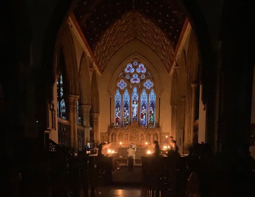
The dawn service (at 5.30am) began in near darkness at the back of church with the Vigil readings. The congregation then gathered around a brazier outside the south door where the Paschal candle was lit, from which all lit their own candles. The candle was then taken into church with the congregation following to the chancel, where all the altar lights were lit whilst the Exsultet was sung. The icon below was placed in front of the altar. The Easter gospel was then read, and the Easter greeting proclaimed and hymns were sung. The renewal of baptismal vows, with sprinkling of blessed water and the Eucharist then followed.
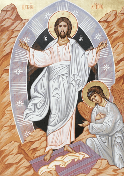
A straightforward traditional language Eucharist was celebrated at 8.00, supplemented on this occasion by hymns. The main Easter Eucharist was celebrated at 10.30 on Easter morning – a choral service with full ceremonial. The liturgy was straightforward beginning with the reading of the Easter Gospel from Matthew and included the renewal of baptismal vows as at the early service, and also, for those who wished, the anointing with oil at the communion rail for healing for themselves or those on their hearts. The icon above was again used as a focus for those receiving communion.
